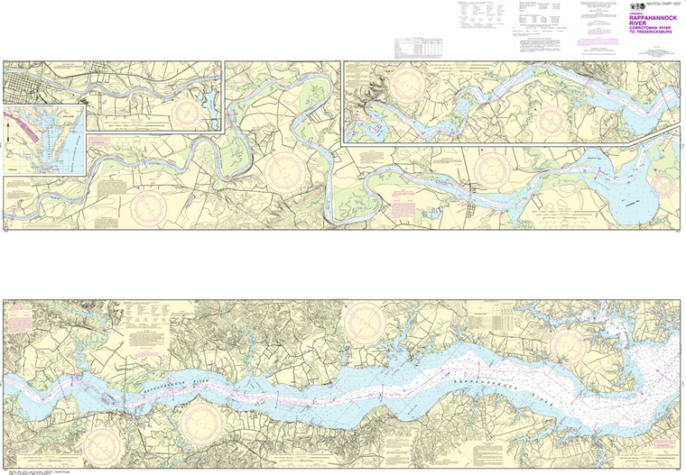
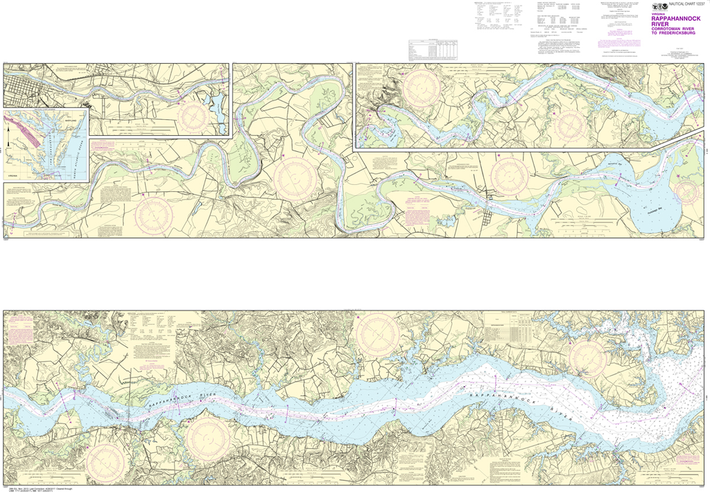
NOAA Chart 12237: Rappahannock River - Corrotoman River to Fredericksburg
$23.75
THIS CHART IS CURRENTLY CANCELED BY NOAA. We know there are many questions about NOAA charts, newest editions and charts being cancelled. The U.S. Office of Coast Survey provides an updated list of all chart updates and the ones being...
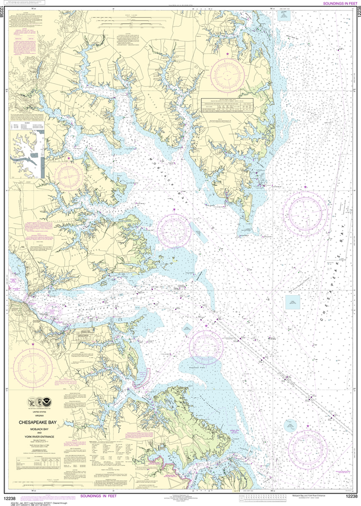
NOAA Chart 12238: Chesapeake Bay - Mobjack Bay and York River Entrance
$23.75
The chart you are viewing is NOT updated weekly and does NOT include all of the latest Notice to Mariners corrections. Region: Mid-Atlantic Paper Size: 50" x 36" Chart Image Size: 46" x 33" Scale: 1:40,000 Captain's Nautical...
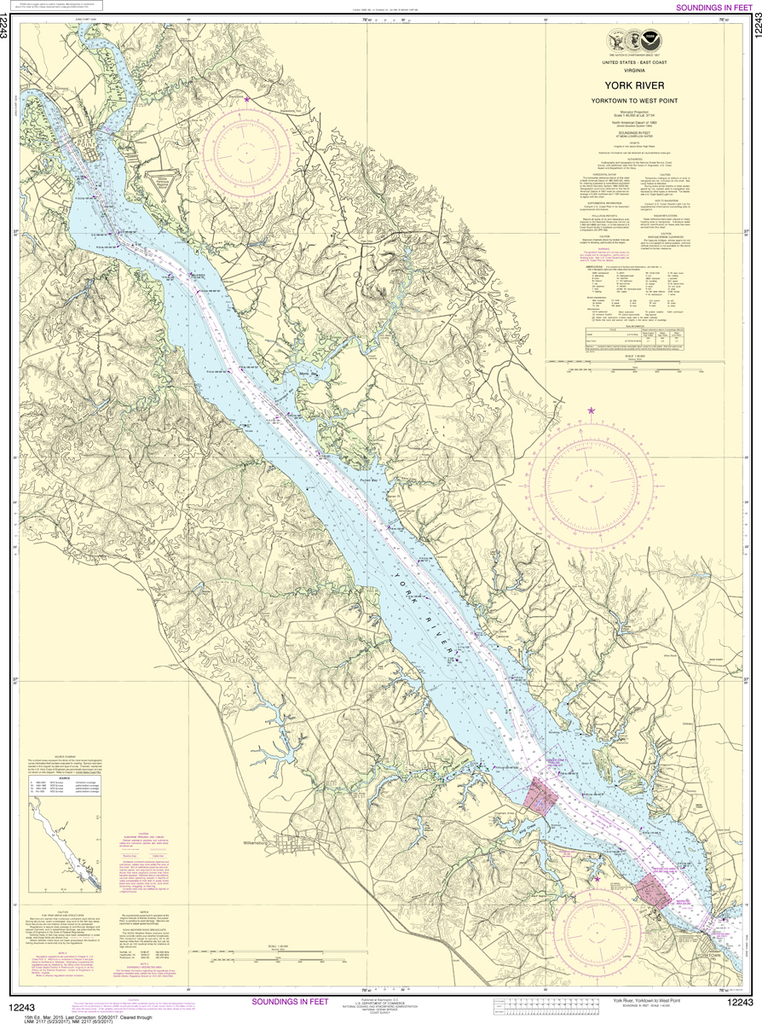
NOAA Chart 12243: York River - Yorktown to West Point
$23.75
The chart you are viewing is NOT updated weekly and does NOT include all of the latest Notice to Mariners corrections. Region: Mid-Atlantic Paper Size: 45" x 36" Chart Image Size: 42" x 31" Scale: 1:40,000 Captain's Nautical...
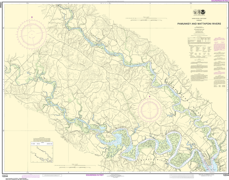
THIS CHART IS CURRENTLY CANCELED BY NOAA. We know there are many questions about NOAA charts, newest editions and charts being cancelled. The U.S. Office of Coast Survey provides an updated list of all chart updates and the ones being...
NOAA Chart 12248: James River - Newport News to Jamestown Island, Back River and College Creek
$23.75
The chart you are viewing is NOT updated weekly and does NOT include all of the latest Notice to Mariners corrections. Region: Mid-Atlantic Paper Size: 45" x 36" Chart Image Size: 42" x 35" Scale: 1:40,000 Captain's Nautical...
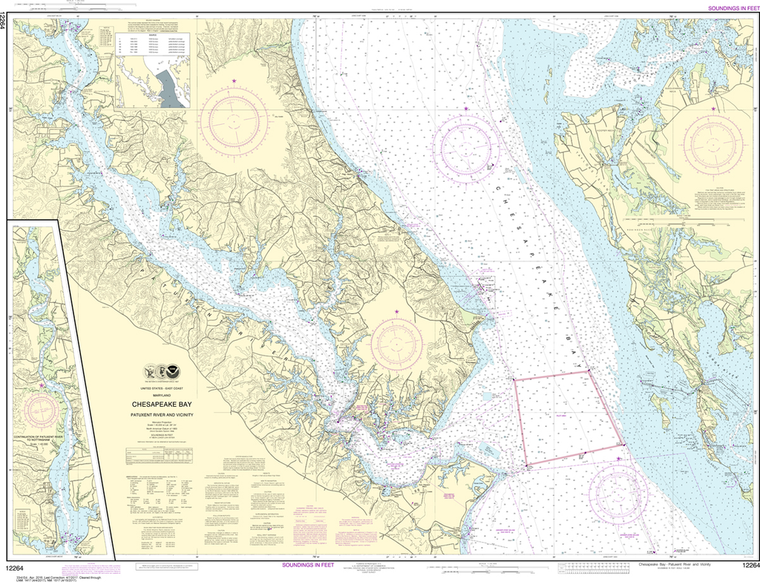
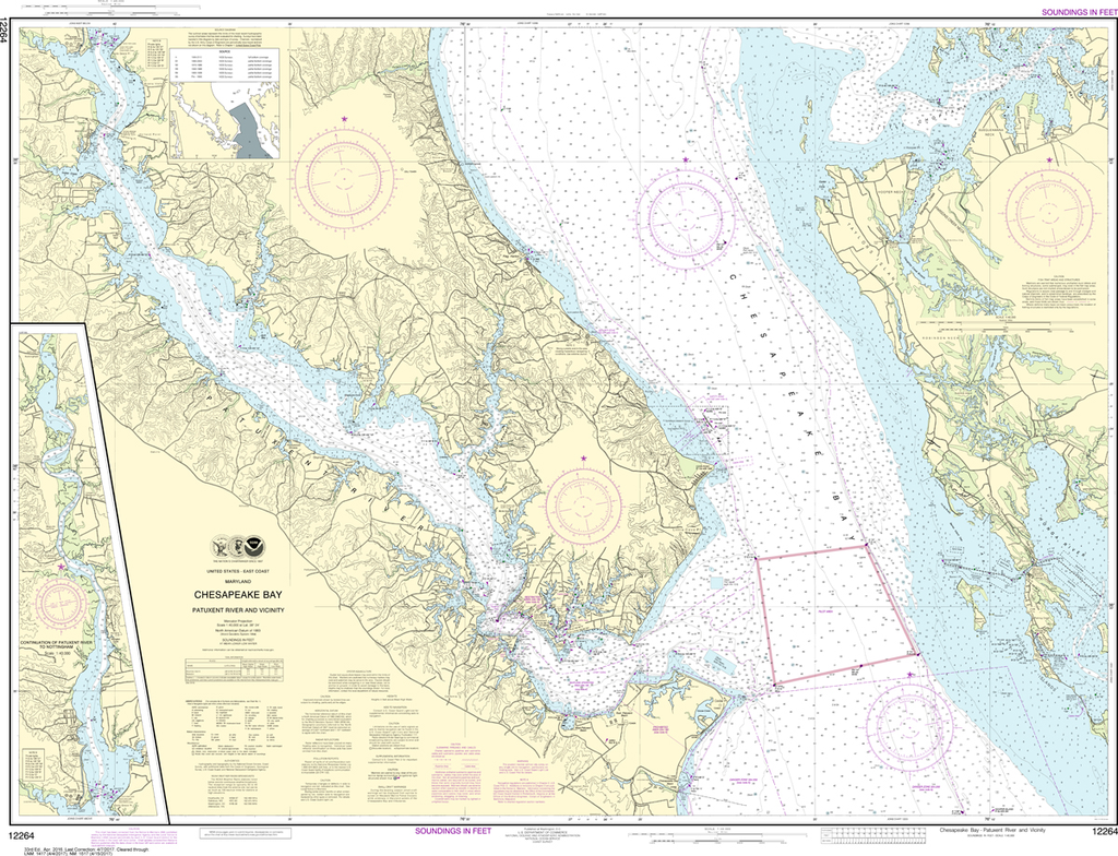
NOAA Chart 12264: Chesapeake Bay - Patuxent River and Vicinity
$23.75
The chart you are viewing is NOT updated weekly and does NOT include all of the latest Notice to Mariners corrections. Region: Mid-Atlantic Paper Size: 49" x 36" Chart Image Size: 35" x 46" Scale: 1:40,000 Captain's Nautical...
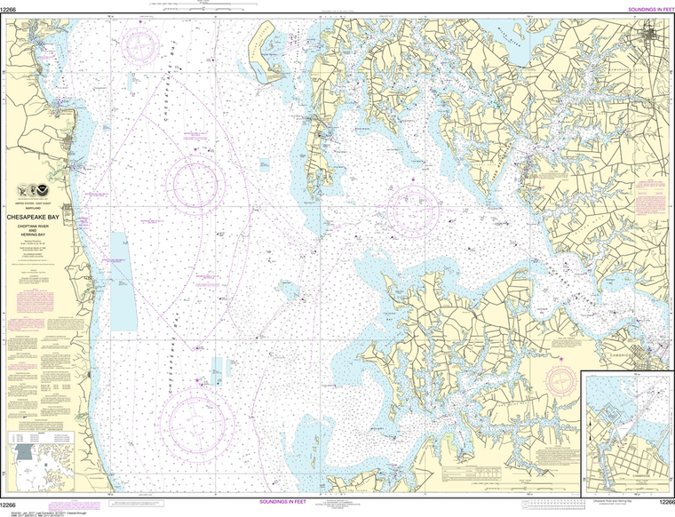
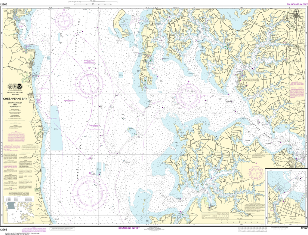
NOAA Chart 12266: Chesapeake Bay - Choptank River and Herring Bay, Cambridge
$23.75
The chart you are viewing is NOT updated weekly and does NOT include all of the latest Notice to Mariners corrections. Region: Mid-Atlantic Paper Size: 49" x 36" Chart Image Size: 35" x 46" Scale: 1:40,000 Captain's Nautical...
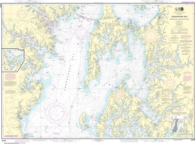
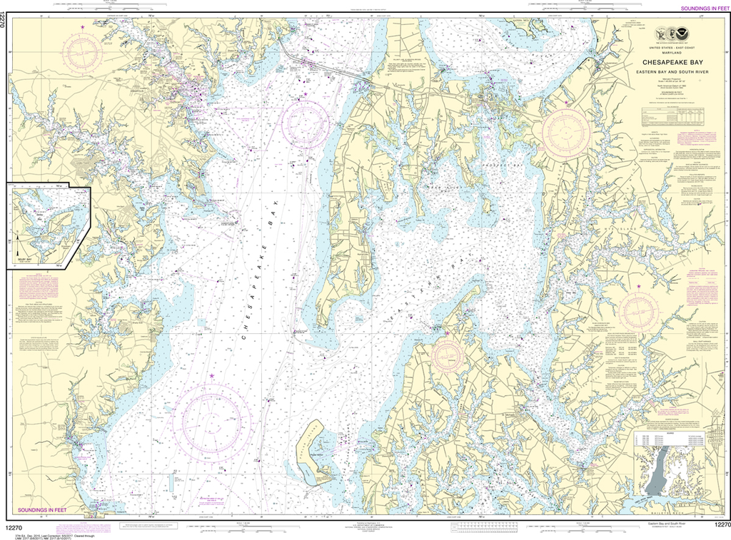
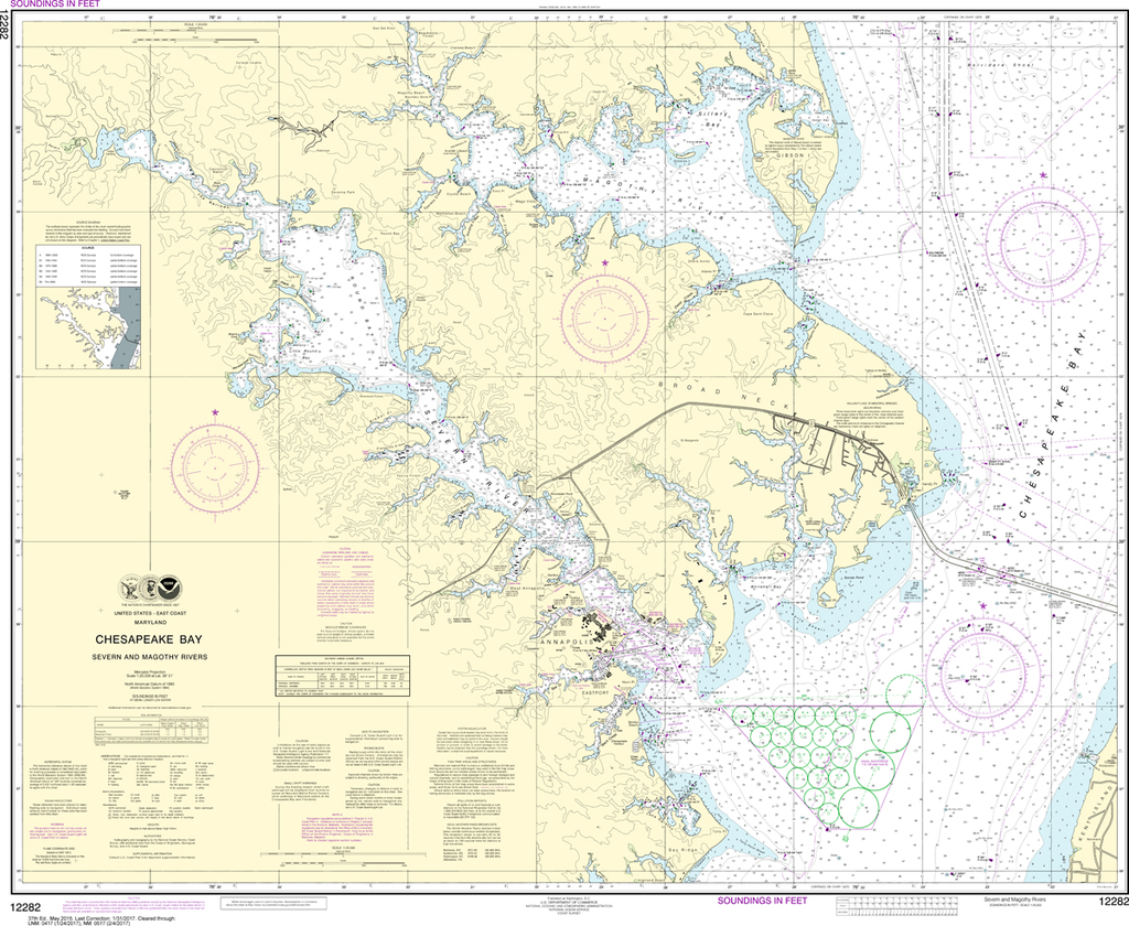
NOAA Chart 12270: Chesapeake Bay - Eastern Bay and South River, Selby Bay
$23.75
The chart you are viewing is NOT updated weekly and does NOT include all of the latest Notice to Mariners corrections. Region: Mid-Atlantic Paper Size: 51" x 36" Chart Image Size: 35" x 47" Scale: 1:40,000 Captain's Nautical...
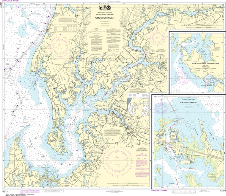
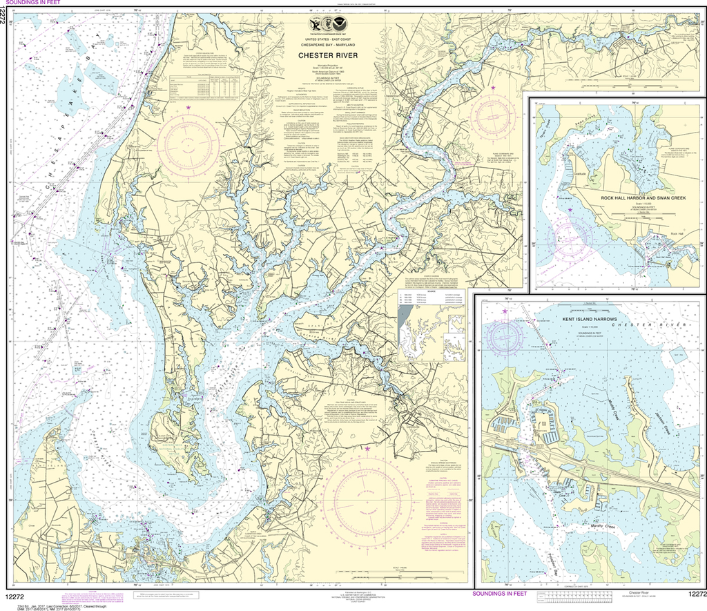
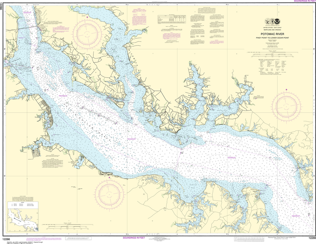
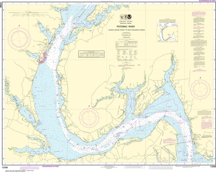
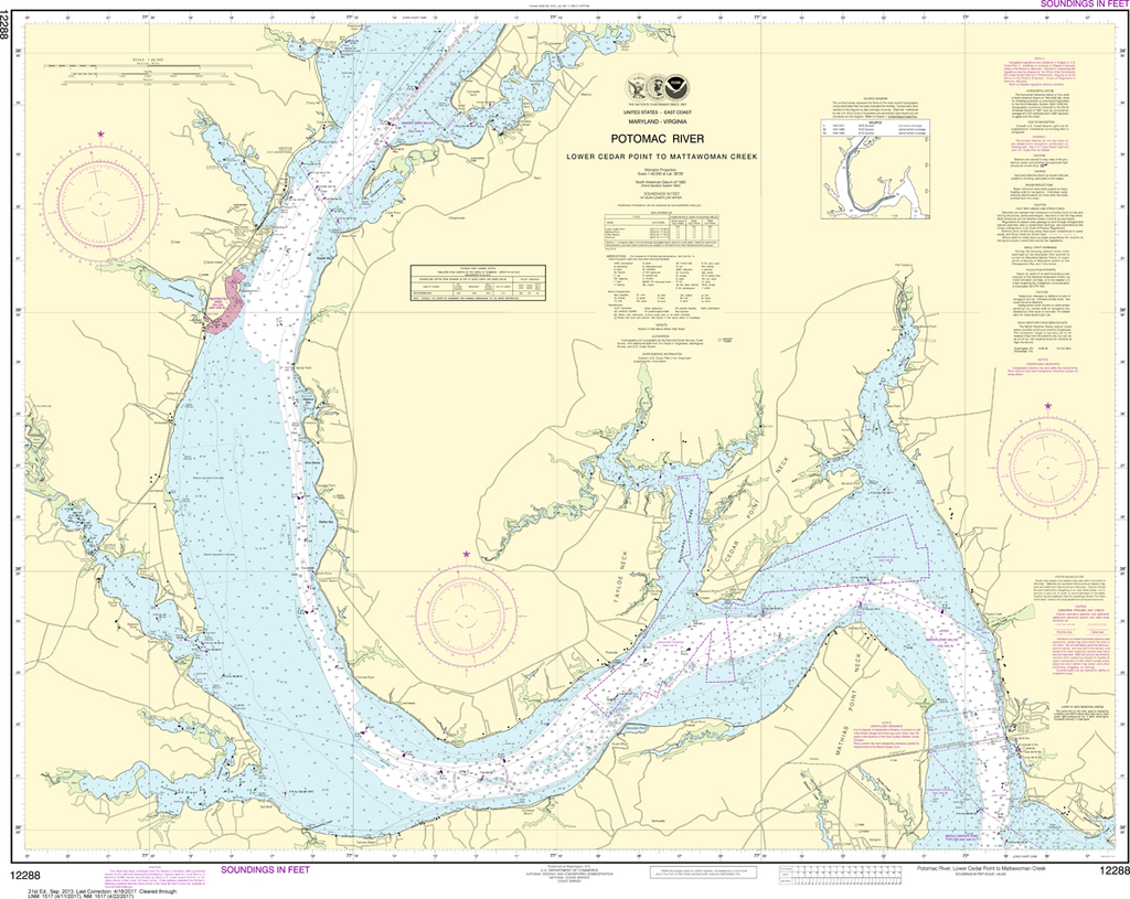
The chart you are viewing is NOT updated weekly and does NOT include all of the latest Notice to Mariners corrections. Region: Mid-Atlantic Paper Size: 54" x 36" Chart Image Size: 35" x 50" Scale: 1:40,000 Captain's Nautical...
NOAA Chart 12278: Chesapeake Bay - Approaches to Baltimore Harbor
$23.75
The chart you are viewing is NOT updated weekly and does NOT include all of the latest Notice to Mariners corrections. Region: Mid-Atlantic Paper Size: 48" x 36" Chart Image Size: 35" x 44" Scale: 1:40,000 Captain's Nautical...
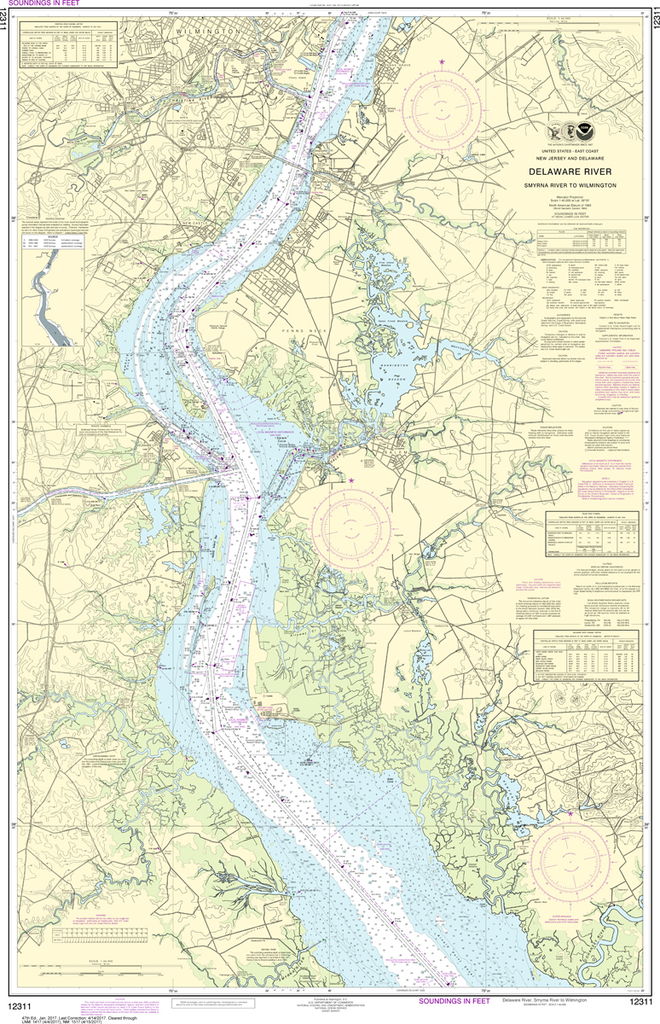
NOAA Chart 12311: Delaware River - Smyrna River to Wilmington
$23.75
The chart you are viewing is NOT updated weekly and does NOT include all of the latest Notice to Mariners corrections. Region: Mid-Atlantic Paper Size: 50" x 36" Chart Image Size: 46" x 30" Scale: 1:40,000 Captain's Nautical...