WAGGONER TRIO- ON SALE NOW!!!
- Shop by Department
- Nautical Charts
- New Releases
- Marine Education Textbooks
- About Us
- +Shop by Department
- +Nautical Charts
- New Releases
- +Marine Education Textbooks
- +About Us
- Contact Us
- FAQ
- Repair Services
- Sign in

$385.00
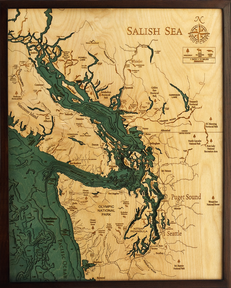
Salish Sea, Washington 3-D Nautical Wood Chart (Large) Size: 24.5" x 31" Laser-cut wooden relief map of the Salish Sea, featuring the Salish Sea, in Washington State and British Columbia. Map is framed and ready to hang, a unique...

$385.00
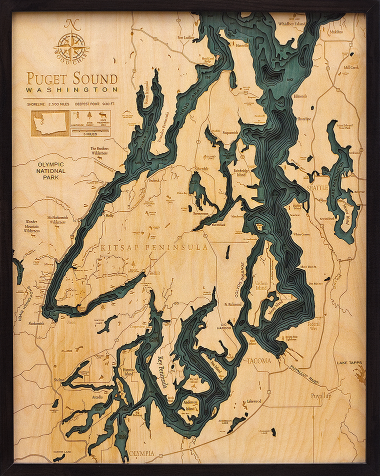
Puget Sound, Washington 3-D Nautical Wood Chart (Large) Size: 24.5" x 31" Laser-cut wooden relief map of the San Juan Islands, featuring the San Juan Islands, in Washington State. Map is framed and ready to hang, a unique and...
$195.00
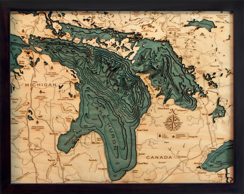
Lake Huron 3-D Nautical Wood Chart (Small) Wood Chart Size 16" x 20" Laser-cut wooden relief map of Lake Huron, featuring the second largest Great Lake. Map is framed and ready to hang, a unique and beautiful gift of artwork...
$200.00
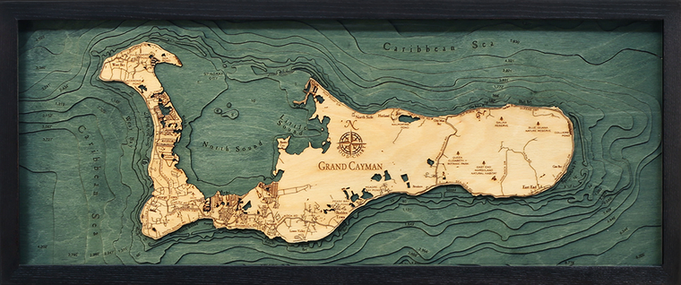
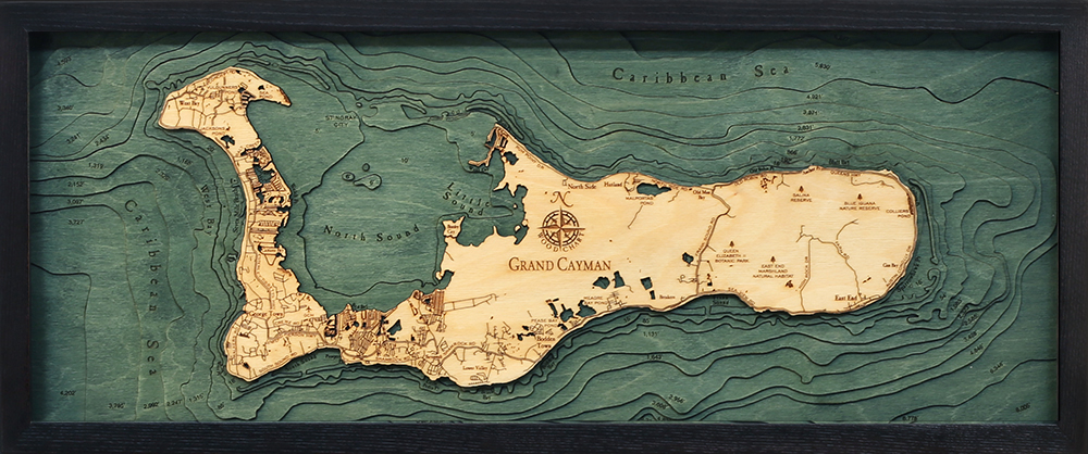
Grand Cayman, Cayman Islands 3-D Nautical Wood Chart (Medium) Size: 13.5" x 31" Laser-cut wooden relief map of Grand Cayman, featuring Grand Cayman Island in the Caribbean Sea. Map is framed and ready to hang, a unique and beautiful gift...

$305.00
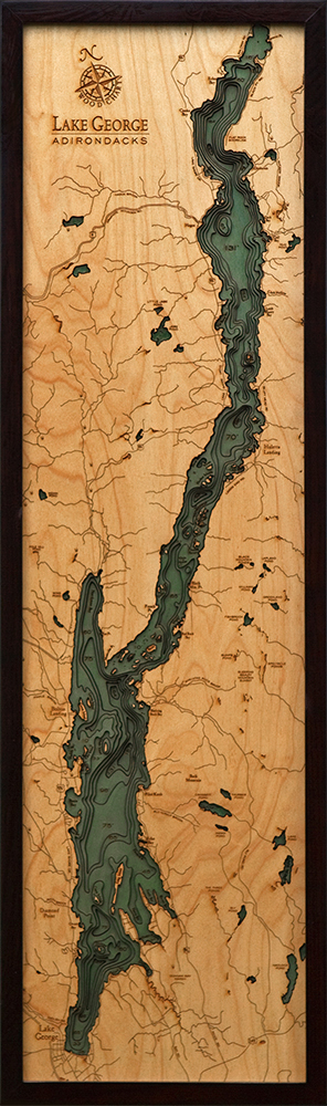
Lake George, New York 3-D Nautical Wood Chart (Narrow) Wood Chart Size 13.5" x 43" Laser-cut wooden relief map of Lake George, New York, featuring Lake George, at the base of the Adirondack Mountains. Map is framed and ready to...

$268.00
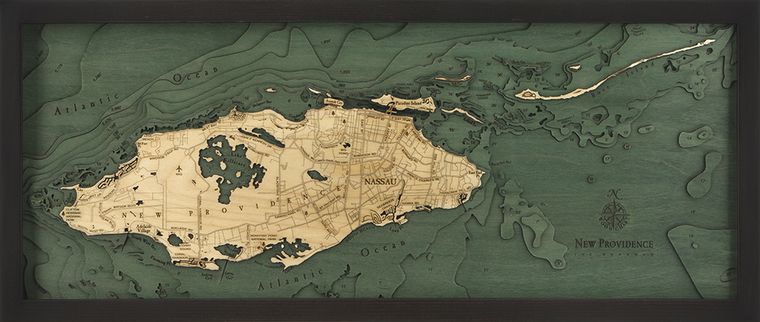
Nassau, Bahamas 3-D Nautical Wood Chart (Medium) Size: 13.5" x 31" Laser-cut wooden relief map of Nassau, the capital of the Bahamas, featuring the Bahamian islands of New Providence, Rose Island, and Paradise Island. Map is framed and ready to...
$340.00
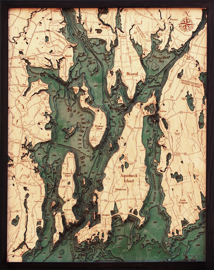
Narragansett/ Newport, Rhode Island 3-D Nautical Wood Chart (Large) Size: 24.5" x 31" Laser-cut wooden relief map of Narragansett Bay, Rhode Island, featuring Narragansett Bay and Newport, Rhode Island. Map is framed and ready to hang, a unique and beautiful...
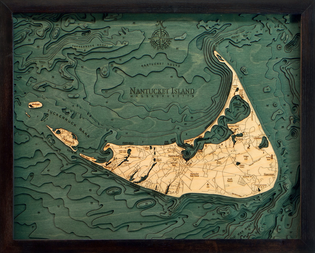
$175.00
Nantucket, Massachusetts 3-D Nautical Wood Chart (Narrow) Size: 16" x 20" Laser-cut wooden relief map of Nantucket, featuring Nantucket Island, Massachusetts. Map is framed and ready to hang, a unique and beautiful gift of artwork for sailors and land-lovers alike....

$282.00
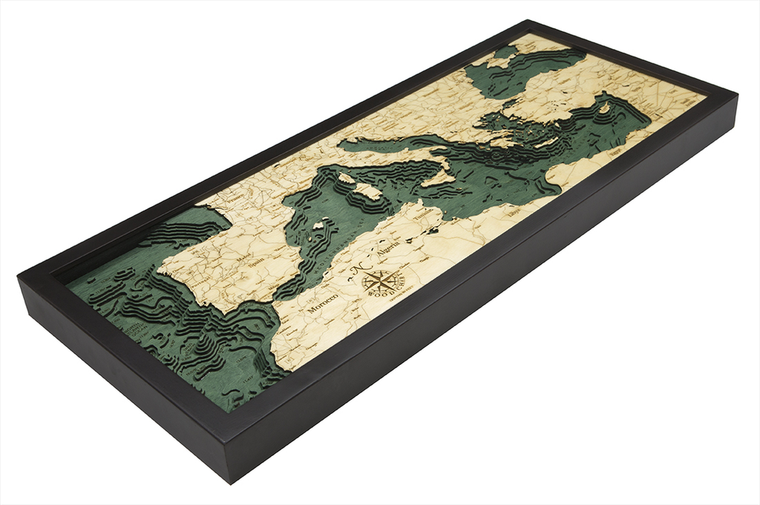
Mediterranean Sea 3-D Nautical Wood Chart (Medium) Size: 13.5" x 31" Laser-cut wooden relief map of The Mediterranean Sea, featuring the Mediterranean region of Northern Africa, Southern Europe, and the Middle East. Map is framed and ready to hang,...

$380.00
Georgia Coast 3-D Nautical Wood Chart (Large) Size: 24.5" x 31" Points of Interest on Georgia Coast Map: Cumberland Island, Sapelo Island, Ossabaw Island, Savannah, Fort Stewart Hinesville, Kingsland, Jekyll Island Georgia Coast Wood Map Details: Made of birch Solid wood...

$156.00
Lake Tahoe 3-D Nautical Wood Chart (Small) Size: 16" x 20" Laser-cut wooden relief map of Lake Tahoe, featuring Lake Tahoe, on the border of California & Nevada. Map is framed and ready to hang, a unique and beautiful...

$190.00
Lake Conroe, Texas 3-D Nautical Wood Chart (Small) Wood Chart Size: 16" x 20" Laser-cut wooden relief map of Lake Conroe, featuring Lake Conroe in Texas. Map is framed and ready to hang, a unique and beautiful gift of artwork...
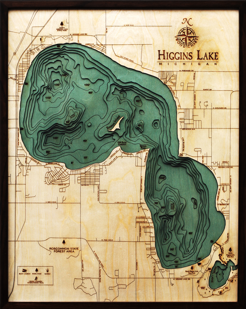
$263.00
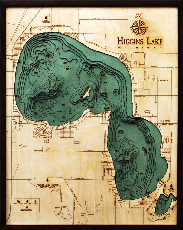
Higgins Lake, Michigan 3-D Nautical Wood Chart (Large) Size: 24.5" x 31" Laser-cut wooden relief map of Higgins Lake, featuring Higgins Lake, in Northern Michigan. Map is framed and ready to hang, a unique and beautiful gift of artwork for...

$175.00
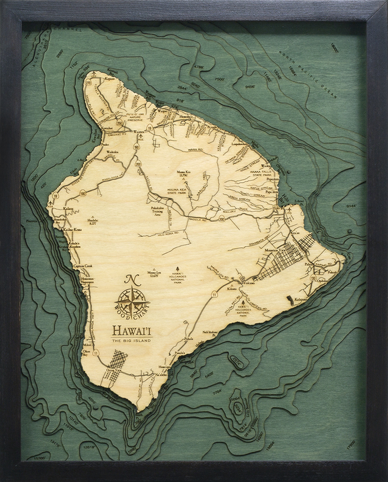
Hawaii ( The Big Island) 3-D Nautical Wood Chart (Small) Size: 16" x 20" Laser-cut wooden relief map of The Big Island, featuring Hawaii. Map is framed and ready to hang, a unique and beautiful gift of artwork for sailors...
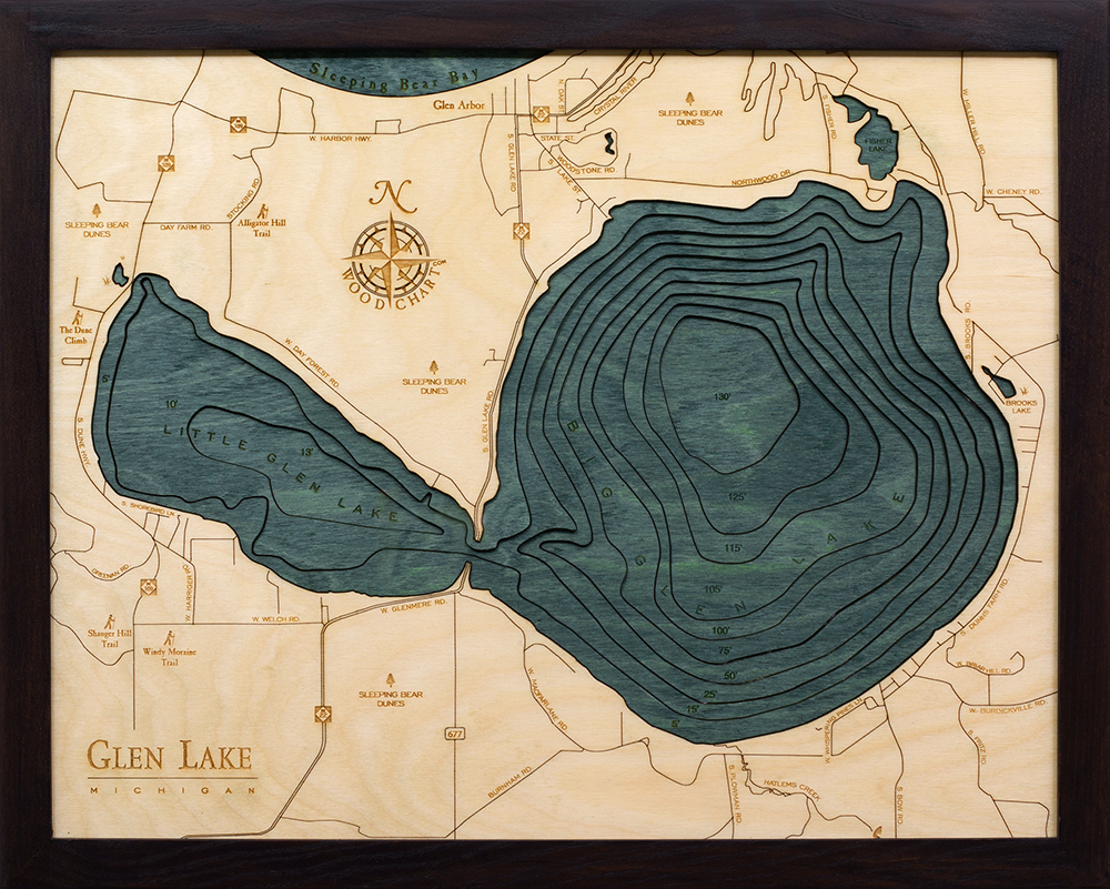
$155.00
Glen Lake, Michigan 3-D Nautical Wood Chart (Small) Size: 16" x 20" Laser-cut wooden relief map of Glen Lake, Michigan, featuring Glen Lake and the Sleeping Bear Dunes in Northern Michigan. Map is framed and ready to hang, a...

$305.00
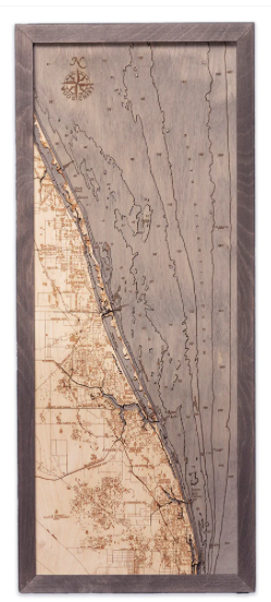
Fort Lauderdale, Florida 3-D Nautical Wood Chart (Narrow) Size: 13.5" x 43" Laser-cut wooden relief map of Fort Lauderdale, Florida, featuring Fort Lauderdale, which is known for its beaches and miles of boating canals, and Port Everglades, which is...
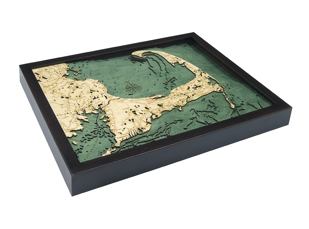
$192.00
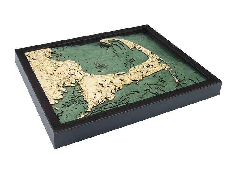
Cape Cod, Massachusetts 3-D Nautical Wood Chart (Small) Size: 16" x 20" inches Laser-cut wooden relief map of Cape Cod, Massachusetts, featuring Cape Cod. Map is framed and ready to hang, a unique and beautiful gift of artwork for...

$310.00
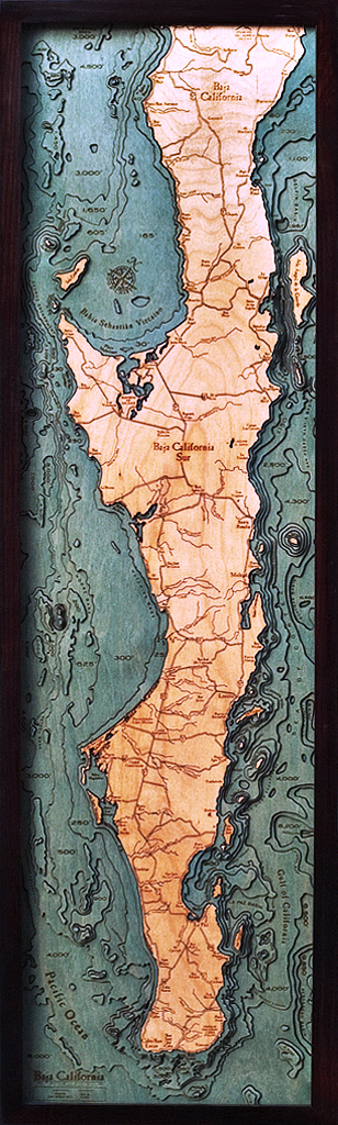
Size: 13.5 x 43 inches Points of Interest on Baja Peninsula Map: Cabo San Lucas, Sea of Cortez, Gulf of California, and the Pacific Ocean Baja Peninsula Wood Map Details: Made of birch Solid wood frame made to fit Laser-cut...

$435.00
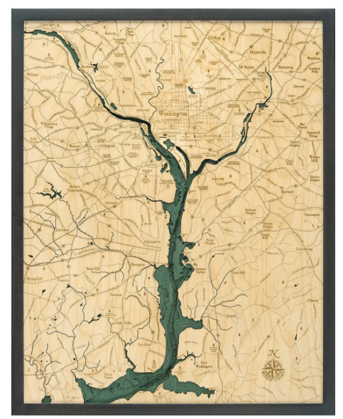
Washington, D.C. 3-D Nautical Wood Chart (Large) Size: 24.5" x 31" Points of Interest on the Washington DC Nautical Wood Map: Alexandria, Arlington, Capitol Hill, Fort Washington, McLean, Mount Vernon, Pentagon, and The White House Washington DC Wood Chart...

$159.00
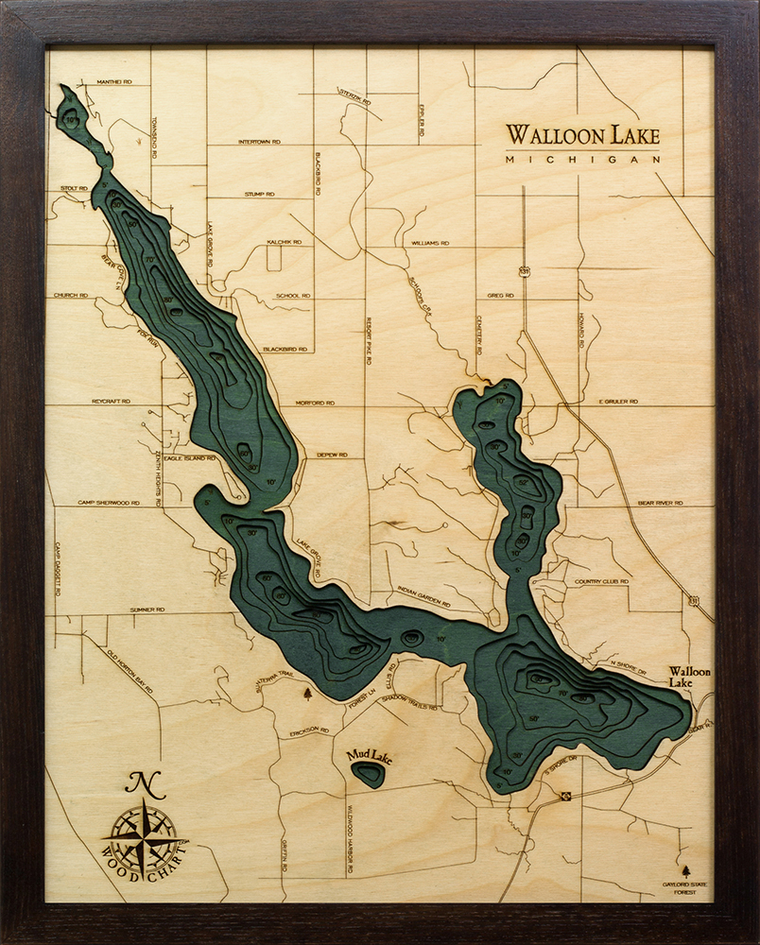
Walloon Lake, Michigan 3-D Nautical Wood Chart (Small) Size: 16" x 20" Laser-cut wooden relief map of Walloon Lake, featuring Walloon Lake, in Northern Michigan. Map is framed and ready to hang, a unique and beautiful gift of artwork...
$342.00
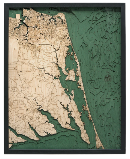
Virginia Beach to Kitty Hawk 3-D Nautical Wood Chart (Large) Size: 24.5" x 31" Virginia Beach to Kitty Hawk Nautical Wood Map Details: Made of birch Solid wood frame made to fit Laser-cut depth Engraved names and locations Acrylic glass protection...
$342.00
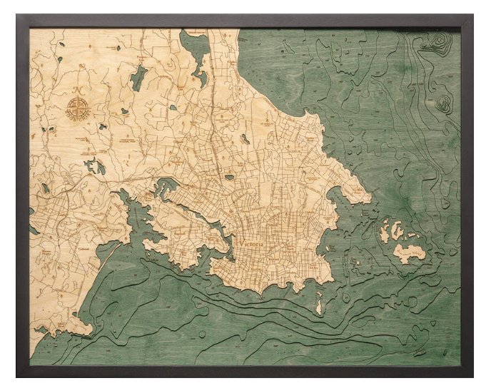
Victoria Canada 3-D Nautical Wood Chart (Large) Size: 24.5" x 31" Victoria Wood Map Details: Made of birch Solid wood frame made to fit Laser-cut depth Engraved names and locations Acrylic glass protection Arrives ready to hang Frame Styles: Dark...
$342.00
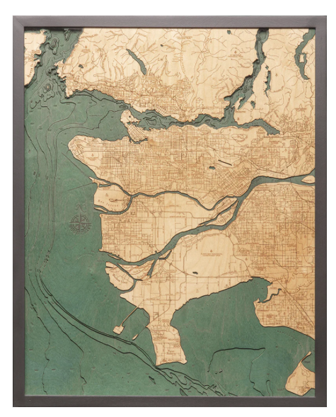
Vancouver Canada 3-D Nautical Wood Chart (Large) Size: 24.5" x 31" Vancouver Wood Map Details: Made of birch Solid wood frame made to fit Laser-cut depth Engraved names and locations Acrylic glass protection Arrives ready to hang Frame Styles: Dark...

$282.00
Treasure Coast 3-D Nautical Wood Chart (Medium) Size: 13.5" x 31" Points of Interest on the Treasure Coast, Florida, Nautical Wood Chart: Gifford, Ft. Pierce, Jensen Beach, Micco, Sebastian, St. Lucie, Vero Beach, Wabasso, White City, Winter Beach Treasure Coast, Florida,...