WAGGONER TRIO- ON SALE NOW!!!
- Shop by Department
- Nautical Charts
- New Releases
- Marine Education Textbooks
- About Us
- +Shop by Department
- +Nautical Charts
- New Releases
- +Marine Education Textbooks
- +About Us
- Contact Us
- FAQ
- Repair Services
- Sign in
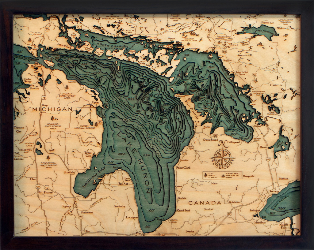
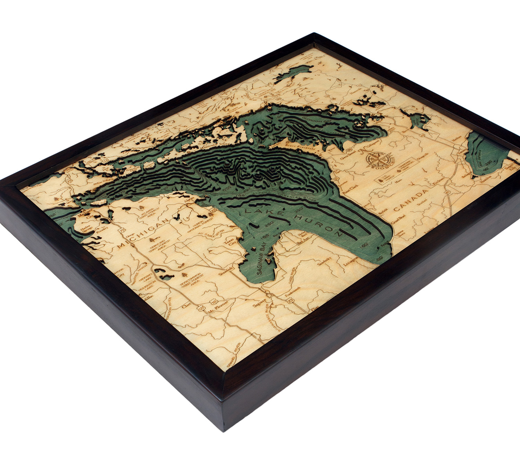
WoodCharts-LH-D2S
$195.00
Laser-cut wooden relief map of Lake Huron, featuring the second largest Great Lake. Map is framed and ready to hang, a unique and beautiful gift of artwork for sailors and land-lovers alike.
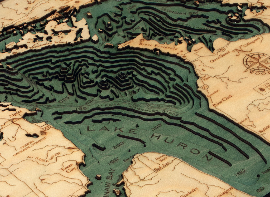
Lake Huron is home to the Georgian Bay, the largest bay in the Great Lakes, and also to Manitoulin Island, which is the largest freshwater island in the world. It's surrounded by the world's largest limestone quarries, and its beaches are sandy and shallow (excluding those along the coast of the Georgian Bay, which are rocky).
Points of Interest: Saginaw Bay, Port Huron, Georgian Bay, Drummond Island, Mackinac Island, Mackinaw City, St. Joseph Island, and Sault Ste. Marie.
Wood Charts are based on soundings and measurements from bathymetric and nautical charts. Each depth layer is laser-cut from sheets of Baltic birch and glued together "bread and butter" style to create the contours and shorelines of striking waterways. Select layers are hand-stained a rich blue-green color to discern water from land, and major byways are etched into the land. The whole work is framed in a custom, solid wood frame and protected with a sheet of durable, ultra-transparent acrylic.
This product is not stocked at Captain's store, but may be special-ordered from the manufacturer or distributor.
Please allow up to two weeks for your special-ordered item to arrive. Captain's will contact you if your item is expected to take longer, or if your item is out of stock at the supplier.
Returns of Special-Order Items:
Since this is a specialty item, there are no returns or exchanges for this product.
$385.00
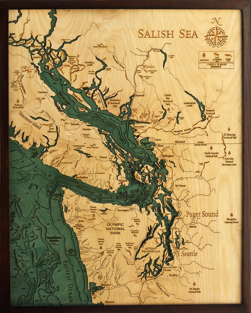
Salish Sea, Washington 3-D Nautical Wood Chart (Large) Size: 24.5" x 31" Laser-cut wooden relief map of the Salish Sea, featuring the Salish Sea, in Washington State and British Columbia. Map is framed and ready to hang, a unique...
$385.00
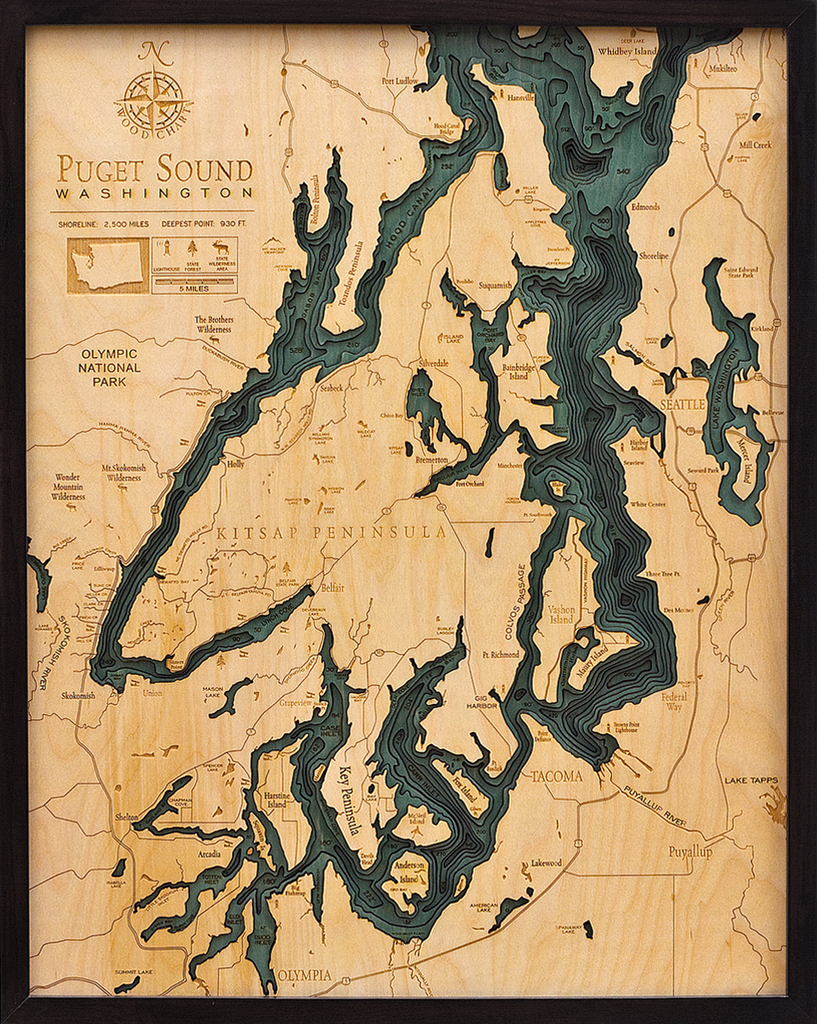
Puget Sound, Washington 3-D Nautical Wood Chart (Large) Size: 24.5" x 31" Laser-cut wooden relief map of the San Juan Islands, featuring the San Juan Islands, in Washington State. Map is framed and ready to hang, a unique and...
$200.00
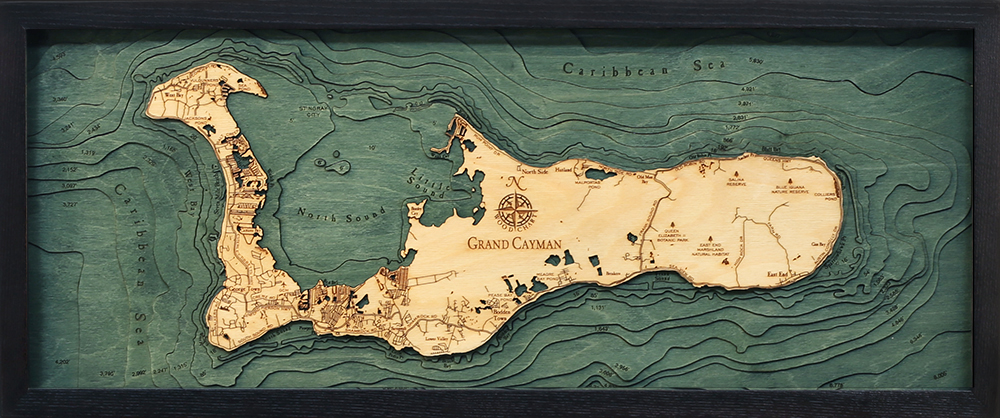
Grand Cayman, Cayman Islands 3-D Nautical Wood Chart (Medium) Size: 13.5" x 31" Laser-cut wooden relief map of Grand Cayman, featuring Grand Cayman Island in the Caribbean Sea. Map is framed and ready to hang, a unique and beautiful gift...
$305.00
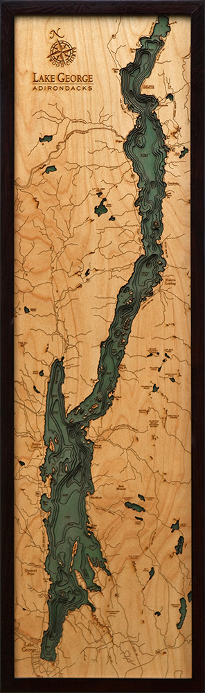
Lake George, New York 3-D Nautical Wood Chart (Narrow) Wood Chart Size 13.5" x 43" Laser-cut wooden relief map of Lake George, New York, featuring Lake George, at the base of the Adirondack Mountains. Map is framed and ready to...


