WAGGONER TRIO- ON SALE NOW!!!
- Shop by Department
- Nautical Charts
- New Releases
- Marine Education Textbooks
- About Us
- +Shop by Department
- +Nautical Charts
- New Releases
- +Marine Education Textbooks
- +About Us
- Contact Us
- FAQ
- Repair Services
- Sign in
Sold Out
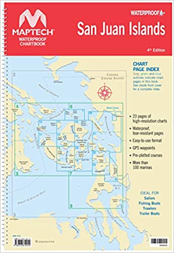
San Juan Islands Chartbook - 4th Edition Waterproof Chartbook Spiral-bound chartbook with color reproductions of NOAA charts, printed on durable waterproof and tear-resistant paper. Features pre-plotted courses and more.

$69.95
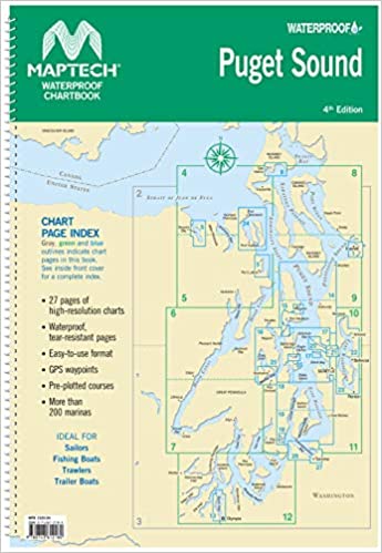
4th Edition Spiral-bound chartbook with color reproductions of NOAA charts, printed on durable waterproof and tear-resistant paper. Features pre-plotted courses and more.
$24.95
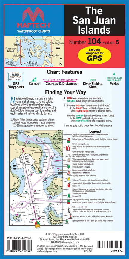
Maptech Number 104- Edition 5 Folding chart printed on durable waterproof and tear-resistant paper. Features pre-plotted courses and distances, GPS waypoints, marine facilities, and parks.#
$24.95
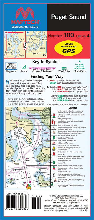
Maptech Number 100 - Edition 5 Folding chart printed on durable waterproof and tear-resistant paper. Features pre-plotted courses and distances, GPS waypoints, marine facilities, and parks.#

$99.95 $149.95
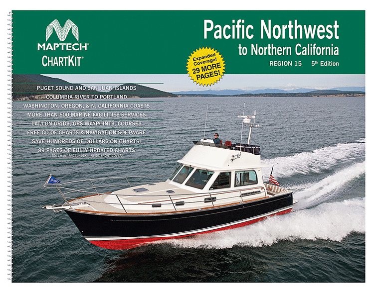
ChartKit® Region 15, 5th EditionPacifice Northwest to Northern California Completely updated. Coastal and offshore coverage. Full-color charts, GPS waypoints, courses and distances, Yeoman points, and color aerial photos. Save hundreds of dollars on charts. 22 X 17", 90 chart pages.ChartKits®...
$24.95
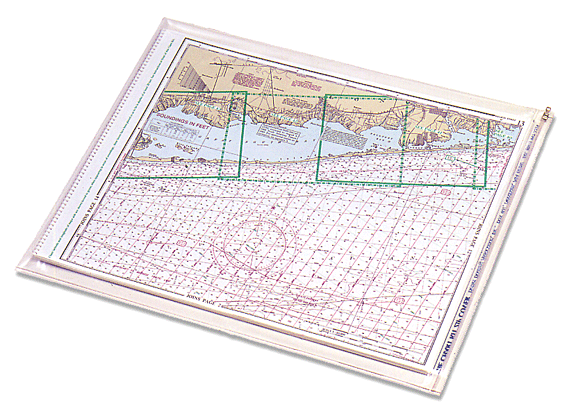
Use this ChartKit Zip Cover to protect your ChartKit from the elements! It's made of durable, see-through vinyl with a slide zipper to seal out moisture.
$24.95
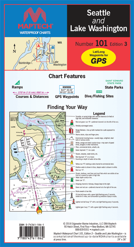
Maptech Number 101- Edition 3 Folding chart printed on durable waterproof and tear-resistant paper. Features pre-plotted courses and distances, GPS waypoints, marine facilities, and parks.#
$69.95
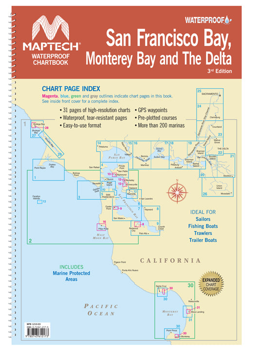
San Francisco Bay, Monterey Bay and The Delta, 3rd Edition Includes San Francisco Bay to Bodega Bay, Monterey Bay and The Delta from Stockton to Sacramento. 31 pages of high-resolution charts with GPS waypoints, pre-plotted courses and more than 200...
$24.95
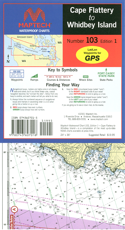
Maptech Number 103- Edition 2 Folding chart printed on durable waterproof and tear-resistant paper. Features pre-plotted courses and distances, GPS waypoints, marine facilities, and parks.
$124.95
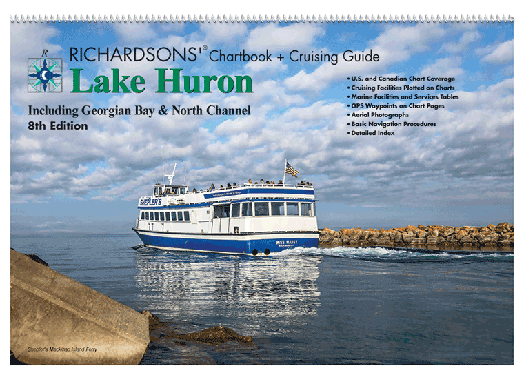
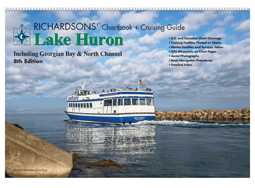
NEW CHARTBOOK & CRUISING GUIDE Includes: North Channel, Georgian Bay, west through the Straits of Mackinac, south to Sarnia, north to St. Joseph Island. - 12" x 18"- Spiral Bound- Cruising Information- Marine Facilities- Aerial Harbor Photographs- GPS Waypoint Labels-...
$49.95
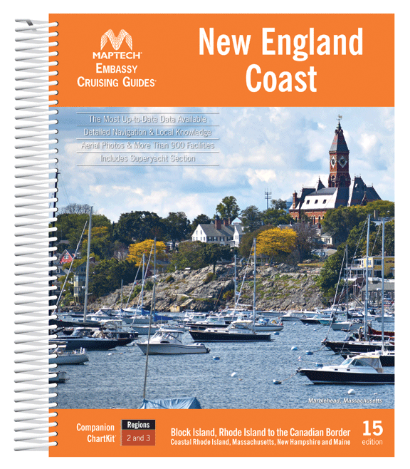
Block Island, Rhode Island to the Canadian Border. This edition includes detailed listings for more than 900 marinas divided into 15 cruising regions. Features include hundreds of GPS waypoints, full-color aerial photos, local navigation advice, and visitor tips for popular...
$59.95
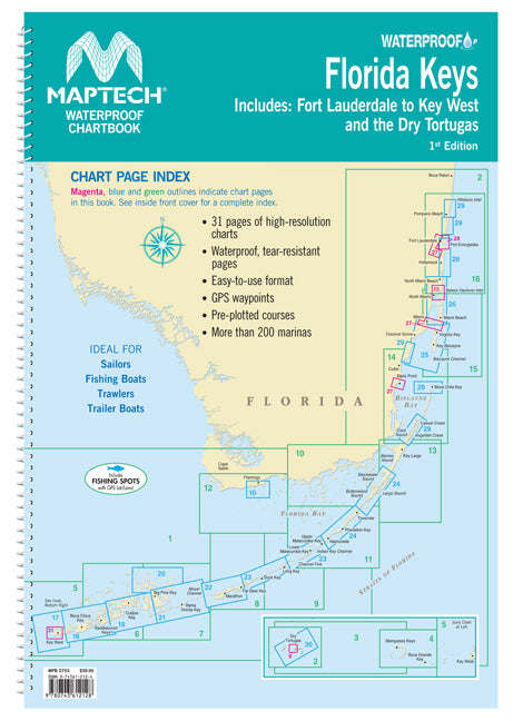
Fort Lauderdale to Key West and the Dry Tortugas. Easy-to-use format includes GPS waypoints, pre-plotted courses and more than 200 marinas. 31 chart pages.
$49.95
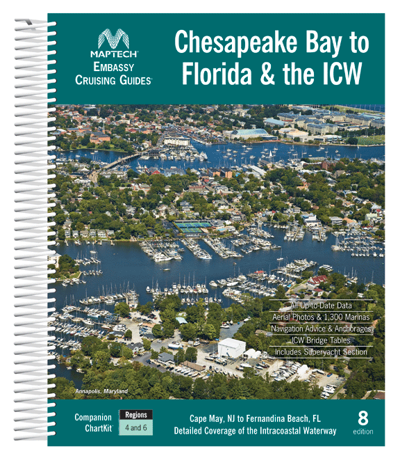
Cape May and Delaware Bay through the Chesapeake and Intracoastal Waterway and offshore to Fernandina Beach in northern Florida. Packed with detailed listings for marinas, local navigation advice, aerial photos, and an Intracoastal Waterway Bridge Table. 572 pages. Description Maptech's...

$149.95
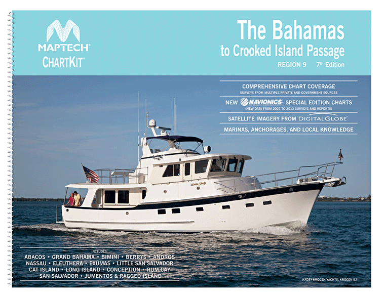
ChartKit® Region 9, 7th EditionThe Bahamas to Crooked Island Passage Includes Abacos, Grand Bahama, Bimini, Berrys, Andros, Nassau, Eleuthera, Exumas, Little San Salvador, Cat Island, Long Island, Conception, Rum Cay, San Salvador, Jumentos & Ragged Island. Full-color satellite imagery, marinas,...
$49.95
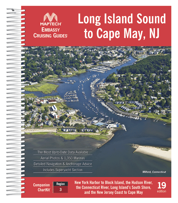
Covering New York Harbor to Block Island, the Hudson River, the Connecticut River, Long Island’s South Shore, and the New Jersey Coast to Cape May. Contains the most up-to-date data available, detailed navigation advice and anchorages, the best coastal dining...

$149.95
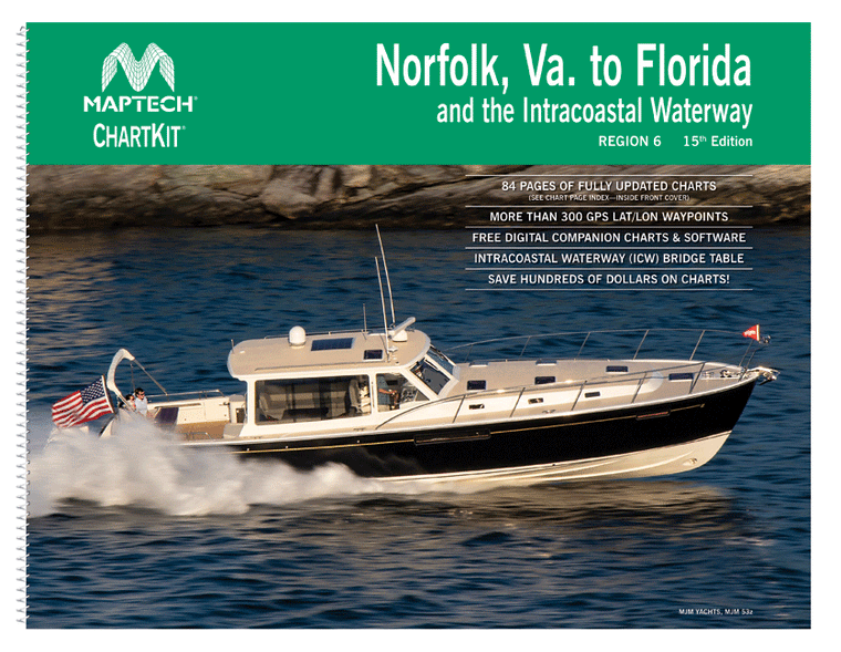
ChartKit® Region 6, 15th EditionNorfolk Va. to Florida and the Intracoastal Waterway Norfolk, VA, to Fernandina Beach, FL, inside and outside. Includes ICW navigation advice and Bridge Table. Full-color charts, GPS waypoints, courses and distances, and Yeoman reference points. Save hundreds...
$19.95
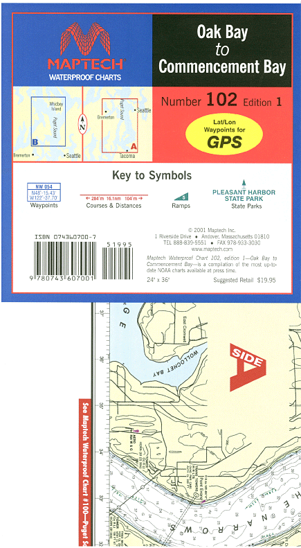
Maptech Number 102- Edition 1 Folding chart printed on durable waterproof and tear-resistant paper. Features pre-plotted courses and distances, GPS waypoints, marine facilities, and parks.#

$124.95
Coastal and offshore coverage. Full-color charts, GPS waypoints, courses and distances, Yeoman points, and color aerial photos. Save hundreds of dollars on charts. 22 X 17", 71 chart pages. ChartKits® have been a mainstay of boating for generations—more than 1 million ChartKits® have...

$29.95
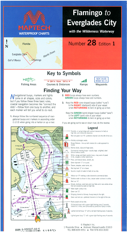
Flamingo to Everglades City, 1st Edtion Flamingo to Everglades City, including the Wilderness Waterway. Featuring waypoints for major buoys, anchorages, and a key to fish species. 24" x 36", scale 1:166,666 with insets,
$29.95
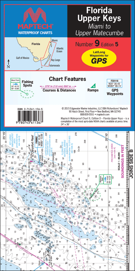
Florida: Upper Keys--Miami to Upper Matecumbe, 5th Edition Bakers Haulover Inlet and Miami to Upper Matecumbe Key. Featuring on-site GPS waypoints for major buoys, courses and distances, 55 fish/dive sites, and ramp locations and information. 24" x 36", scale 1:80,000...

$69.95
New York Harbor to Cape May, NJ. Easy-to-use format includes GPS waypoints, pre-plotted courses and more than 380 marinas. 24 chart pages.

$149.95
ChartKit® Region 8, 16th Edition Florida West Coast and the Keys Completely updated. Coastal and offshore coverage. Full-color charts, more than 300 GPS waypoints and lat/lon minute grids for easy reference. Save hundreds of dollars on charts and free digital companion charts...

$149.95
ChartKit® Region 3, 17th EditionNew York to Nantucket and to Cape May, New Jersey Maptech®’s ChartKits® are full-color reproductions of NOAA charts bundled together in large cruising regions.ChartKits® have been a mainstay of boating for generations—more than 1 million ChartKits®...

$29.95
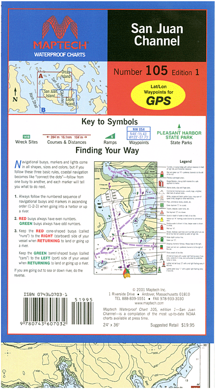
Maptech Number 105- Edition 1 Folding chart printed on durable waterproof and tear-resistant paper. Features pre-plotted courses and distances, GPS waypoints, marine facilities, and parks.#