The chart you are viewing is NOT updated weekly and does NOT include all of the latest Notice to Mariners corrections. Region: Northeast Atlantic Latest Edition: 30 Ed. (1-Feb-2016) Last Correction: 8-Nov-2019 Cleared Through: NTM 47/2019...
The chart you are viewing is NOT updated weekly and does NOT include all of the latest Notice to Mariners corrections. Region: Northeast Atlantic Paper Size: 52" x 36" Chart Image Size: 35" x 48" Scale: 1:40,000 Captain's...
The chart you are viewing is NOT updated weekly and does NOT include all of the latest Notice to Mariners corrections. Region: Northeast Atlantic Latest Edition: 24 Ed. (1-Jul-2014) Last Correction: 6-Sep-2019 Cleared Through: NTM 47/2019...
NOAA Chart 13318: Frenchman Bay and Mount Desert lsland
$23.75
The chart you are viewing is NOT updated weekly and does NOT include all of the latest Notice to Mariners corrections. Region: Northeast Atlantic Paper Size: 51" x 36" Chart Image Size: 47" x 30" Scale:...
NOAA Chart 13324: Tibbett Narrows to Schoodic Island
$23.75
The chart you are viewing is NOT updated weekly and does NOT include all of the latest Notice to Mariners corrections. Region: Northeast Atlantic Latest Edition: 15 Ed. (1-Mar-2013) Last Correction: 21-Jun-2019 Cleared Through: NTM 47/2019...
The chart you are viewing is NOT updated weekly and does NOT include all of the latest Notice to Mariners corrections. Region: Northeast Atlantic Latest Edition: 14 Ed. (1-Aug-2014) Last Correction: 25-Oct-2019 Cleared Through: NTM 47/2019...
NOAA Chart 13392: Grand Manan Channel - Southern Part
$23.75
The chart you are viewing is NOT updated weekly and does NOT include all of the latest Notice to Mariners corrections. Region: Northeast Atlantic Latest Edition: 3 Ed. (1-Feb-2011) Last Correction: 3-Dec-2019 Cleared Through: NTM 47/2019...
NOAA Chart 13394: Grand Manan Channel - Northern Part, North Head and Flagg Cove
$23.75
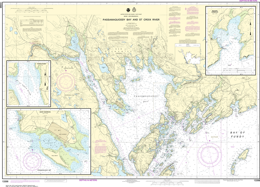
The chart you are viewing is NOT updated weekly and does NOT include all of the latest Notice to Mariners corrections. Region: Northeast Atlantic Latest Edition: 5 Ed. (1-Aug-2013) Last Correction: 5-Apr-2019 Cleared Through: NTM 47/2019 (23-Nov-2019)...
NOAA Chart 13398: Passamaquoddy Bay and St. Croix River, Beaver Harbor, Saint Andrews, Todds Point
$23.75
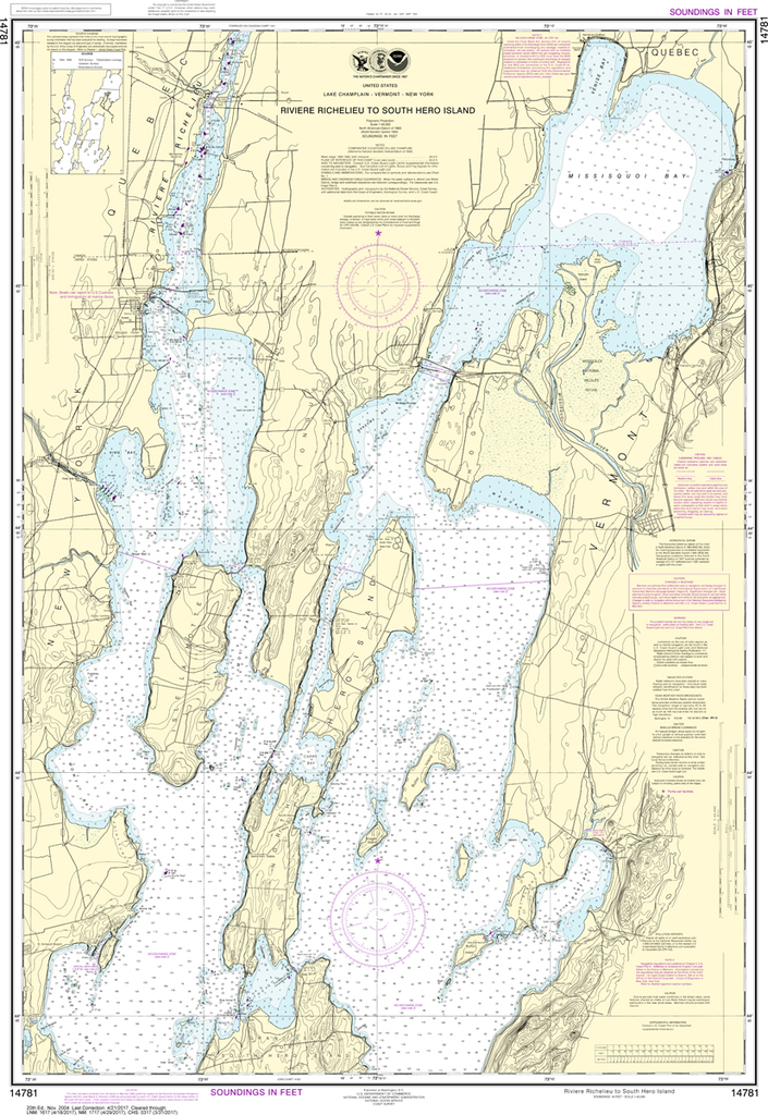
The chart you are viewing is NOT updated weekly and does NOT include all of the latest Notice to Mariners corrections. Region: Northeast Atlantic Latest Edition: 4 Ed. (1-Nov-2012) Last Correction: 9-Mar-2018 Cleared Through: NTM 47/2019 (23-Nov-2019)...
NOAA Chart 14781: Riviere Richelieu to South Hero Island
$23.75
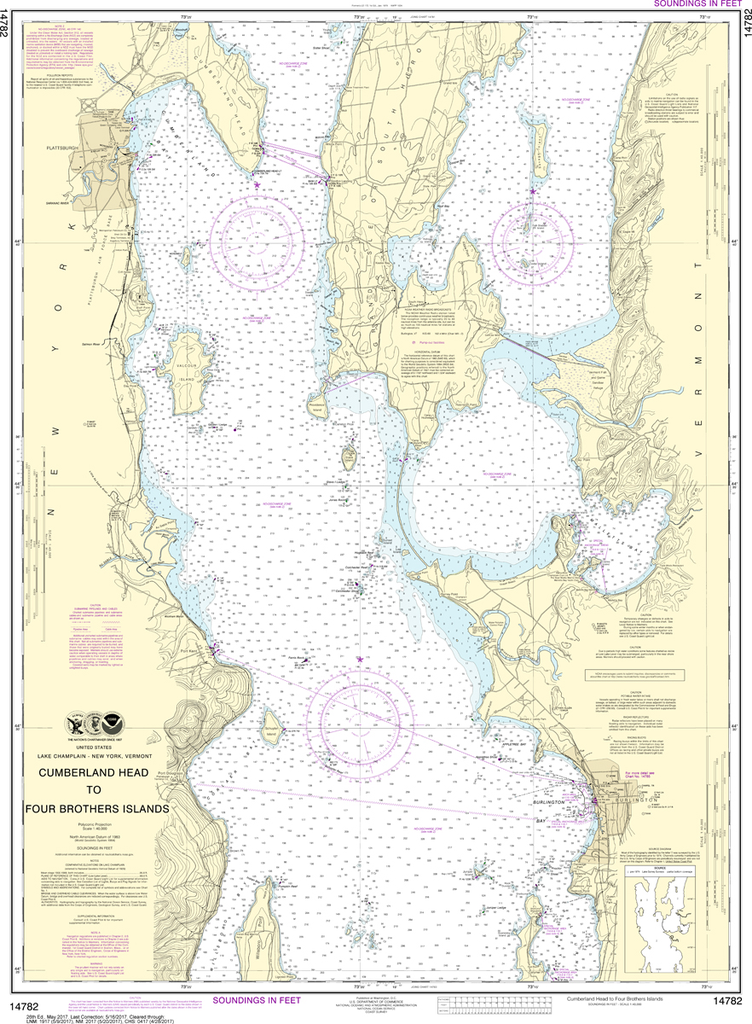
THIS CHART IS CURRENTLY CANCELED BY NOAA. We know there are many questions about NOAA charts, newest editions and charts being cancelled. The U.S. Office of Coast Survey provides an updated list of all chart updates and the ones being...
NOAA Chart 14782: Cumberland Head to Four Brothers Islands
$23.75
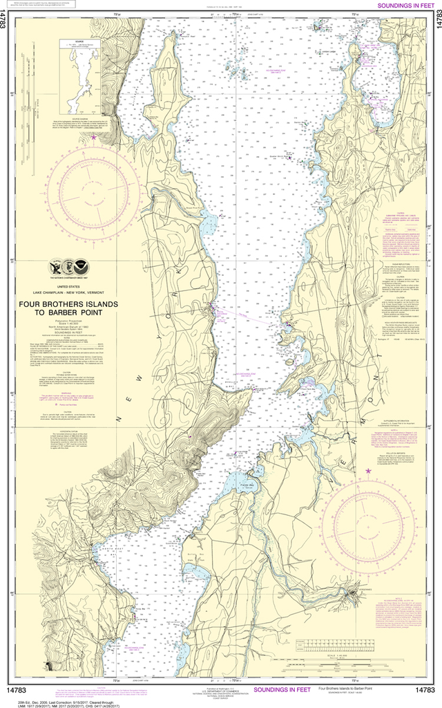
THIS CHART IS CURRENTLY CANCELED BY NOAA. We know there are many questions about NOAA charts, newest editions and charts being cancelled. The U.S. Office of Coast Survey provides an updated list of all chart updates and the ones being...
NOAA Chart 14783: Four Brothers Islands to Barber Point
$23.75
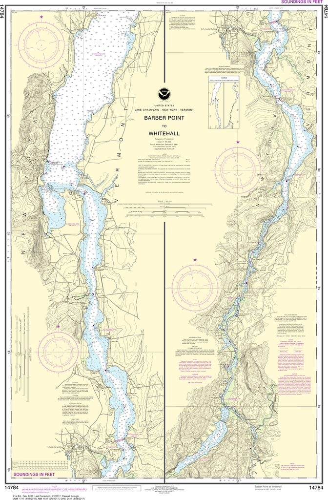
THIS CHART IS CURRENTLY CANCELED BY NOAA. We know there are many questions about NOAA charts, newest editions and charts being cancelled. The U.S. Office of Coast Survey provides an updated list of all chart updates and the ones being...
THIS CHART IS CURRENTLY CANCELED BY NOAA. We know there are many questions about NOAA charts, newest editions and charts being cancelled. The U.S. Office of Coast Survey provides an updated list of all chart updates and the ones being...
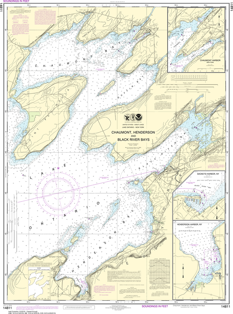
The chart you are viewing is NOT updated weekly and does NOT include all of the latest Notice to Mariners corrections. Region: Great Lakes Latest Edition: 20 Ed. (1-Apr-2016) Last Correction: 15-Nov-2019 Cleared Through: NTM 47/2019 (23-Nov-2019)...
NOAA Chart 14811: Chaumont, Henderson and Black River Bays; Sackets Harbor; Henderson Harbor; Chaumont Harbor
$23.75
The chart you are viewing is NOT updated weekly and does NOT include all of the latest Notice to Mariners corrections. Region: Great Lakes Latest Edition: 18 Ed. (1-May-2016) Last Correction: 3-Dec-2018 Cleared Through: NTM 47/2019...
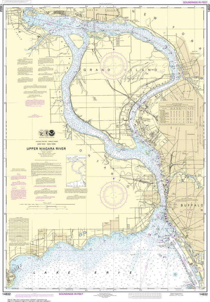
The chart you are viewing is NOT updated weekly and does NOT include all of the latest Notice to Mariners corrections. Region: Great Lakes Latest Edition: 24 Ed. (1-Feb-2004) Last Correction: 5-Jul-2017 Cleared Through: NTM 47/2019...
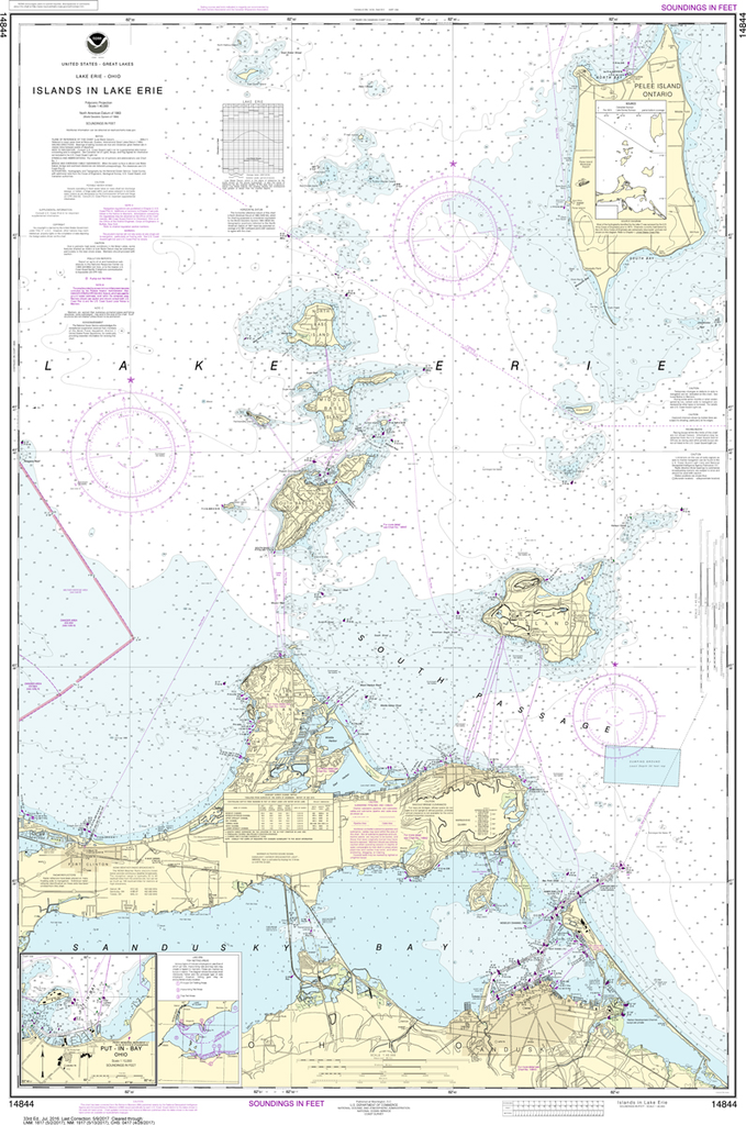
The chart you are viewing is NOT updated weekly and does NOT include all of the latest Notice to Mariners corrections. Region: Great Lakes Latest Edition: 35 Ed. (1-Mar-2013) Last Correction: 30-Nov-2018 Cleared Through: NTM...
NOAA Chart 14844: Islands in Lake Erie, Put-In-Bay
$23.75
THIS CHART IS CURRENTLY CANCELED BY NOAA. We know there are many questions about NOAA charts, newest editions and charts being cancelled. The U.S. Office of Coast Survey provides an updated list of all chart updates and the ones being...
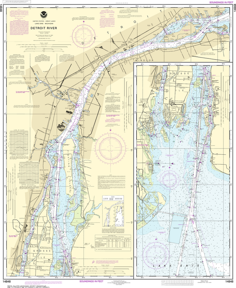
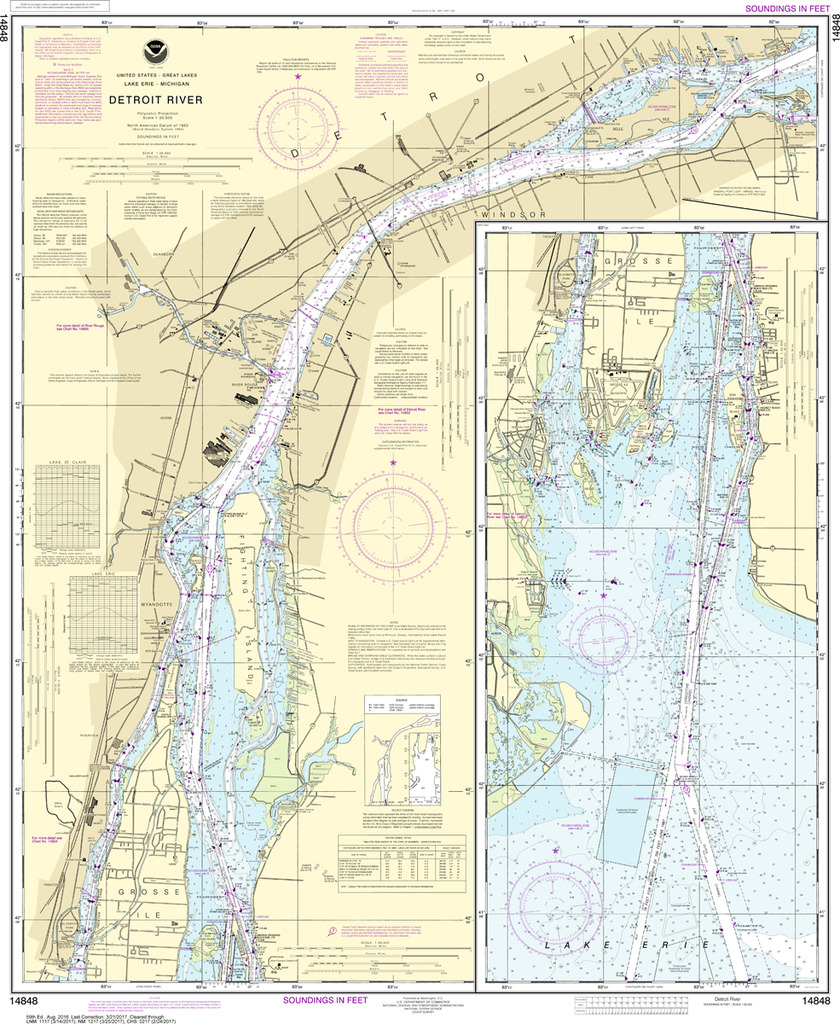
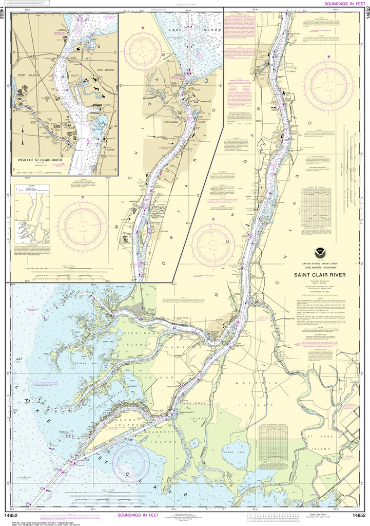
The chart you are viewing is NOT updated weekly and does NOT include all of the latest Notice to Mariners corrections. Region: Great Lakes Latest Edition: 60 Ed. (1-Oct-2018) Last Correction: 18-Jul-2019 Cleared Through: NTM 47/2019 (23-Nov-2019)...
NOAA Chart 14852: St. Clair River, Head of St. Clair River
$23.75
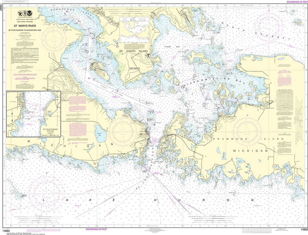
The chart you are viewing is NOT updated weekly and does NOT include all of the latest Notice to Mariners corrections. Region: Great Lakes Latest Edition: 48 Ed. (1-Oct-2018) Last Correction: 26-Dec-2019 Cleared Through: NTM 47/2019 (23-Nov-2019)...
NOAA Chart 14882: St. Marys River - Detour Passage to Munuscong Lake, Detour Passage
$23.75
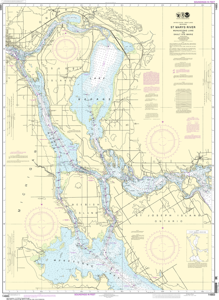
The chart you are viewing is NOT updated weekly and does NOT include all of the latest Notice to Mariners corrections. Region: Great Lakes Latest Edition: 36 Ed. (1-Jan-2014) Last Correction: 29-Nov-2019 Cleared Through: NTM 47/2019...
NOAA Chart 14883: St. Marys River - Munuscong Lake to Sault Ste Marie
$23.75
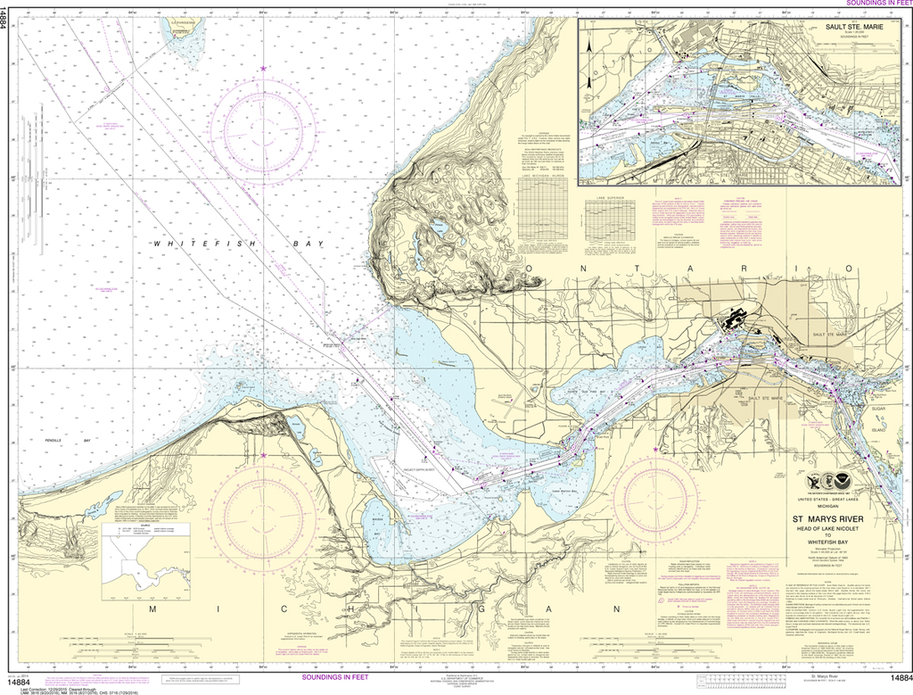
The chart you are viewing is NOT updated weekly and does NOT include all of the latest Notice to Mariners corrections. Region: Great Lakes Latest Edition: 44 Ed. (1-Jan-2014) Last Correction: 29-Nov-2019 Cleared Through: NTM 47/2019 (23-Nov-2019)...
NOAA Chart 14884: St. Marys River; Head of Lake Nicolet to Whitefish Bay, Sault Ste Marie
$23.75
The chart you are viewing is NOT updated weekly and does NOT include all of the latest Notice to Mariners corrections. Region: Great Lakes Latest Edition: 40 Ed. (1-Jan-2014) Last Correction: 29-Nov-2019 Cleared Through: NTM 47/2019...
The chart you are viewing is NOT updated weekly and does NOT include all of the latest Notice to Mariners corrections. Region: Great Lakes Latest Edition: 26 Ed. (1-Mar-2014) Last Correction: 30-Nov-2018 Cleared Through: NTM 47/2019...