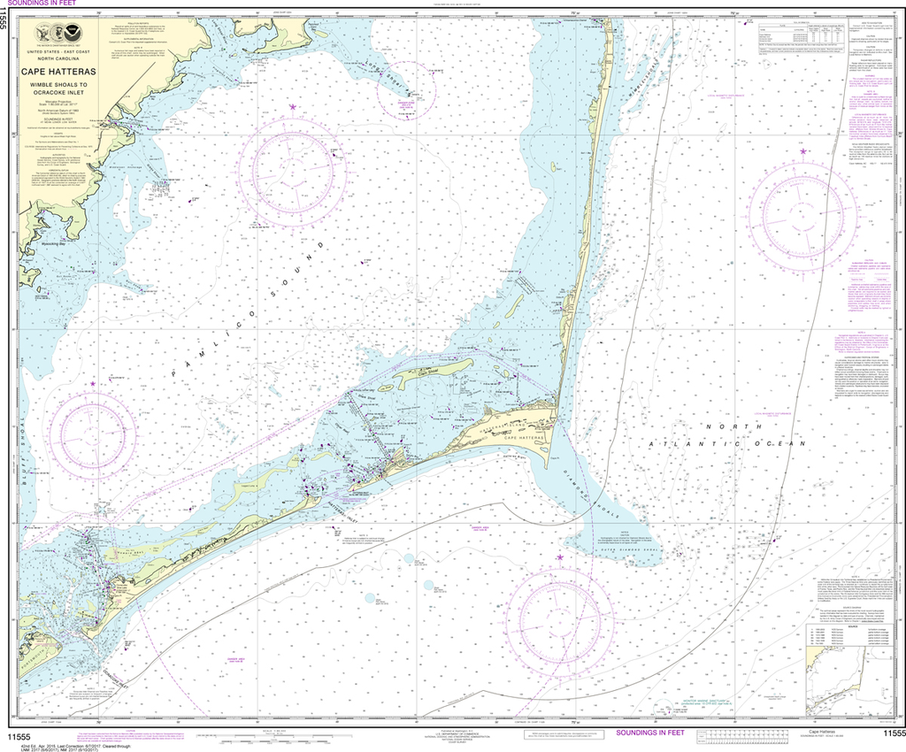
The chart you are viewing is NOT updated weekly and does NOT include all of the latest Notice to Mariners corrections. Region: Mid-Atlantic Latest Edition: 20 Ed. (1-Jan-2015) Last Correction: 20-Nov-2019 Cleared Through: NTM 47/2019 (23-Nov-2019) ...
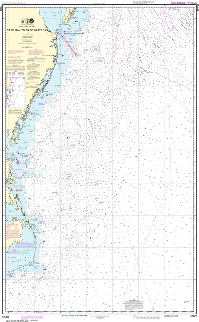
The chart you are viewing is NOT updated weekly and does NOT include all of the latest Notice to Mariners corrections. Region: Mid-Atlantic Latest Edition: 20 Ed. (1-Sep-2014) Last Correction: 3-Oct-2019 Cleared Through: NTM 47/2019 (23-Nov-2019) ...
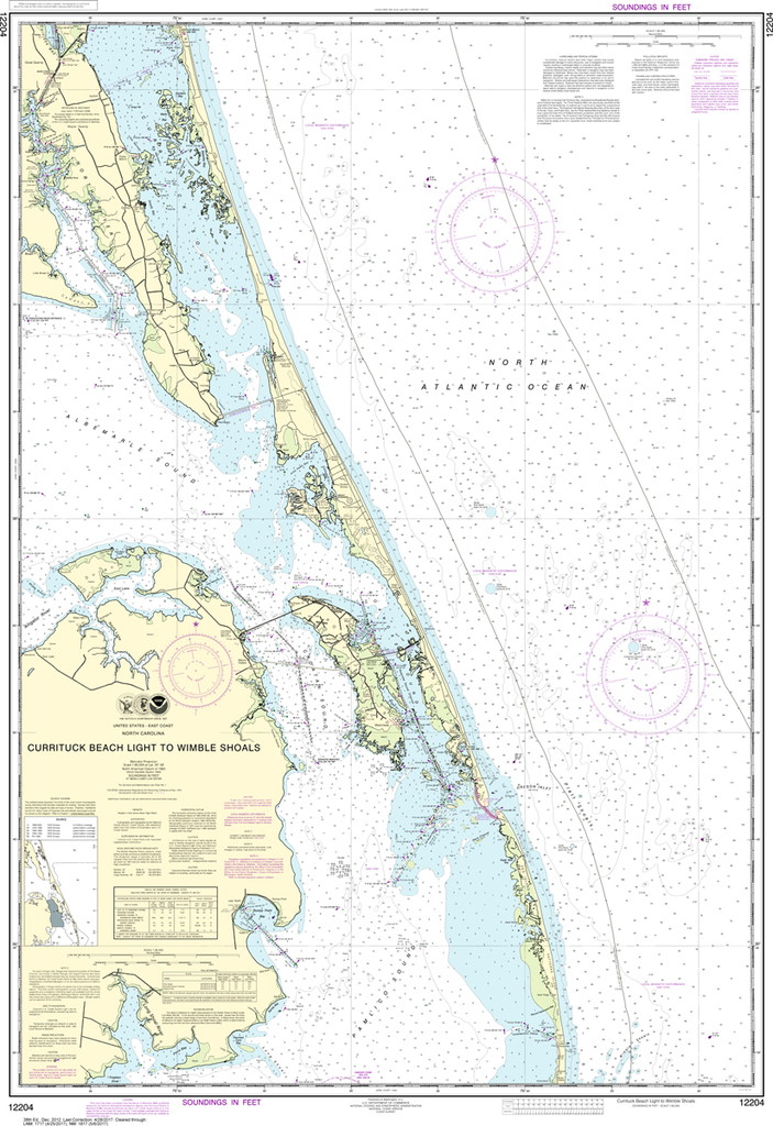
The chart you are viewing is NOT updated weekly and does NOT include all of the latest Notice to Mariners corrections. Region: Mid-Atlantic Latest Edition: 25 Ed. (1-Apr-2015) Last Correction: 6-Sep-2019 Cleared Through: NTM 47/2019 (23-Nov-2019) ...
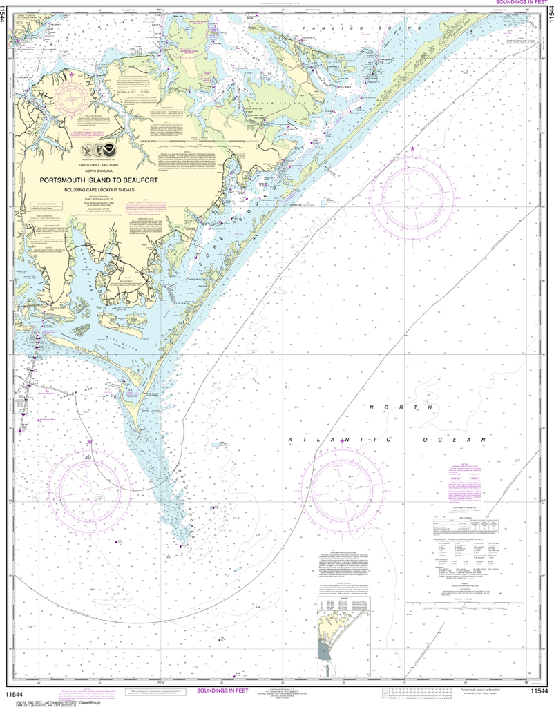
NOAA Chart 11544: Portsmouth Island to Beaufort, Including Cape Lookout Shoals
$23.75
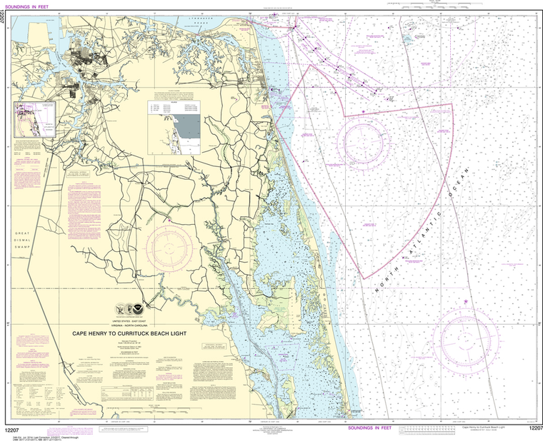
The chart you are viewing is NOT updated weekly and does NOT include all of the latest Notice to Mariners corrections. Region: Mid-Atlantic Latest Edition: 41 Ed. (1-Dec-2013) Last Correction: 20-Nov-2019 Cleared Through: NTM 47/2019 (23-Nov-2019) ...
NOAA Chart 12210: Chincoteague Inlet to Great Machipongo Inlet, Chincoteague Inlet
$23.75
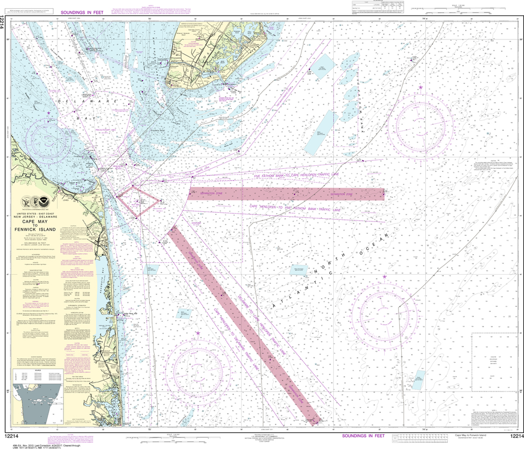
The chart you are viewing is NOT updated weekly and does NOT include all of the latest Notice to Mariners corrections. Region: Mid-Atlantic Latest Edition: 45 Ed. (1-Nov-2019) Last Correction: 26-Nov-2019 Cleared Through: NTM 47/2019 (23-Nov-2019) ...
NOAA Chart 12211: Fenwick Island to Chincoteague Inlet, Ocean City Inlet
$23.75
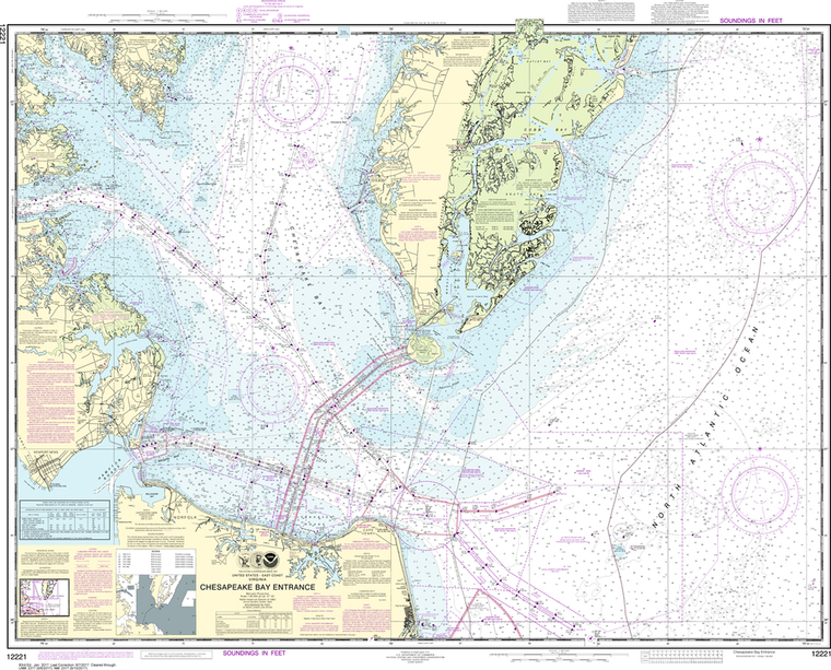
The chart you are viewing is NOT updated weekly and does NOT include all of the latest Notice to Mariners corrections. Region: Mid-Atlantic Latest Edition: 48 Ed. (1-Dec-2018) Last Correction: 10-Dec-2019 Cleared Through: NTM 47/2019 (23-Nov-2019) ...
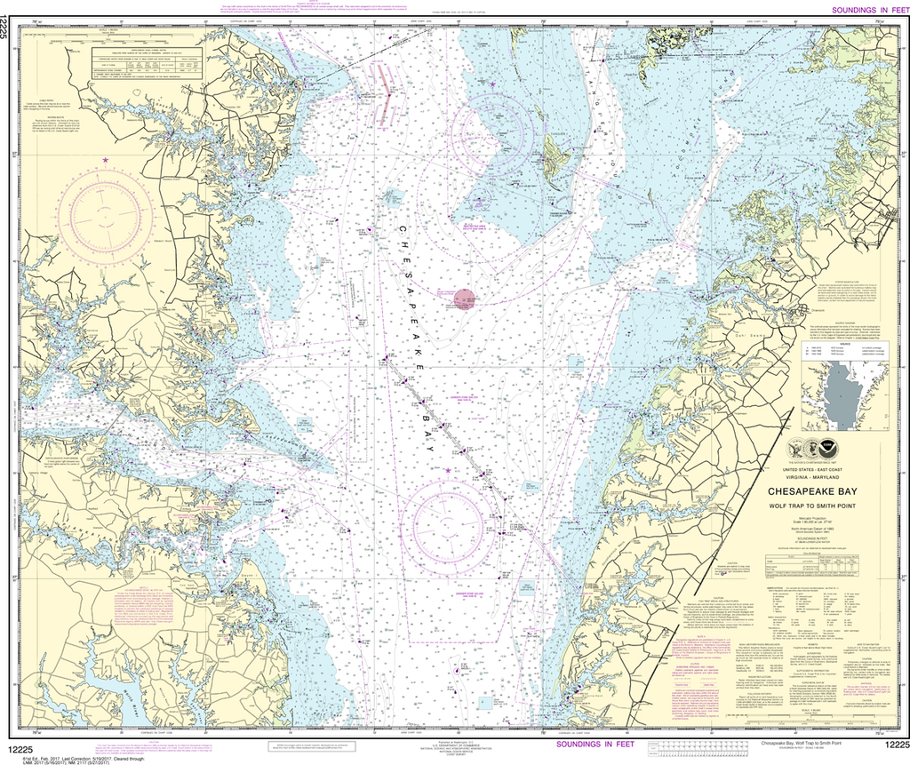
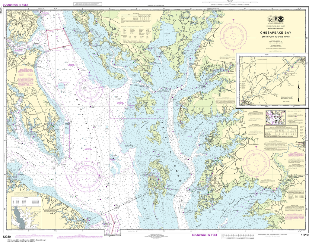
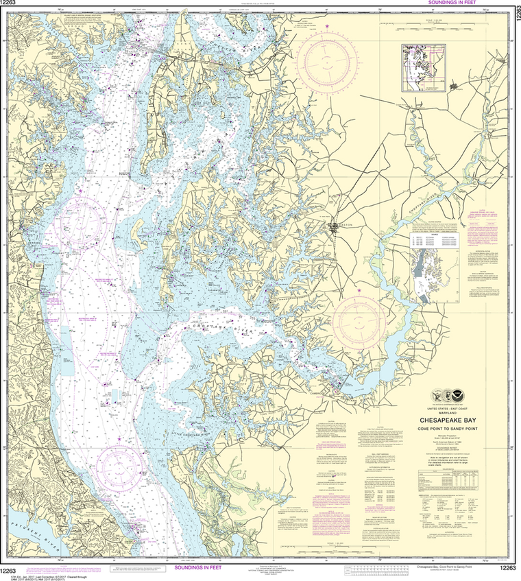
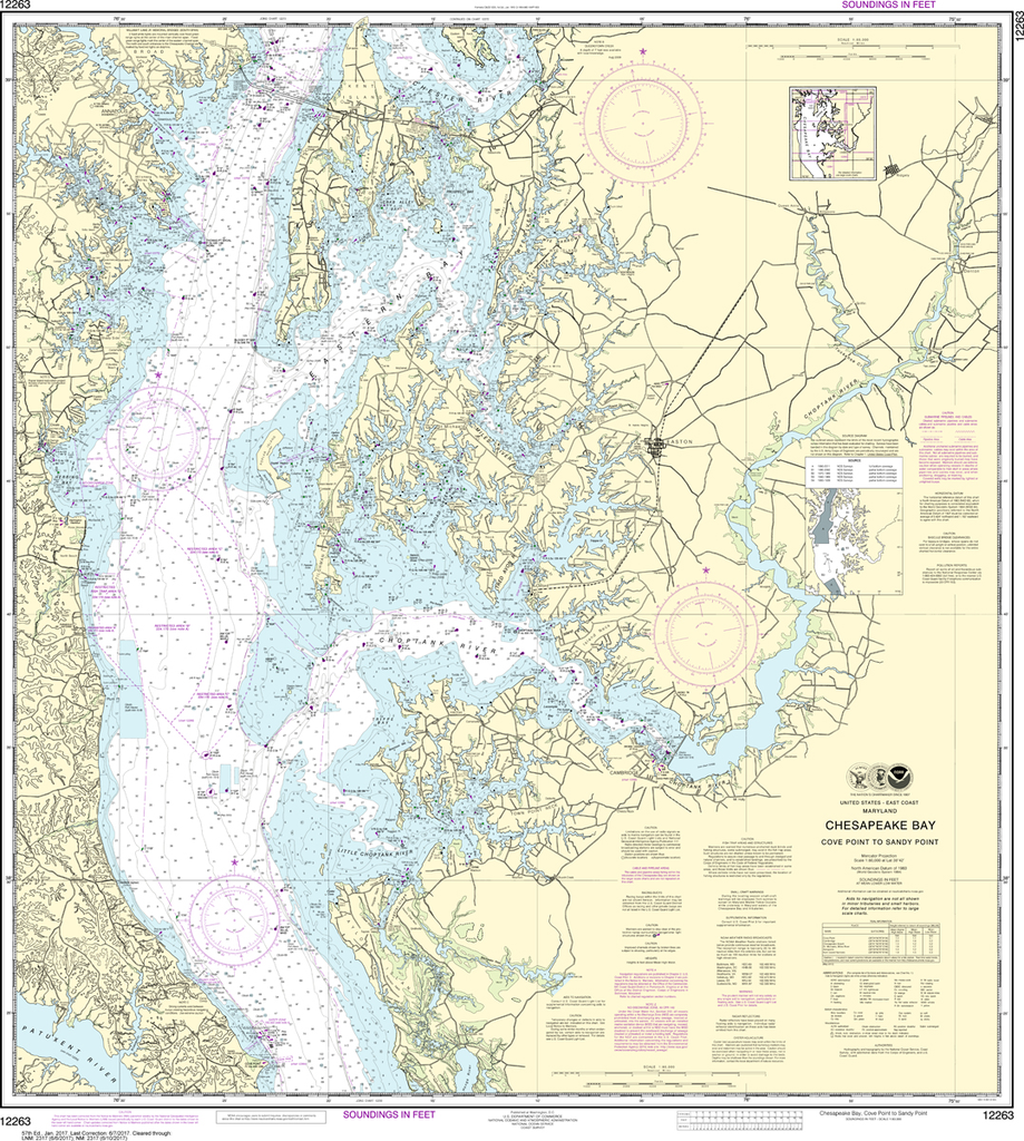
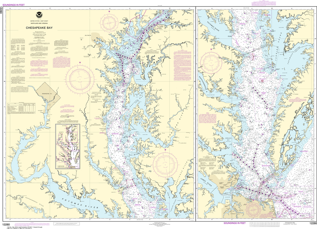
The chart you are viewing is NOT updated weekly and does NOT include all of the latest Notice to Mariners corrections. Region: Mid-Atlantic Latest Edition: 51 Ed. (1-Mar-2019) Last Correction: 10-Dec-2019 Cleared Through: NTM 47/2019 (23-Nov-2019) ...
NOAA Chart 12263: Chesapeake Bay - Cove Point to Sandy Point
$23.75
Region: Mid-Atlantic Paper Size: 42" x 36" Chart Image Size: 39" x 35" Scale: 1:80,000 Captain's Nautical Supplies is a Print-on-Demand nautical chart dealer for US Waters. All charts are printed up-to-date and corrected to the...
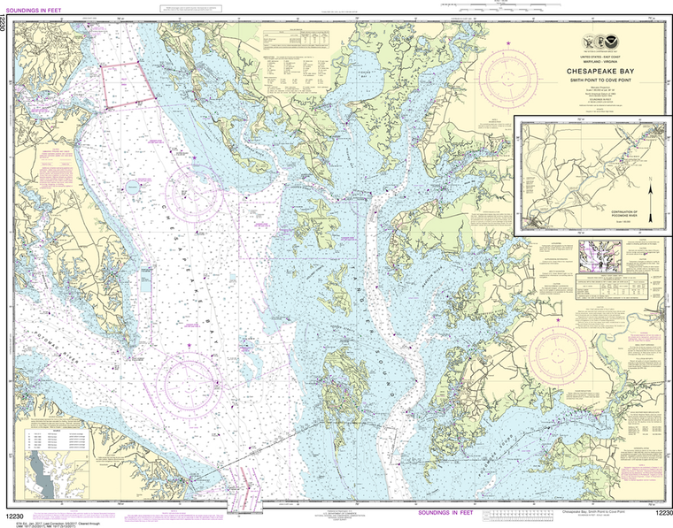
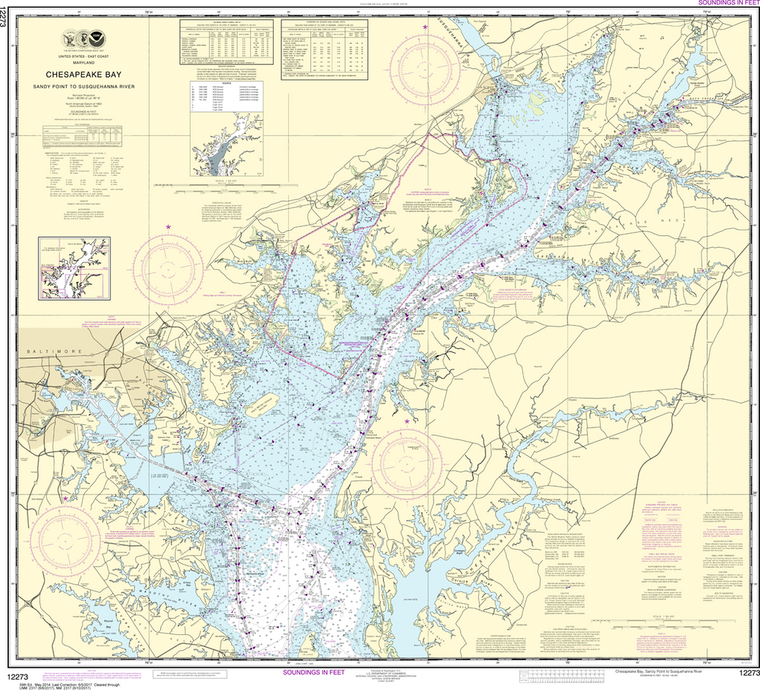
NOAA Chart 12273: Chesapeake Bay - Sandy Point to Susquehanna River
$23.75
Region: Mid-Atlantic Paper Size: 42" x 36" Chart Image Size: 35" x 39" Scale: 1:80,000 Captain's Nautical Supplies is a Print-on-Demand nautical chart dealer for US Waters. All charts are printed up-to-date and corrected to the...
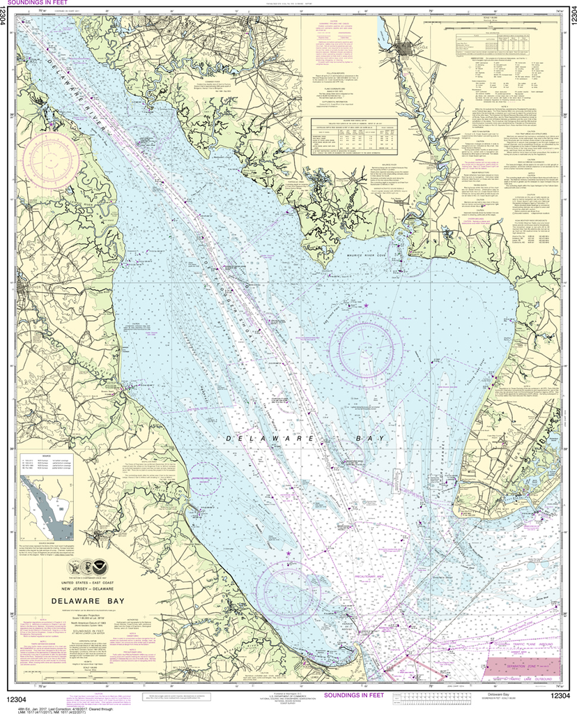
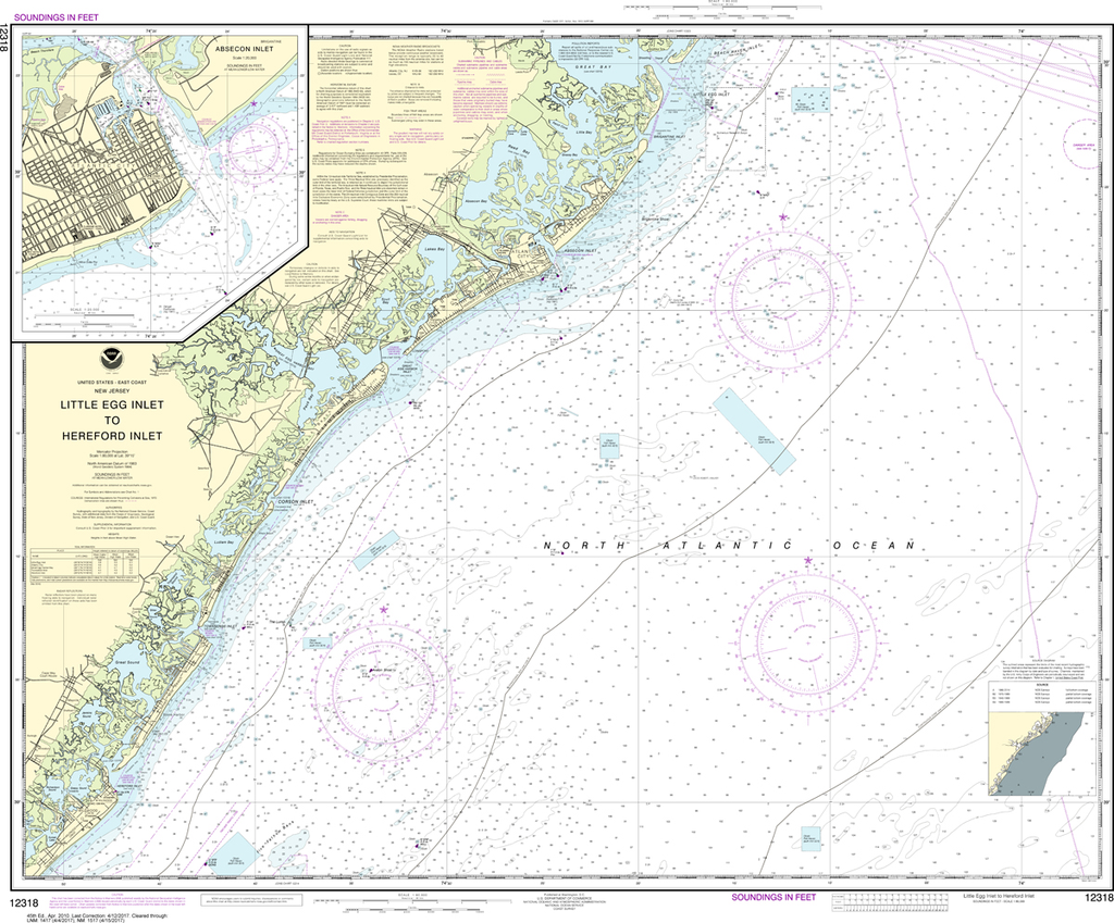
The chart you are viewing is NOT updated weekly and does NOT include all of the latest Notice to Mariners corrections. Region: Mid-Atlantic Latest Edition: 49 Ed. (1-Dec-2018) Last Correction: 2-Dec-2019 Cleared Through: NTM 47/2019 (23-Nov-2019) ...
NOAA Chart 12318: Little Egg Inlet to Hereford Inlet, Absecon Inlet
$23.75
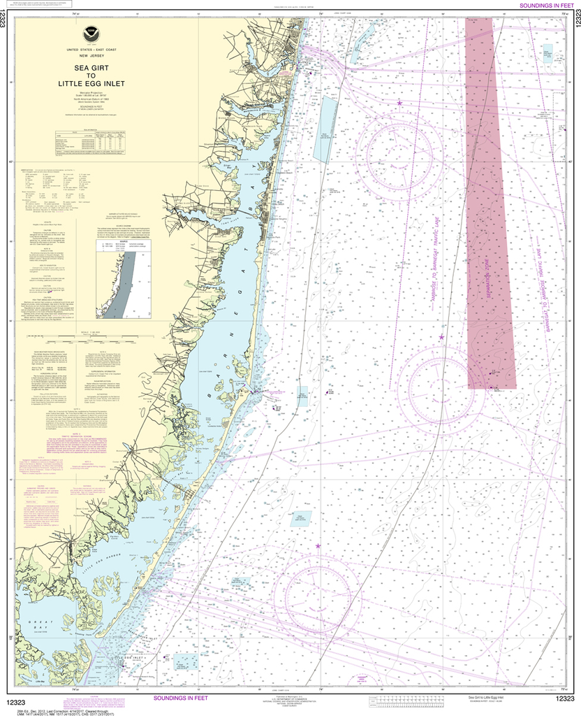
The chart you are viewing is NOT updated weekly and does NOT include all of the latest Notice to Mariners corrections. Region: Mid-Atlantic Latest Edition: 45 Ed. (1-Apr-2010) Last Correction: 8-Jul-2019 Cleared Through: NTM 47/2019 (23-Nov-2019) ...
NOAA Chart 12326: Approaches to New York - Fire lsland Light to Sea Girt
$23.75
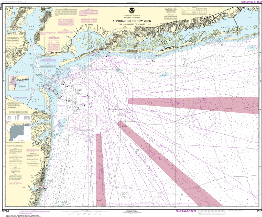
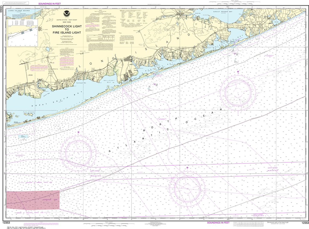
The chart you are viewing is NOT updated weekly and does NOT include all of the latest Notice to Mariners corrections. Region: Mid-Atlantic Latest Edition: 53 Ed. (1-Jan-2016) Last Correction: 25-Nov-2019 Cleared Through: NTM 47/2019 (23-Nov-2019) ...
NOAA Chart 12353: Shinnecock Light to Fire Island Light
$23.75
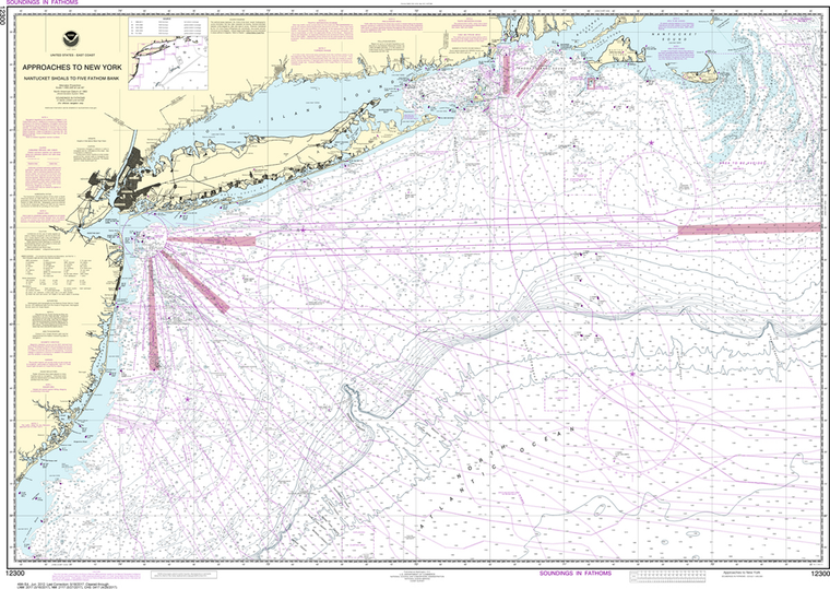
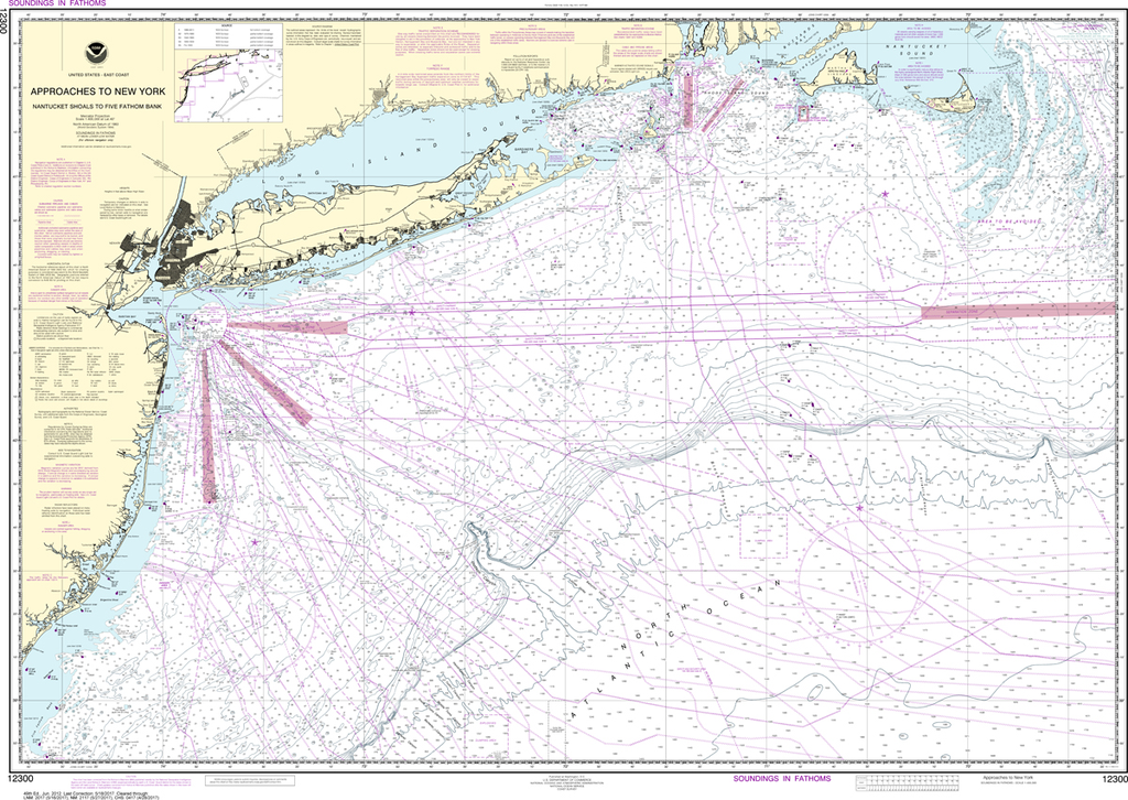
The chart you are viewing is NOT updated weekly and does NOT include all of the latest Notice to Mariners corrections. Region: Northeast Atlantic Latest Edition: 19 Ed. (1-Nov-2011) Last Correction: 6-Jan-2020 Cleared Through: NTM 47/2019 (23-Nov-2019)...