WAGGONER TRIO- ON SALE NOW!!!
- Shop by Department
- Nautical Charts
- New Releases
- Marine Education Textbooks
- About Us
- +Shop by Department
- +Nautical Charts
- New Releases
- +Marine Education Textbooks
- +About Us
- Contact Us
- FAQ
- Repair Services
- Sign in

NOAA-18662
$26.95
The chart you are viewing is NOT updated weekly and does NOT include all of the latest Notice to Mariners corrections.
Region: Pacific Coast Paper Size: 48" x 36"
Chart Image Size: 44" x 33"
Scale: 1:40,000
Captain's Nautical Supplies is a Print-on-Demand nautical chart dealer for US Waters. All charts are printed up-to-date and corrected to the latest Notice to Mariners and meet commercial carriage requirements. Charts are printed on high-quality heavy paper with waterproof ink unless otherwise selected.
$19.95
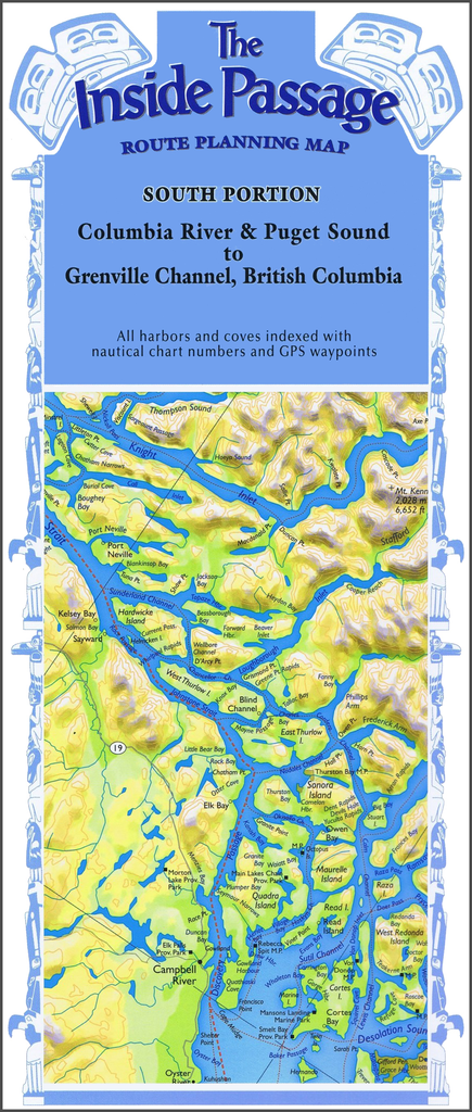
Columbia River & Puget Sound to Grenville Channel, British Columbia Plot your own itinerary and prepare for your trip of a lifetime through the Inside Passage! Route Planning Maps allow a bird’s-eye view of the coastline in one view. Use...
$29.95
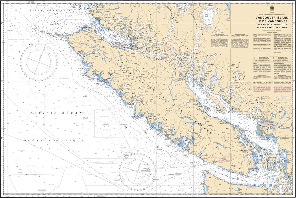
Region: Pacific Coast Paper Size: 48" x 36" Chart Image Size: 44" x 31?" Scale: 1:525,000 Captain's Supplies is a Print-on-Demand nautical chart dealer for Canadian Waters. All charts are printed up-to-date and corrected to the...
$49.95
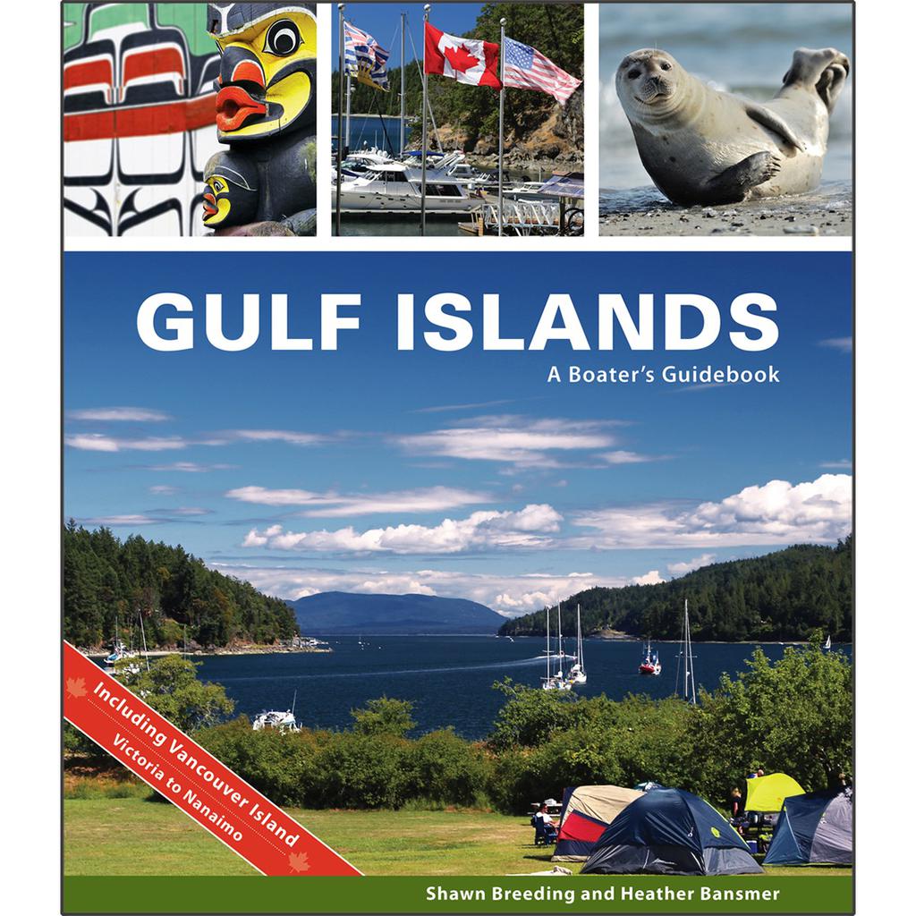
by Heather Bansmer & Shawn Breeding Gulf Islands: A Boater’s Guidebook, was created for the adventurer, the mariner or charterer who wants to get the ultimate experience out of their Canadian cruise and to do it confidently. This guide covers...
$23.75
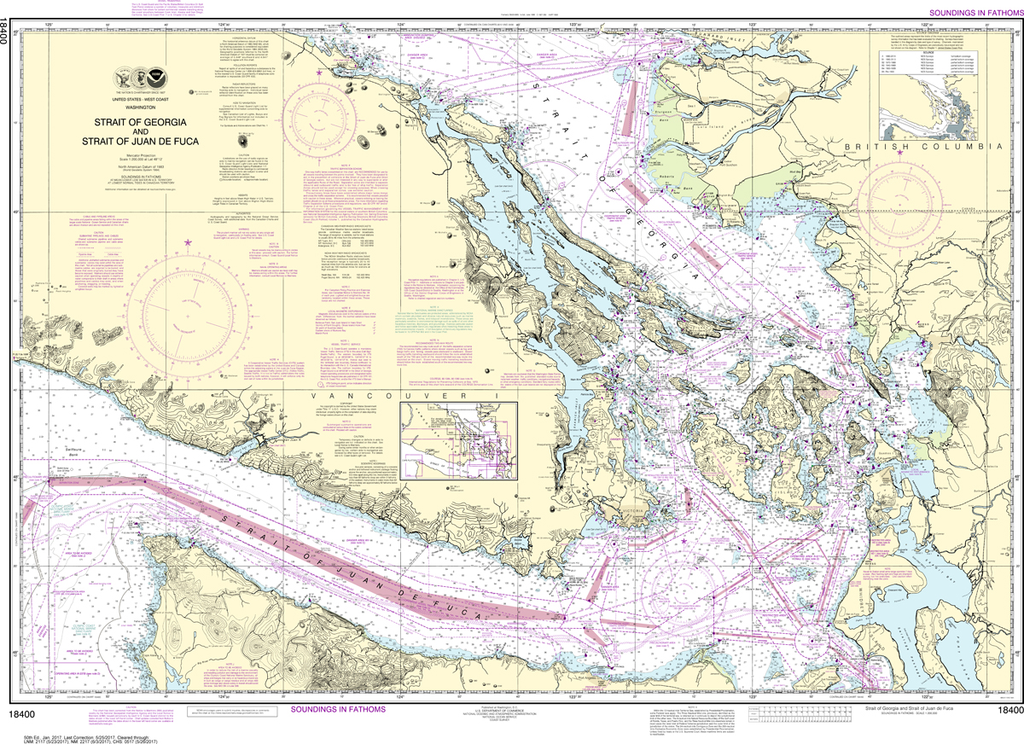
Region: Pacific Coast Latest Edition: 51 Ed. (1-Aug-2019) Last Correction: 26-Dec-2019 Cleared Through: NTM 47/2019 (23-Nov-2019) Paper Size: 46" x 36" Chart Image Size: 31" x 43" Scale: 1:200,000 Captain's Nautical Supplies is...


