WAGGONER TRIO- ON SALE NOW!!!
- Shop by Department
- Nautical Charts
- New Releases
- Marine Education Textbooks
- About Us
- +Shop by Department
- +Nautical Charts
- New Releases
- +Marine Education Textbooks
- +About Us
- Contact Us
- FAQ
- Repair Services
- Sign in

NOAA-17426
$23.75
Region: Alaska Coast
Latest Edition: 16 Ed. (1-Jun-2014)
Last Correction: 16-Sep-2019
Cleared Through: NTM 47/2019 (23-Nov-2019)
Paper Size: 48" x 36"
Chart Image Size: 34" x 44"
Scale: 1:40,000
Captain's Nautical Supplies is a Print-on-Demand nautical chart dealer for US Waters. All charts are printed up-to-date and corrected to the latest Notice to Mariners and meet commercial carriage requirements. Charts are printed on high-quality heavy paper with waterproof ink unless otherwise selected.
The chart you are viewing is NOT updated weekly and does NOT include all the of the latest Notice to Mariners corrections.
$19.95
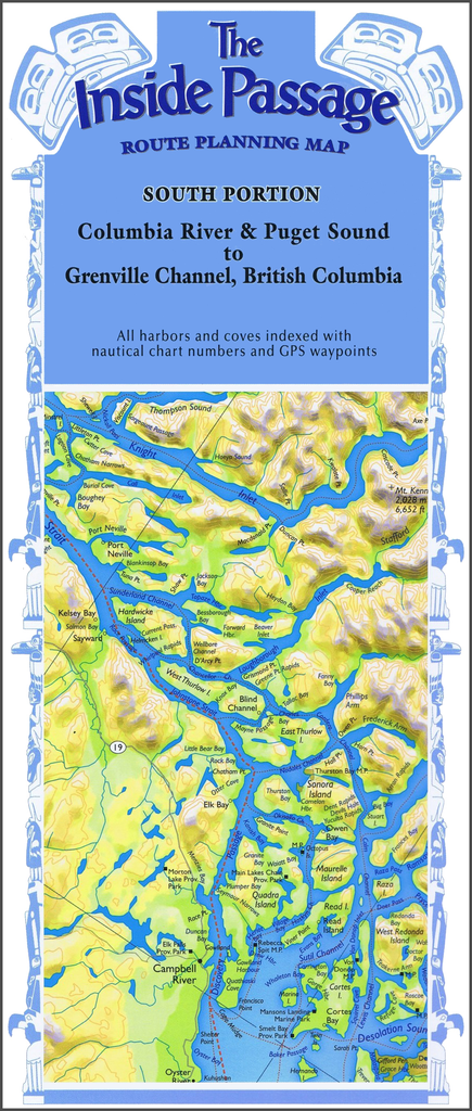
Columbia River & Puget Sound to Grenville Channel, British Columbia Plot your own itinerary and prepare for your trip of a lifetime through the Inside Passage! Route Planning Maps allow a bird’s-eye view of the coastline in one view. Use...
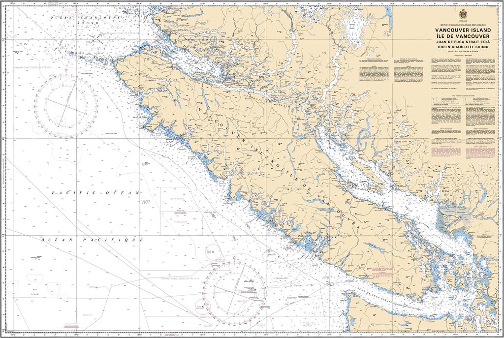
$29.95
Region: Pacific Coast Paper Size: 48" x 36" Chart Image Size: 44" x 31?" Scale: 1:525,000 Captain's Supplies is a Print-on-Demand nautical chart dealer for Canadian Waters. All charts are printed up-to-date and corrected to the...
$49.95
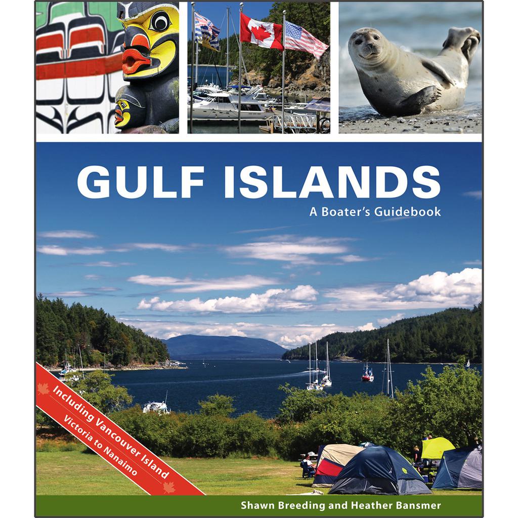
by Heather Bansmer & Shawn Breeding Gulf Islands: A Boater’s Guidebook, was created for the adventurer, the mariner or charterer who wants to get the ultimate experience out of their Canadian cruise and to do it confidently. This guide covers...
$23.75
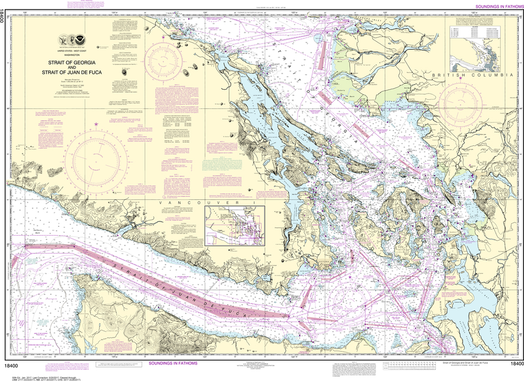
Region: Pacific Coast Latest Edition: 51 Ed. (1-Aug-2019) Last Correction: 26-Dec-2019 Cleared Through: NTM 47/2019 (23-Nov-2019) Paper Size: 46" x 36" Chart Image Size: 31" x 43" Scale: 1:200,000 Captain's Nautical Supplies is...


