WAGGONER TRIO- ON SALE NOW!!!
- Shop by Department
- Nautical Charts
- New Releases
- Marine Education Textbooks
- About Us
- +Shop by Department
- +Nautical Charts
- New Releases
- +Marine Education Textbooks
- +About Us
- Contact Us
- FAQ
- Repair Services
- Sign in

$26.95
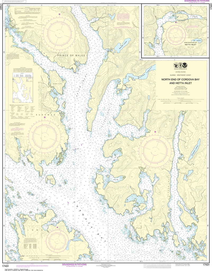
The chart you are viewing is NOT updated weekly and does NOT include all of the latest Notice to Mariners corrections. Region: Alaska Coast Latest Edition: 4 Ed. (1-Nov-2011) Last Correction: 13-Sep-2019 Cleared Through: NTM 47/2019...

$26.95
Region: Alaska Coast Latest Edition: 24 Ed. (1-Dec-2015) Last Correction: 27-Feb-2019 Cleared Through: NTM 47/2019 (23-Nov-2019) Paper Size: 50" x 36" Chart Image Size: 34" x 46" Scale: 1:1,126,321 Captain's Nautical Supplies is...

$26.95
The chart you are viewing is NOT updated weekly and does NOT include all of the latest Notice to Mariners corrections. Region: Alaska Coast Latest Edition: 14 Ed. (1-Apr-2015) Last Correction: 30-Oct-2018 Cleared Through: NTM 47/2019...

$26.95
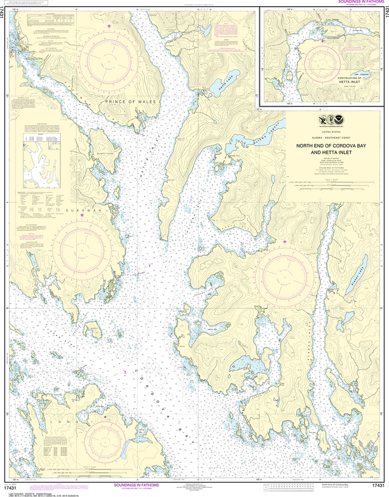
Region: Alaska Coast Latest Edition: 15 Ed. (1-Oct-2013) Last Correction: 24-May-2016 Cleared Through: NTM 47/2019 (23-Nov-2019) Paper Size: 44" x 36" Chart Image Size: 35" x 40" Scale: 1:40,000 Captain's Nautical Supplies is...

$26.95
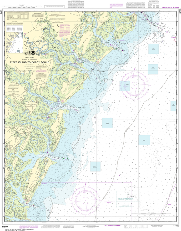
Region: Alaska Coast Latest Edition: 3 Ed. (1-Mar-2015) Last Correction: 19-Nov-2018 Cleared Through: NTM 47/2019 (23-Nov-2019) Paper Size: 48" x 36" Chart Image Size: 44" x 31" Scale: 1:50,000 Captain's Nautical Supplies is...

$26.95
Region: Alaska Coast Latest Edition: 12 Ed. (1-Sep-2012) Last Correction: 12-Sep-2012 Cleared Through: NTM 47/2019 (23-Nov-2019) Paper Size: 45" x 36" Chart Image Size: 42" x 31" Scale: 1:40,000 Captain's Nautical Supplies is...
$26.95
Region: Alaska Coast Latest Edition: 12 Ed. (1-Dec-2014) Last Correction: 28-Jun-2017 Cleared Through: NTM 47/2019 (23-Nov-2019) Paper Size: 46" x 36" Chart Image Size: 43" x 33" Scale: 1:40,000 Captain's Nautical Supplies is...

$26.95
Region: Alaska Coast Latest Edition: 10 Ed. (1-Apr-2015) Last Correction: 9-Aug-2019 Cleared Through: NTM 47/2019 (23-Nov-2019) Paper Size: 48" x 36" Chart Image Size: 44" x 32" Scale: 1:80,000 Captain's Nautical Supplies is...

$26.95
Region: Gulf Coast & Caribbean Islands Paper Size: 33" x 36" Chart Image Size: 30" x 35" Scale: 1:30,000 Captain's Nautical Supplies is a Print-on-Demand nautical chart dealer for US Waters. All charts are printed up-to-date...

$26.95
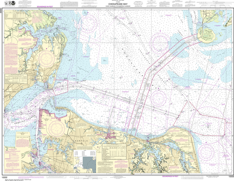
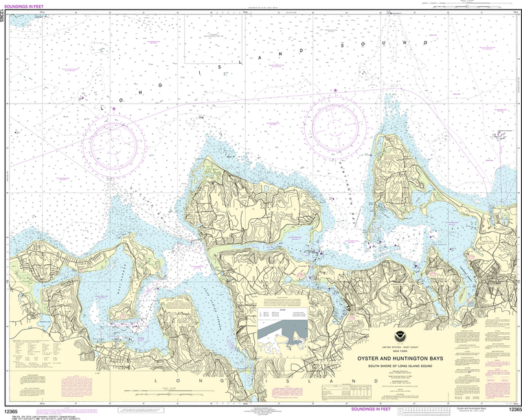
Region: Mid-Atlantic Latest Edition: 32 Ed. (1-Feb-2012) Last Correction: 17-Sep-2019 Cleared Through: NTM 47/2019 (23-Nov-2019) Paper Size: 47" x 36" Chart Image Size: 43" x 34" Scale: 1:80,000 Captain's Nautical Supplies is a...
$26.95
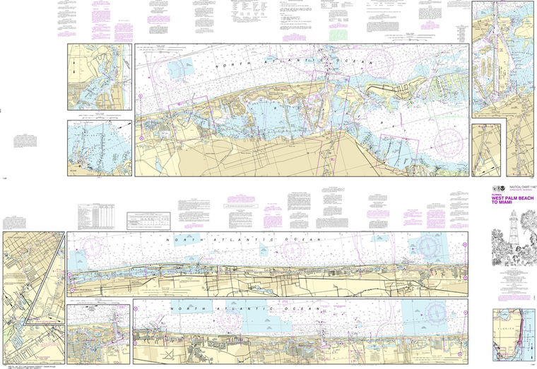
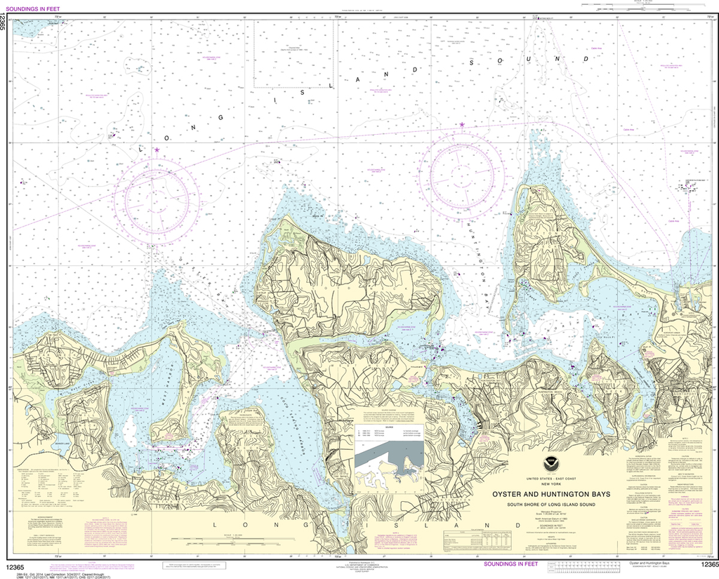
Region: Mid-Atlantic Paper Size: 62" x 42" Chart Image Size: 41" x 59" Scale: 1:40,000 Captain's Nautical Supplies is a Print-on-Demand nautical chart dealer for US Waters. All charts are printed up-to-date and corrected to the latest Notice to...
$26.95
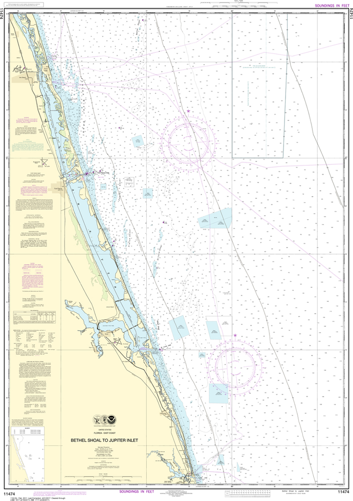
The chart you are viewing is NOT updated weekly and does NOT include all the of the latest Notice to Mariners corrections. Region: Mid-Atlantic Paper Size: 49" x 36" Chart Image Size: 35" x 46" Scale: 1:40,000

$26.95
The chart you are viewing is NOT updated weekly and does NOT include all of the latest Notice to Mariners corrections. Region: Northeast Atlantic Latest Edition: 25 Ed. (1-Apr-2019) Last Correction: 8-Nov-2019 Cleared Through: NTM 47/2019...

$26.95
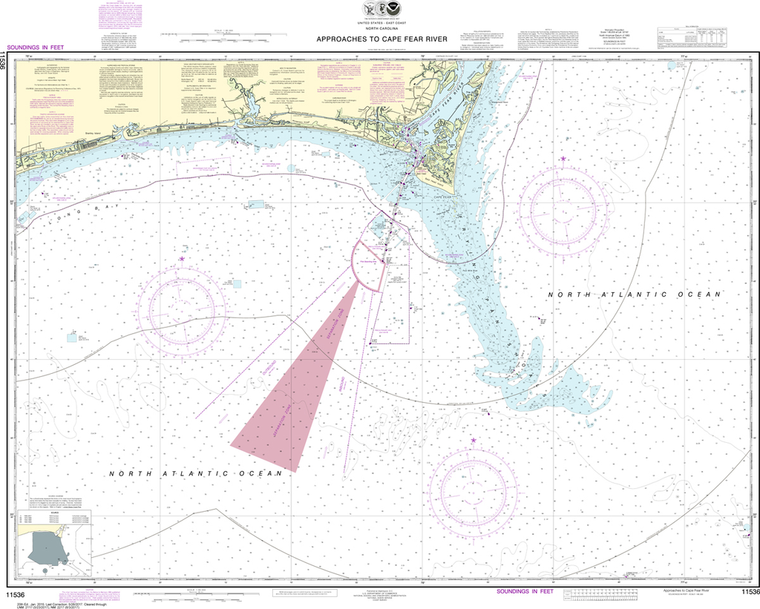
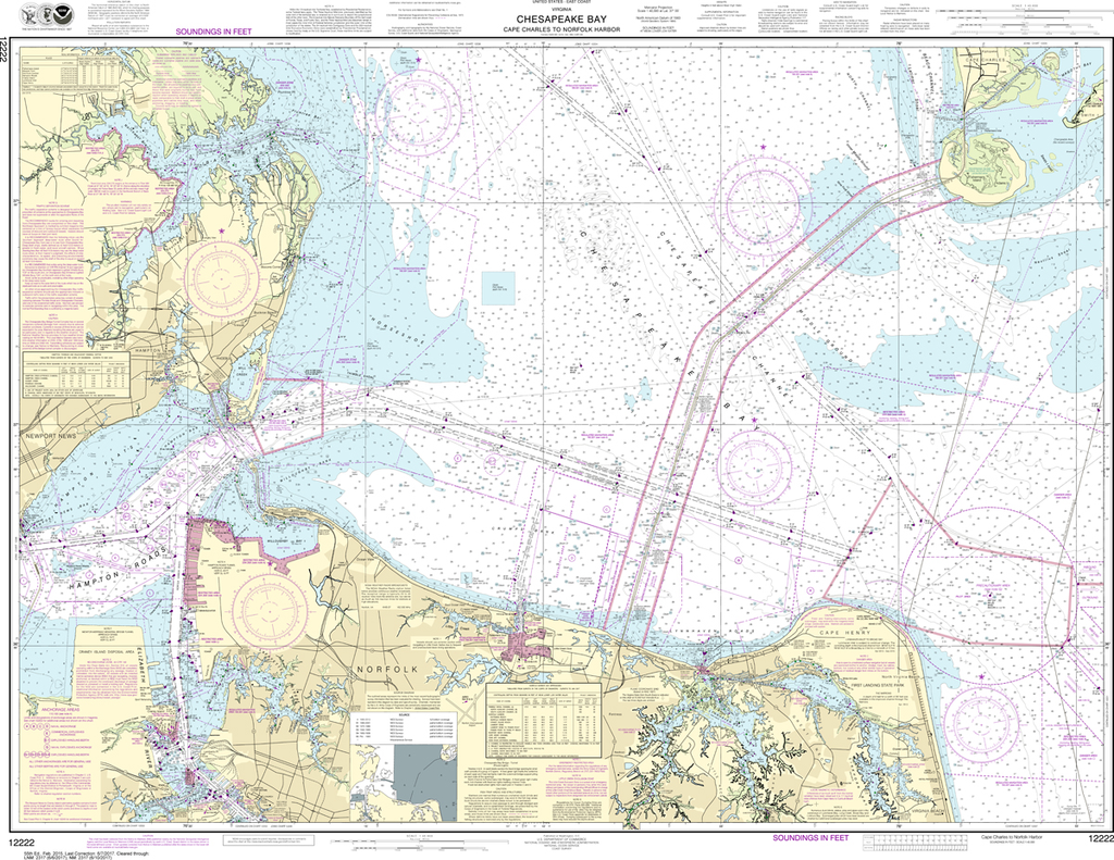
The chart you are viewing is NOT updated weekly and does NOT include all of the latest Notice to Mariners corrections. Region: Mid-Atlantic Latest Edition: 20 Ed. (1-Jan-2015) Last Correction: 20-Nov-2019 Cleared Through: NTM 47/2019 (23-Nov-2019) ...
$26.95
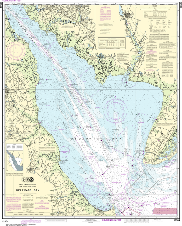
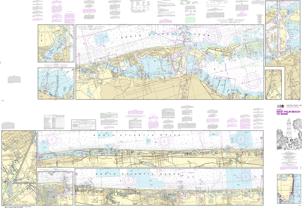
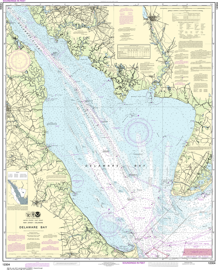
The chart you are viewing is NOT updated weekly and does NOT include all of the latest Notice to Mariners corrections. Region: Mid-Atlantic Latest Edition: 49 Ed. (1-Dec-2018) Last Correction: 2-Dec-2019 Cleared Through: NTM 47/2019 (23-Nov-2019) ...
$26.95
The chart you are viewing is NOT updated weekly and does NOT include all of the latest Notice to Mariners corrections. Region: Northeast Atlantic Latest Edition: 28 Ed. (1-Oct-2014) Last Correction: 16-Aug-2019 Cleared Through: NTM 47/2019...
$26.95
Region: Gulf Coast & Caribbean Islands Paper Size: 51" x 36" Chart Image Size: 47" x 34" Scale: 1:80,000 Captain's Nautical Supplies is a Print-on-Demand nautical chart dealer for US Waters. All charts are printed up-to-date and corrected...

$26.95
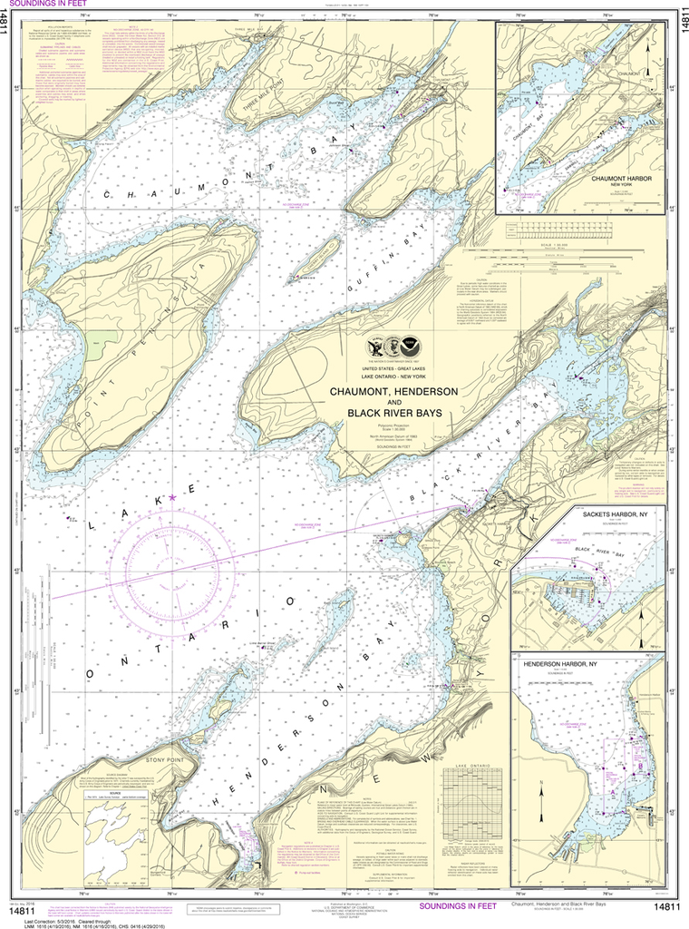
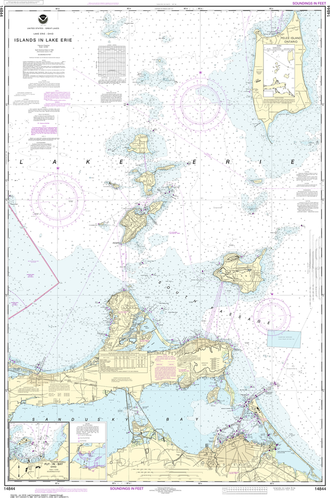
The chart you are viewing is NOT updated weekly and does NOT include all of the latest Notice to Mariners corrections. Region: Great Lakes Latest Edition: 18 Ed. (1-May-2016) Last Correction: 3-Dec-2018 Cleared Through: NTM 47/2019...

$26.95
THIS CHART IS CURRENTLY CANCELED BY NOAA. We know there are many questions about NOAA charts, newest editions and charts being cancelled. The U.S. Office of Coast Survey provides an updated list of all chart updates and the ones being...
$26.95
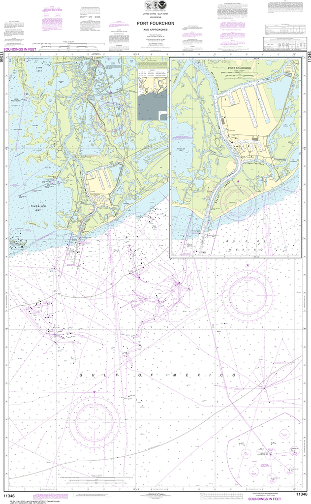
Region: Gulf Coast & Caribbean Islands Paper Size: 54" x 36" Chart Image Size: 51" x 31" Scale: 1:20,000 Captain's Nautical Supplies is a Print-on-Demand nautical chart dealer for US Waters. All charts are printed up-to-date and...

$26.95
The chart you are viewing is NOT updated weekly and does NOT include all of the latest Notice to Mariners corrections. Region: Gulf Coast & Caribbean Islands Paper Size: 62" x 42" Chart Image Size: 41" x 58" Scale:...

$26.95
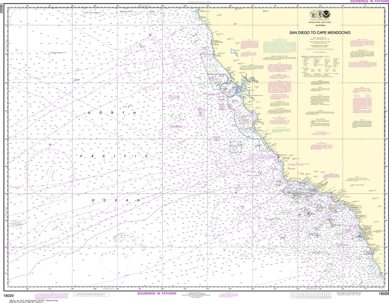
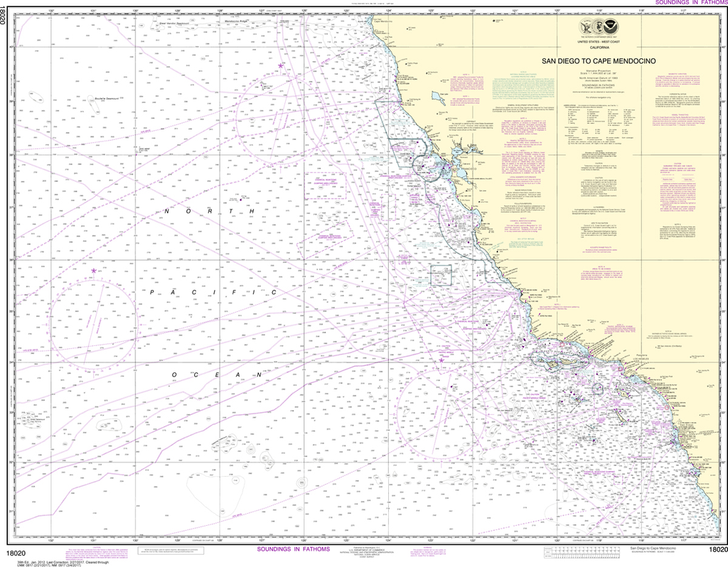
The chart you are viewing is NOT updated weekly and does NOT include all of the latest Notice to Mariners corrections. Region: Pacific Coast Paper Size: 48" x 36" Chart Image Size: 45" x 30" Scale: 1:40,000 ...

$26.95
THIS CHART IS CURRENTLY CANCELED BY NOAA. We know there are many questions about NOAA charts, newest editions and charts being cancelled. The U.S. Office of Coast Survey provides an updated list of all chart updates and the ones being...
$26.95
The chart you are viewing is NOT updated weekly and does NOT include all the of the latest Notice to Mariners corrections. Region: Hawai'ian & Pacific Islands Paper Size: 45" x 36" Chart Image Size: 32" x 41"...