WAGGONER TRIO- ON SALE NOW!!!
- Shop by Department
- Nautical Charts
- New Releases
- Marine Education Textbooks
- About Us
- +Shop by Department
- +Nautical Charts
- New Releases
- +Marine Education Textbooks
- +About Us
- Contact Us
- FAQ
- Repair Services
- Sign in
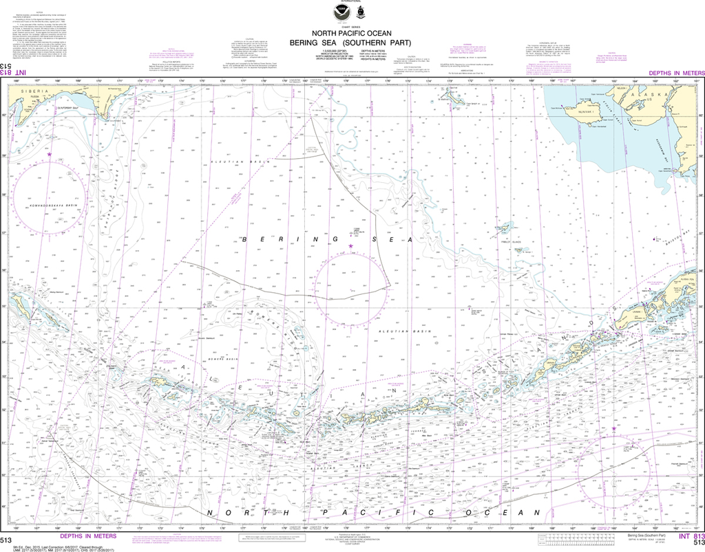

NOAA-513
$26.95
Region: Alaska Coast
Latest Edition: 10 Ed. (1-Nov-2018)
Last Correction: 23-Dec-2019
Cleared Through: NTM 47/2019 (23-Nov-2019)
Paper Size: 43" x 36"
Chart Image Size: 31" x 40"
Scale: 1:3,500,000
Captain's Nautical Supplies is a Print-on-Demand nautical chart dealer for US Waters. All charts are printed up-to-date and corrected to the latest Notice to Mariners and meet commercial carriage requirements. Charts are printed on high-quality heavy paper with waterproof ink unless otherwise selected.
$23.75
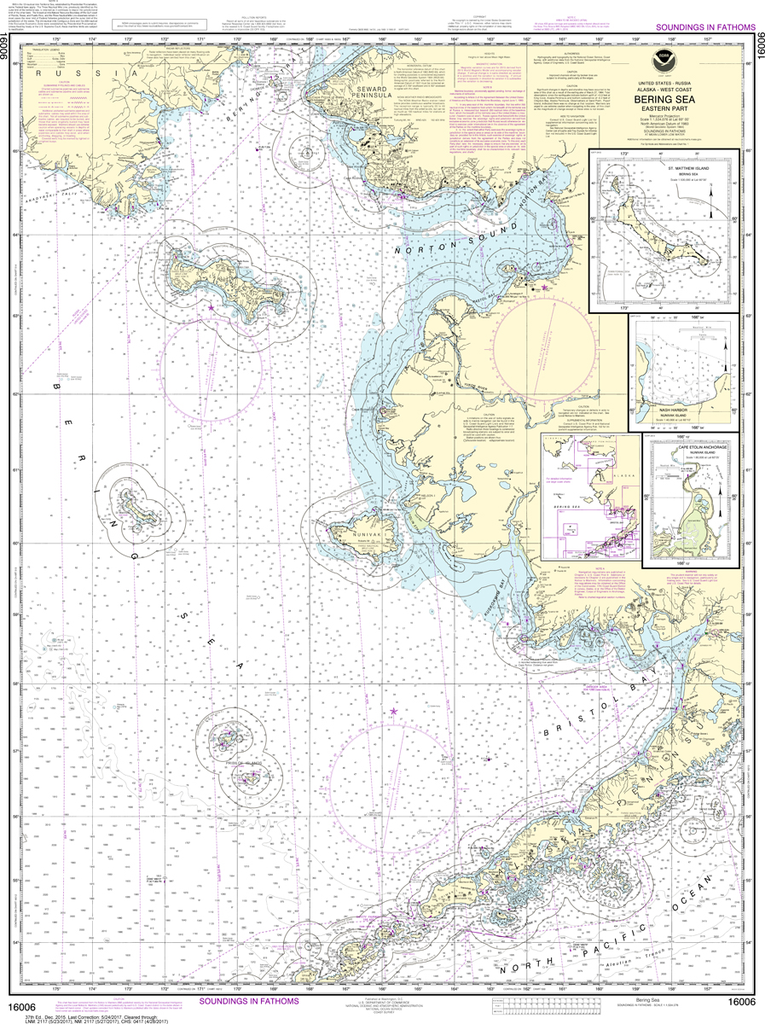
Region: Alaska Coast Latest Edition: 38 Ed. (1-Nov-2018) Last Correction: 23-Dec-2019 Cleared Through: NTM 47/2019 (23-Nov-2019) Paper Size: 44" x 36" Chart Image Size: 41" x 30" Scale: 1:1,534,076 Captain's Nautical Supplies is...
$26.95
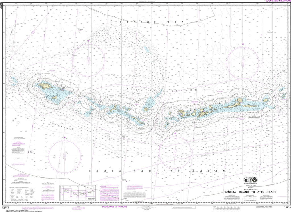
Region: Alaska Coast Latest Edition: 24 Ed. (1-Dec-2015) Last Correction: 27-Feb-2019 Cleared Through: NTM 47/2019 (23-Nov-2019) Paper Size: 50" x 36" Chart Image Size: 34" x 46" Scale: 1:1,126,321 Captain's Nautical Supplies is...
$23.75
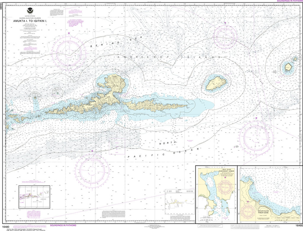
Region: Alaska Coast Latest Edition: 13 Ed. (1-Dec-2015) Last Correction: 17-May-2019 Cleared Through: NTM 47/2019 (23-Nov-2019) Paper Size: 49" x 36" Chart Image Size: 35" x 46" Scale: 1:300,000 Captain's Nautical Supplies is a Print-on-Demand nautical chart dealer for...

$26.95
Region: Alaska Coast Latest Edition: 12 Ed. (1-Dec-2015) Last Correction: 12-Jul-2019 Cleared Through: NTM 47/2019 (23-Nov-2019) Paper Size: 50" x 36" Chart Image Size: 35" x 46" Scale: 1:300,000 Captain's Nautical Supplies is a Print-on-Demand nautical chart dealer for...


