NEW COAST PILOT EDITIONS OUT NOW!
- Shop by Department
- Nautical Charts
- New Releases
- Marine Education Textbooks
- About Us
- +Shop by Department
- +Nautical Charts
- New Releases
- +Marine Education Textbooks
- +About Us
- Contact Us
- FAQ
- Repair Services
- Sign in


WoodCharts-CRTR-D1S
$192.00
Size: 16" x 20" inches
Laser-cut wooden relief map of Crater Lake, featuring Crater Lake, Oregon. Map is framed and ready to hang, a unique and beautiful gift of artwork for sailors and land-lovers alike.
Nestled scenically in a 2,148' deep caldera, Crater Lake was formed approximately 7,700 years ago by the collapse of the volcano Mount Mazama and is the d eepest lake in the United States at 1,949 feet deep. There are no rivers running in or out of the lake, it's supplied solely by rain- and snow-fall and, drained only by evaporation.
Points of Interest:
Wood Charts are based on soundings and measurements from bathymetric and nautical charts. Each depth layer is laser-cut from sheets of Baltic birch and glued together "bread and butter" style to create the contours and shorelines of striking waterways. Select layers are hand-stained a rich blue-green color to discern water from land, and major byways are etched into the land. The whole work is framed in a custom, solid wood frame and protected with a sheet of durable, ultra-transparent acrylic.
This product is not stocked at Captain's store, but may be special-ordered from the manufacturer or distributor.
Please allow up to two weeks for your special-ordered item to arrive. Captain's will contact you if your item is expected to take longer, or if your item is out of stock at the supplier.
Returns of Special-Order Items:
Since this is a specialty item, there are no returns or exchanges for this product.
$385.00
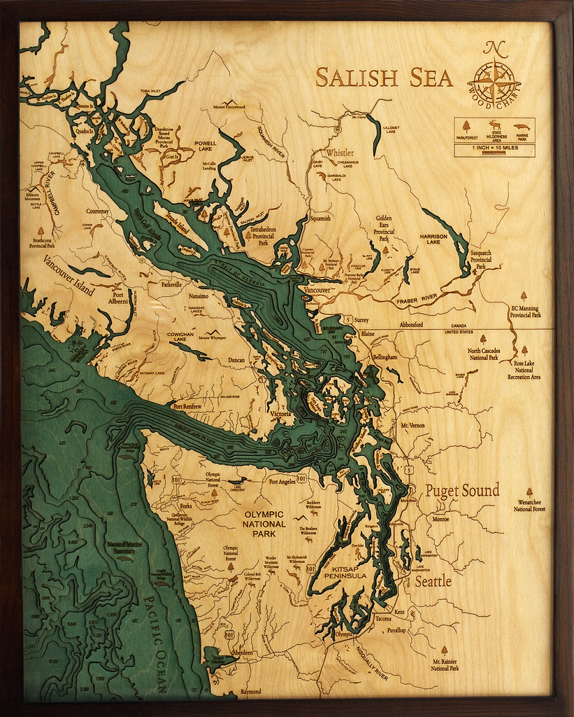
Salish Sea, Washington 3-D Nautical Wood Chart (Large) Size: 24.5" x 31" Laser-cut wooden relief map of the Salish Sea, featuring the Salish Sea, in Washington State and British Columbia. Map is framed and ready to hang, a unique...
$385.00
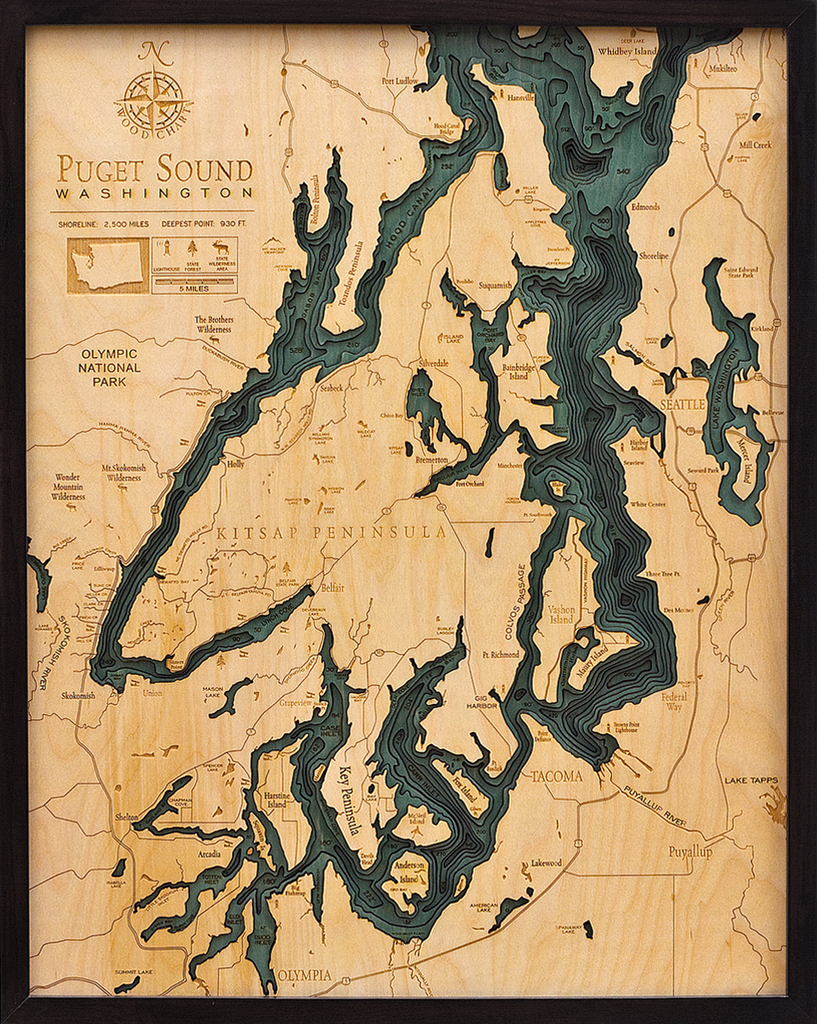
Puget Sound, Washington 3-D Nautical Wood Chart (Large) Size: 24.5" x 31" Laser-cut wooden relief map of the San Juan Islands, featuring the San Juan Islands, in Washington State. Map is framed and ready to hang, a unique and...
$195.00
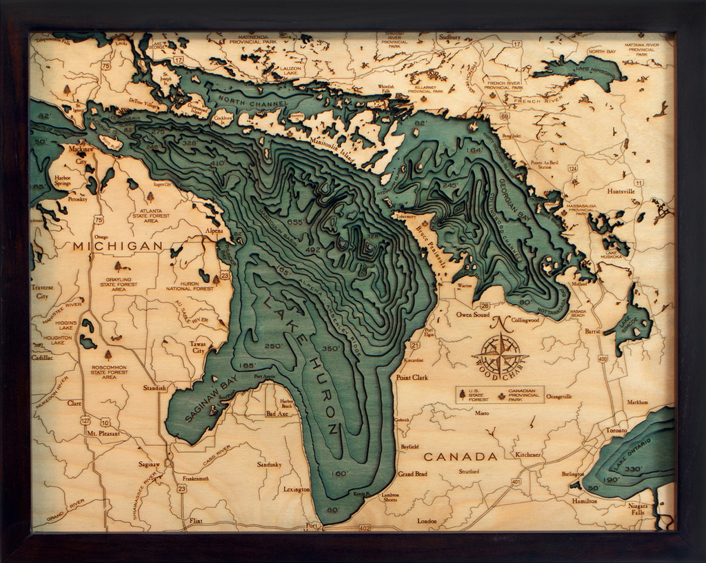
Lake Huron 3-D Nautical Wood Chart (Small) Wood Chart Size 16" x 20" Laser-cut wooden relief map of Lake Huron, featuring the second largest Great Lake. Map is framed and ready to hang, a unique and beautiful gift of artwork...
$200.00
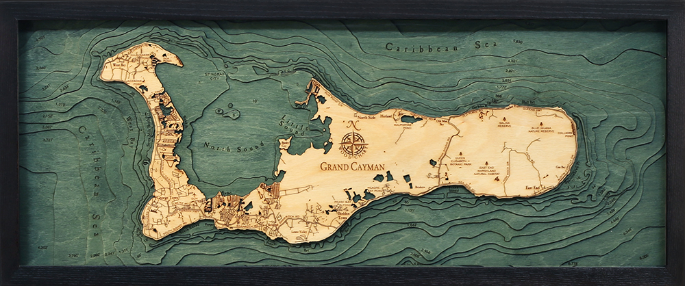
Grand Cayman, Cayman Islands 3-D Nautical Wood Chart (Medium) Size: 13.5" x 31" Laser-cut wooden relief map of Grand Cayman, featuring Grand Cayman Island in the Caribbean Sea. Map is framed and ready to hang, a unique and beautiful gift...


