WAGGONER TRIO- ON SALE NOW!!!
- Shop by Department
- Nautical Charts
- New Releases
- Marine Education Textbooks
- About Us
- +Shop by Department
- +Nautical Charts
- New Releases
- +Marine Education Textbooks
- +About Us
- Contact Us
- FAQ
- Repair Services
- Sign in

MAPTECH-WPC027
$29.95
Portsmouth, Great Bay and Isles of Shoals, 4th Edition
Great Bay and Piscataqua River to Isles of Shoals. Featuring GPS Waypoints, courses and distances, ramp locations, state parks, and fishing areas. 24" x 36", scale 1:26,666 with insets.
$29.95
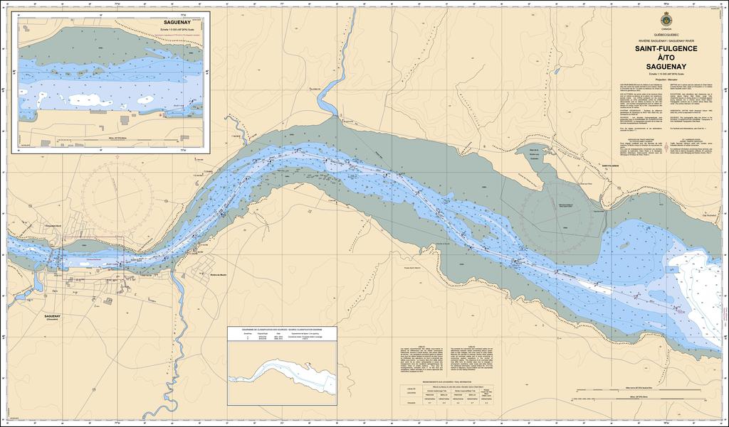
Region: Quebec Paper Size: 47" x 36" Chart Image Size: 43½" x 26⅜" Scale: 1:15,000 Captain's Supplies is a Print-on-Demand nautical chart dealer for Canadian Waters. All charts are printed up-to-date and corrected to the latest Notice...
$29.95
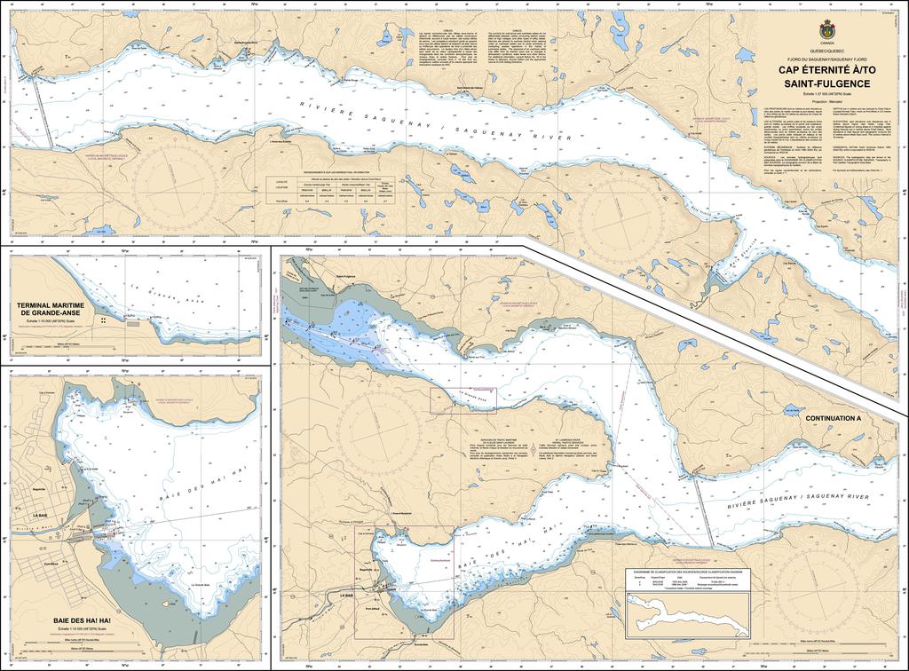
Region: Quebec Paper Size: 43" x 36" Chart Image Size: 39⅜" x 30" Scale: 1:37,500 Captain's Supplies is a Print-on-Demand nautical chart dealer for Canadian Waters. All charts are printed up-to-date and corrected to the latest Notice...
$29.95
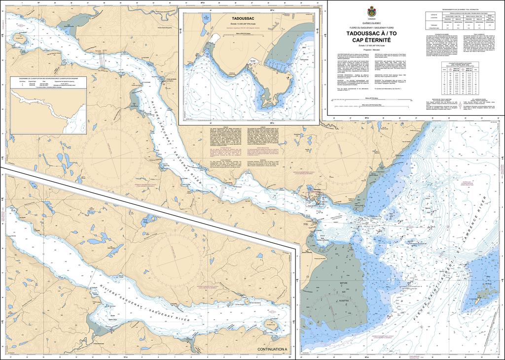
Region: Quebec Paper Size: 48" x 36" Chart Image Size: 44⅛" x 33⅜" Scale: 1:37,500 Captain's Supplies is a Print-on-Demand nautical chart dealer for Canadian Waters. All charts are printed up-to-date and corrected to the latest Notice...
$29.95
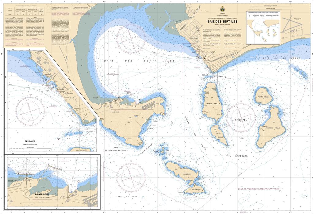
Region: Quebec Paper Size: 48" x 36" Chart Image Size: 44¾" x 31⅝" Scale: 1:25,000 Captain's Supplies is a Print-on-Demand nautical chart dealer for Canadian Waters. All charts are printed up-to-date and corrected to the latest Notice...


