WAGGONER TRIO- ON SALE NOW!!!
- Shop by Department
- Nautical Charts
- New Releases
- Marine Education Textbooks
- About Us
- +Shop by Department
- +Nautical Charts
- New Releases
- +Marine Education Textbooks
- +About Us
- Contact Us
- FAQ
- Repair Services
- Sign in

NOAA-18440
$23.75
The chart you are viewing is NOT updated weekly and does NOT include all of the latest Notice to Mariners corrections.
Region: Pacific Coast
Paper Size: 44" x 36"
Chart Image Size: 41" x 28"
Scale: 1:150,000
$26.95
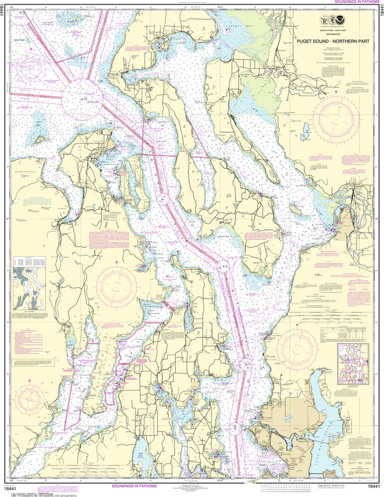
The chart you are viewing is NOT updated weekly and does NOT include all of the latest Notice to Mariners corrections. Region: Pacific Coast Paper Size: 47" x 36" Chart Image Size: 44" x 34" Scale: 1:80,000
$26.95
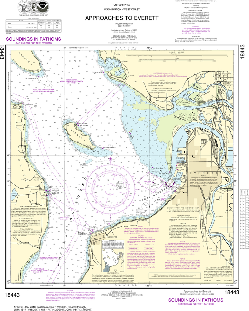
The chart you are viewing is NOT updated weekly and does NOT include all of the latest Notice to Mariners corrections. Region: Pacific Coast Paper Size: 26" x 36" Chart Image Size: 22" x 18" Scale: 1:40,000
$26.95
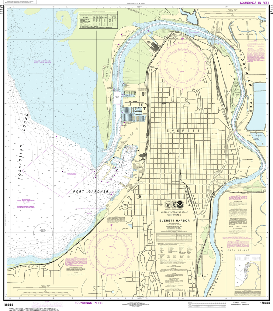
Region: Pacific Coast Paper Size: 39" x 36" Chart Image Size: 35" x 31" Scale: 1:10,000
$26.95
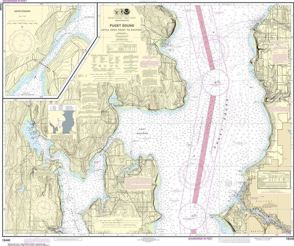
The chart you are viewing is NOT updated weekly and does NOT include all of the latest Notice to Mariners corrections. Region: Pacific Coast Paper Size: 43" x 36" Chart Image Size: 33" x 40" Scale: 1:25,000 ...


