WAGGONER TRIO- ON SALE NOW!!!
- Shop by Department
- Nautical Charts
- New Releases
- Marine Education Textbooks
- About Us
- +Shop by Department
- +Nautical Charts
- New Releases
- +Marine Education Textbooks
- +About Us
- Contact Us
- FAQ
- Repair Services
- Sign in


Maptech-CGLIS-15
$49.95
Covering New York Harbor to Block Island, the Hudson River, the Connecticut River, Long Island’s South Shore, and the New Jersey Coast to Cape May. Contains the most up-to-date data available, detailed navigation advice and anchorages, the best coastal dining and attractions, aerial photos, and marina information.
Maptech's Embassy Cruising Guides are the most comprehensive and accurate guides available for ports of call along the East Coast and Gulf of Mexico. These wonderful trip planners are chock-full of all the information you'll need, making them perfect companions aboard any boat. Bound with a crush-proof, plastic spiral and wrap-around covers, the guides are specifically designed for easy use. No boater should depart without Embassy Cruising Guides aboard!
Embassy Cruising Guides are organized divided into regions, identified by a color bar throughout the geographic area. Each region begins with an overview of highlights and a map identifying harbors, distances between ports, approximate statute mile if the port is on the ICW, and page numbers for each harbor chapter.
Harbor chapters describe all the viable cruising destinations in the area, including an overview of the port’s significance, why it’s worth a visit, things to see and do (such as popular attractions, festivals and events, beaches, wildlife preserves, walking trails, and parks), and a harbor chart with some or all of the following:
Publisher: Edgewater Marine Industries / Richardson’s Maptech
Series: Embassy Cruising Guides
Edition: 19th Edition
Pages: 574
Binding: Spiral-Bound with Wrap-Around Cover
ISBN-13: 9780743612456
$49.95
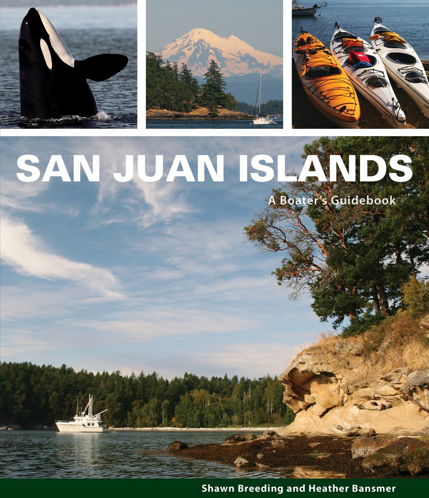
by Heather Bansmer & Shawn Breeding 2nd Edition San Juan Islands: A Boater’s Guidebook, is the newest, most up to date guide featuring the vibrant and pristine anchorages of Washington state’s cherished San Juan Islands

$46.00 $49.00
What's New In The 2026 Waggoner Cruising Guide: 528 PAGES OF ESSENTIAL PNW BOATING INFOINSIDE PASSAGE LOCAL KNOWLEDGEBORDER CROSSING PROCEDURESENTERTAINING NAUTICAL PET TALES SIDEBARS300+ DETAILED MAPS & DOCK DIAGRAMS500+ MARINAS & MARINE PARKS780+ ANCHORAGES Waggoner Cruising Guide is the...
$49.95
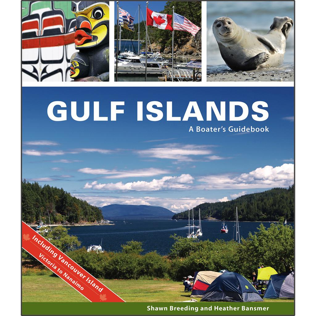
by Heather Bansmer & Shawn Breeding Gulf Islands: A Boater’s Guidebook, was created for the adventurer, the mariner or charterer who wants to get the ultimate experience out of their Canadian cruise and to do it confidently. This guide covers...
$59.95
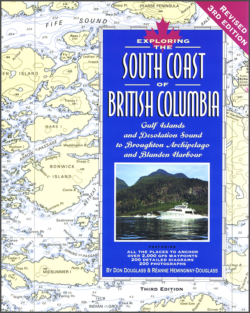
By Don Douglass & Reanne Hemingway-Douglass Features entrance waypoints, as well as anchor-site waypoints! The South Coast of British Columbia is designed by experts to give small boat skippers the kind of accurate, up-to-date information they need to cruise the...


