WAGGONER TRIO- ON SALE NOW!!!
- Shop by Department
- Nautical Charts
- New Releases
- Marine Education Textbooks
- About Us
- +Shop by Department
- +Nautical Charts
- New Releases
- +Marine Education Textbooks
- +About Us
- Contact Us
- FAQ
- Repair Services
- Sign in

NOAA-13205
$26.95
The chart you are viewing is NOT updated weekly and does NOT include all of the latest Notice to Mariners corrections.
Region: Northeast Atlantic
Latest Edition: 41 Ed. (1-Feb-2017)
Last Correction: 6-Sep-2019
Cleared Through: NTM 47/2019 (23-Nov-2019)
Paper Size: 51" x 36"
Chart Image Size: 47" x 34"
Scale: 1:80,000
$26.95
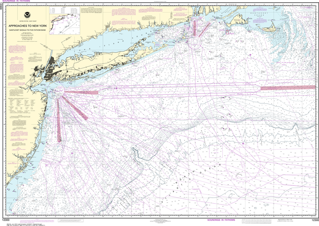
Region: Northeast Atlantic Latest Edition: 49 Ed. (1-Jun-2012) Last Correction: 6-Jan-2020 Cleared Through: NTM 47/2019 (23-Nov-2019) Paper Size: 51" x 36" Chart Image Size: 33" x 47" Scale: 1:400,000 Captain's Nautical Supplies is a Print-on-Demand nautical chart dealer for...
$26.95
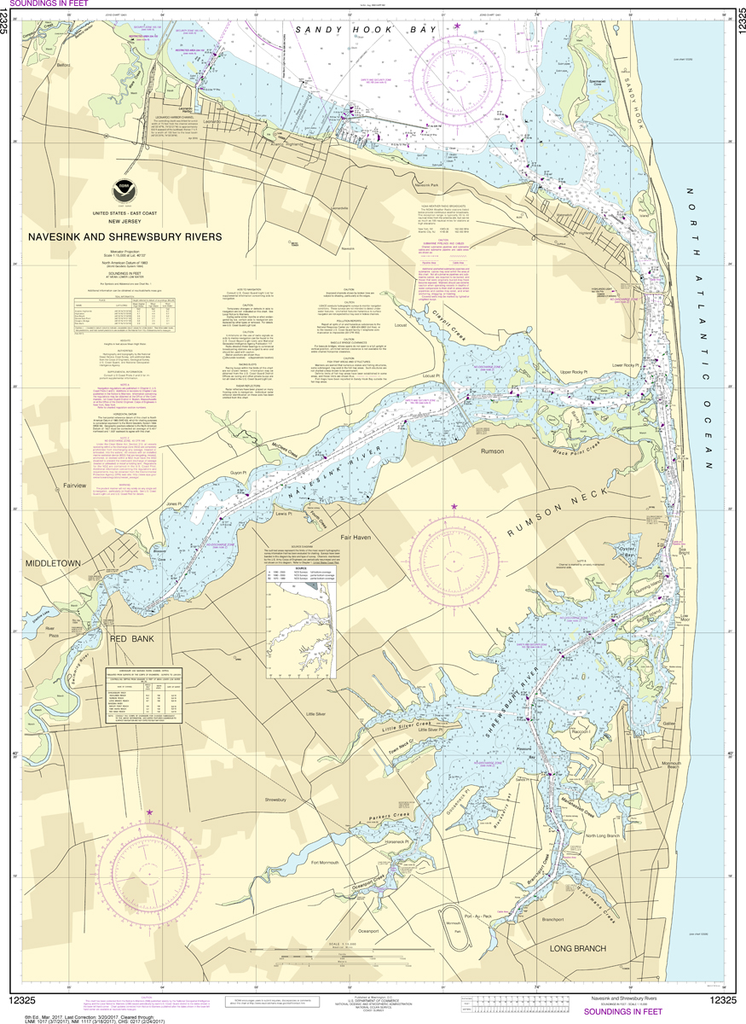
The chart you are viewing is NOT updated weekly and does NOT include all of the latest Notice to Mariners corrections. Region: Northeast Atlantic Latest Edition: 6 Ed. (1-Mar-2017) Last Correction: 30-Nov-2018 Cleared Through: NTM...
$26.95
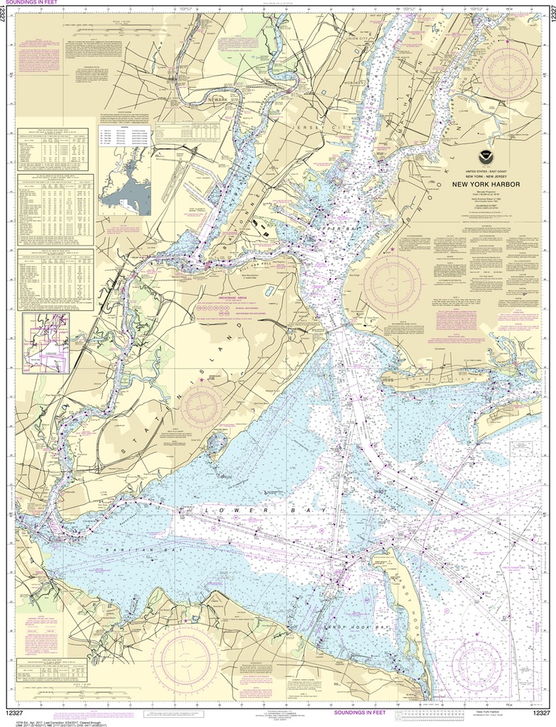
The chart you are viewing is NOT updated weekly and does NOT include all of the latest Notice to Mariners corrections. Region: Northeast Atlantic Latest Edition: 108 Ed. (1-Nov-2018) Last Correction: 20-Dec-2019 Cleared Through: NTM 47/2019 (23-Nov-2019)...
$26.95
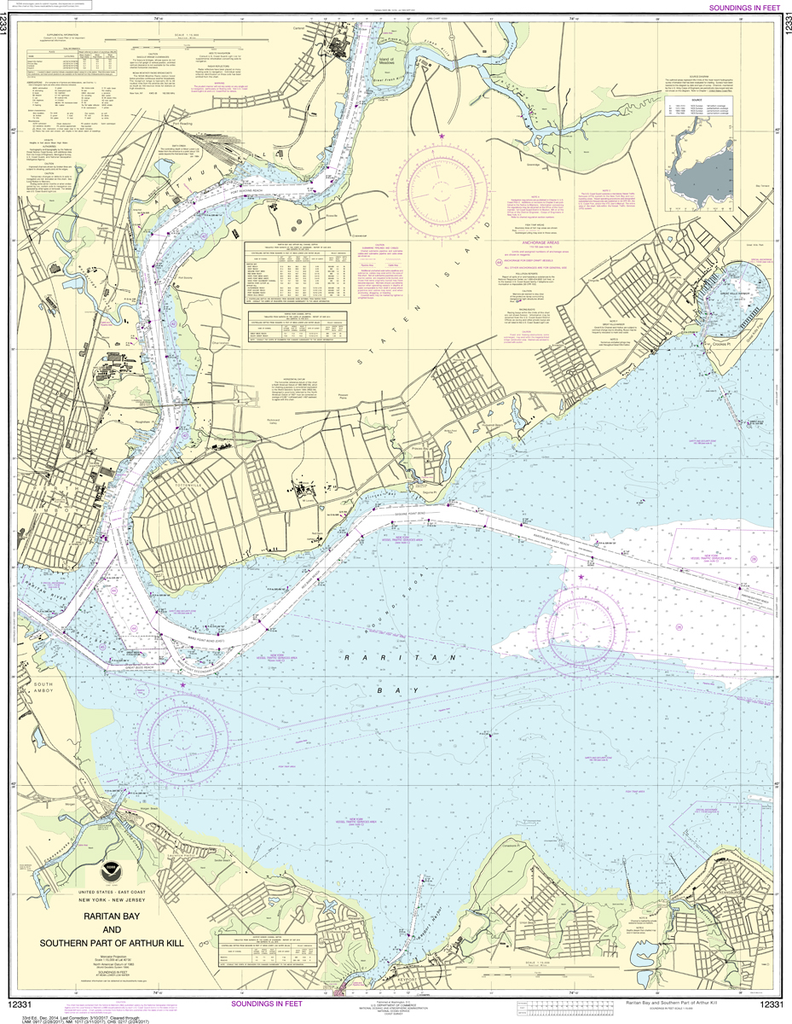
The chart you are viewing is NOT updated weekly and does NOT include all of the latest Notice to Mariners corrections. Region: Northeast Atlantic Latest Edition: 33 Ed. (1-Dec-2014) Last Correction: 15-Nov-2019 Cleared Through: NTM 47/2019...


