WAGGONER TRIO- ON SALE NOW!!!
- Shop by Department
- Nautical Charts
- New Releases
- Marine Education Textbooks
- About Us
- +Shop by Department
- +Nautical Charts
- New Releases
- +Marine Education Textbooks
- +About Us
- Contact Us
- FAQ
- Repair Services
- Sign in

NOAA-13233
$23.75
The chart you are viewing is NOT updated weekly and does NOT include all of the latest Notice to Mariners corrections.
Region: Northeast Atlantic
Latest Edition: 19 Ed. (1-Nov-2019)
Last Correction: 13-Dec-2019
Cleared Through: NTM 47/2019 (23-Nov-2019)
Paper Size: 46" x 36"
Chart Image Size: 35" x 42"
Scale: 1:40,000
$23.75
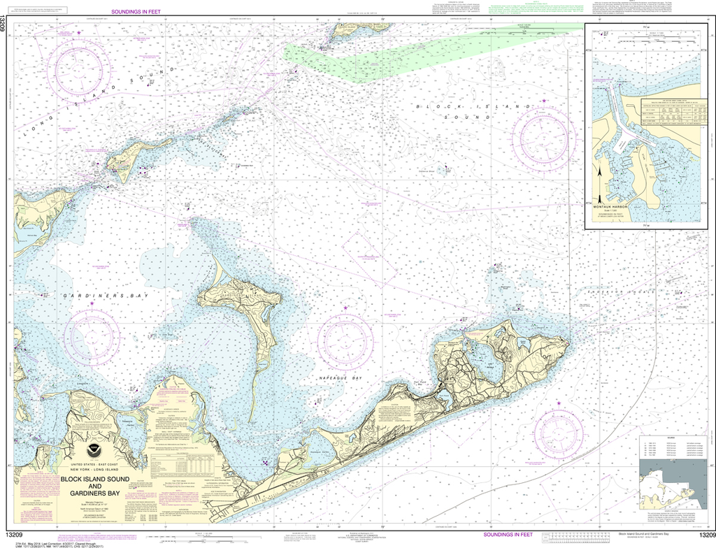
Region: Northeast Atlantic Latest Edition: 47 Ed. (1-Dec-2018) Last Correction: 25-Nov-2019 Cleared Through: NTM 47/2019 (23-Nov-2019) Paper Size: 50" x 36" Chart Image Size: 29" x 46" Scale: 1:80,000 Captain's Nautical Supplies is...
$23.75
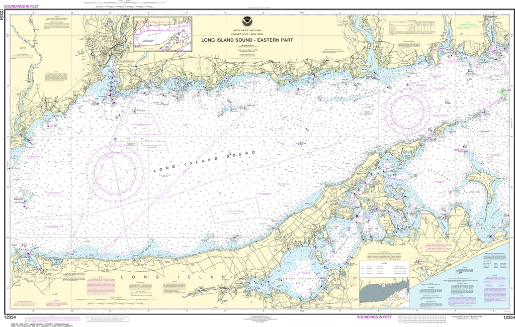
The chart you are viewing is NOT updated weekly and does NOT include all of the latest Notice to Mariners corrections. Region: Northeast Atlantic Latest Edition: 41 Ed. (1-Feb-2017) Last Correction: 6-Sep-2019 Cleared Through: NTM 47/2019 (23-Nov-2019)...
$23.75
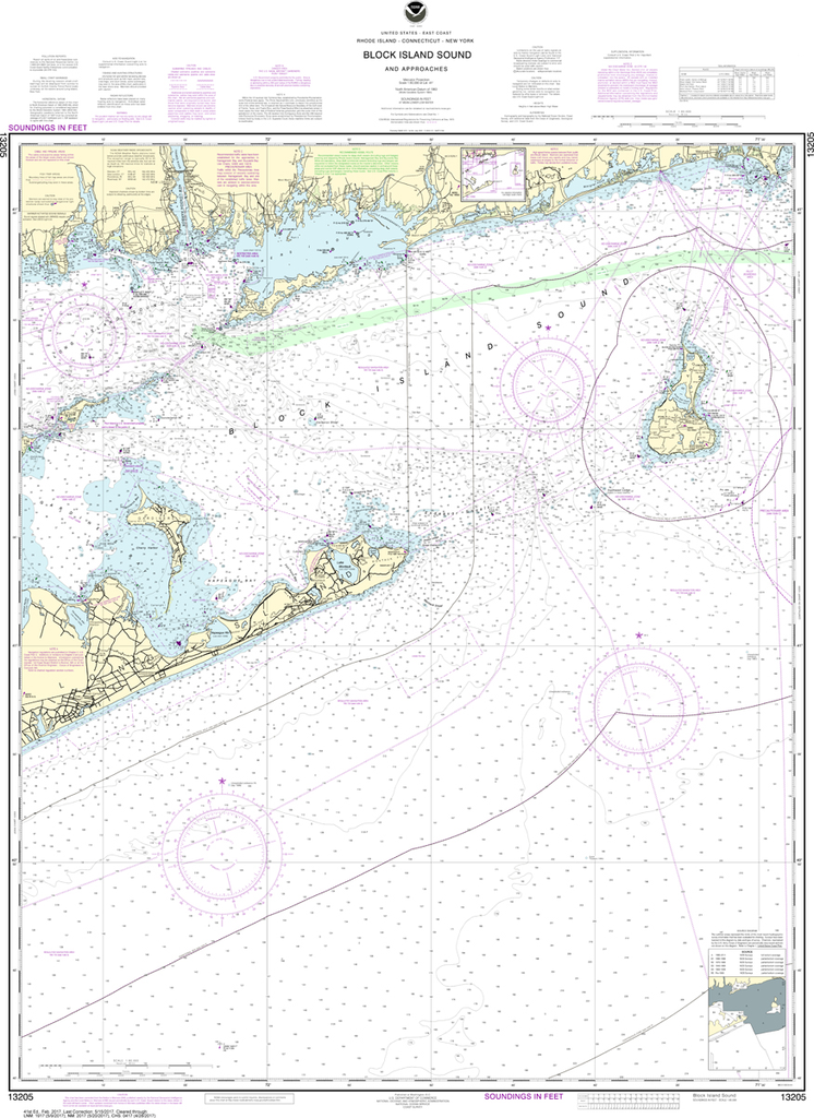
The chart you are viewing is NOT updated weekly and does NOT include all of the latest Notice to Mariners corrections. Region: Northeast Atlantic Latest Edition: 28 Ed. (1-Aug-2017) Last Correction: 6-Sep-2019 Cleared Through: NTM 47/2019 (23-Nov-2019)...
$23.75
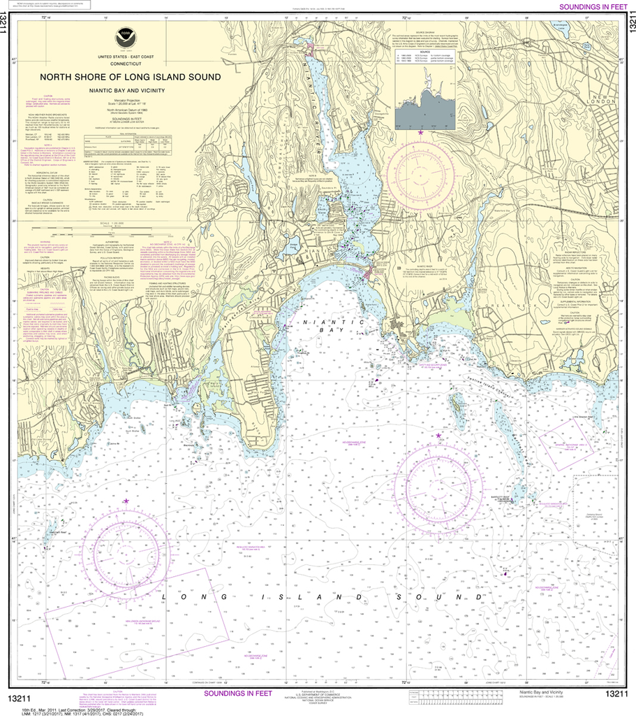
The chart you are viewing is NOT updated weekly and does NOT include all of the latest Notice to Mariners corrections. Region: Northeast Atlantic Paper Size: 36" x 36" Chart Image Size: 33" x 29" Scale: 1:20,000 Captain's...


