WAGGONER TRIO- ON SALE NOW!!!
- Shop by Department
- Nautical Charts
- New Releases
- Marine Education Textbooks
- About Us
- +Shop by Department
- +Nautical Charts
- New Releases
- +Marine Education Textbooks
- +About Us
- Contact Us
- FAQ
- Repair Services
- Sign in

PUB-9780938665892
$19.95
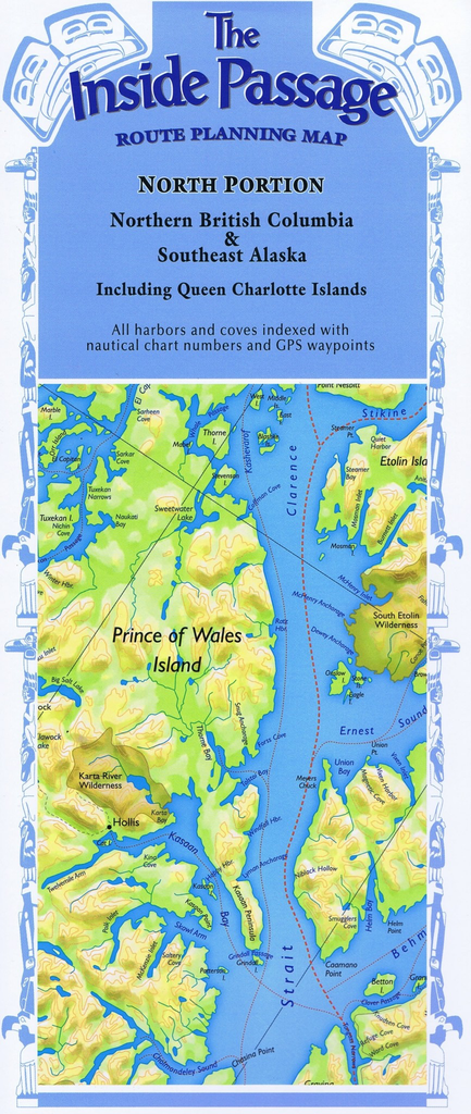
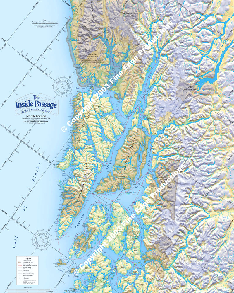
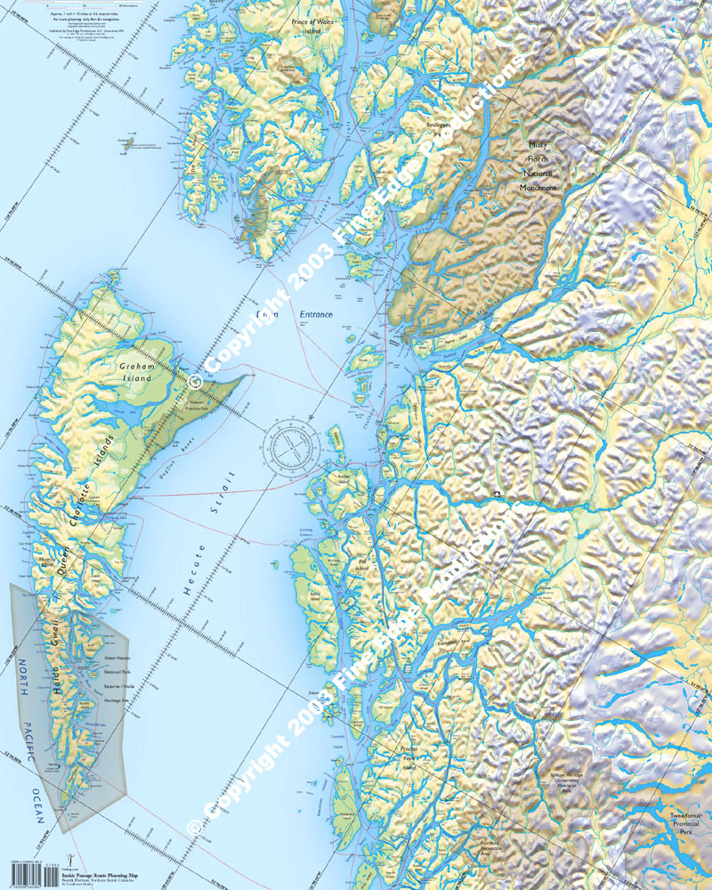
Plot your own itinerary and prepare for your trip of a lifetime through the Inside Passage! Route Planning Maps allow a bird’s-eye view of the coastline in one view. Use the references and suggested routes to plan your trip, or just hang these full-color maps up in your office or den.
Includes hundreds of unique scenic and sheltered routes between islands, as well as the more direct express routes. Over 4,000 place names are alphabetically indexed on the southern and northern portions of this full color two-map series. Descriptions include geographical locations, nautical chart numbers, and nearly 6,000 GPS waypoints. This will help you locate all the named places, as well as hundreds of other coves on each map.
Both North Portion and South Portion maps are 24 inches wide by 60 inches long. The folded version accordion-folds down to 12 inches by five inches for easy flat storage. The laminated version is packaged rolled up in a plastic sleeve.

$21.95
Alaska & Canada's INSIDE PASSAGE Cruise Tour Guide This unique guide/map allows you to explore the magnificent Inside Passage before your trip begins. The giant six-foot by 11 3/4 inch fold-out map opens from the center of the guidebook to...
$21.95
Alaska & Canada's INSIDE PASSAGE Cruise Tour Guide This unique guide/map allows you to explore the magnificent Inside Passage before your trip begins. The giant six-foot by 11 3/4 inch fold-out map opens from the center of the guidebook to...
$6.95
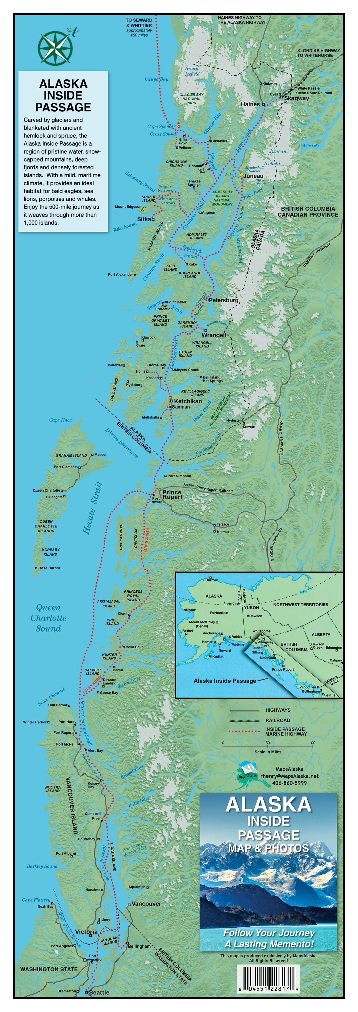
Ronald Henry's Alaska Inside Passage Map & Photos NEW EDITION OUT NOW Map measures 8 1/2" x 24" and features information and photos that allow you to track your Alaskan Inside Passage experience along the way from Seattle, WA, north all...
$6.95
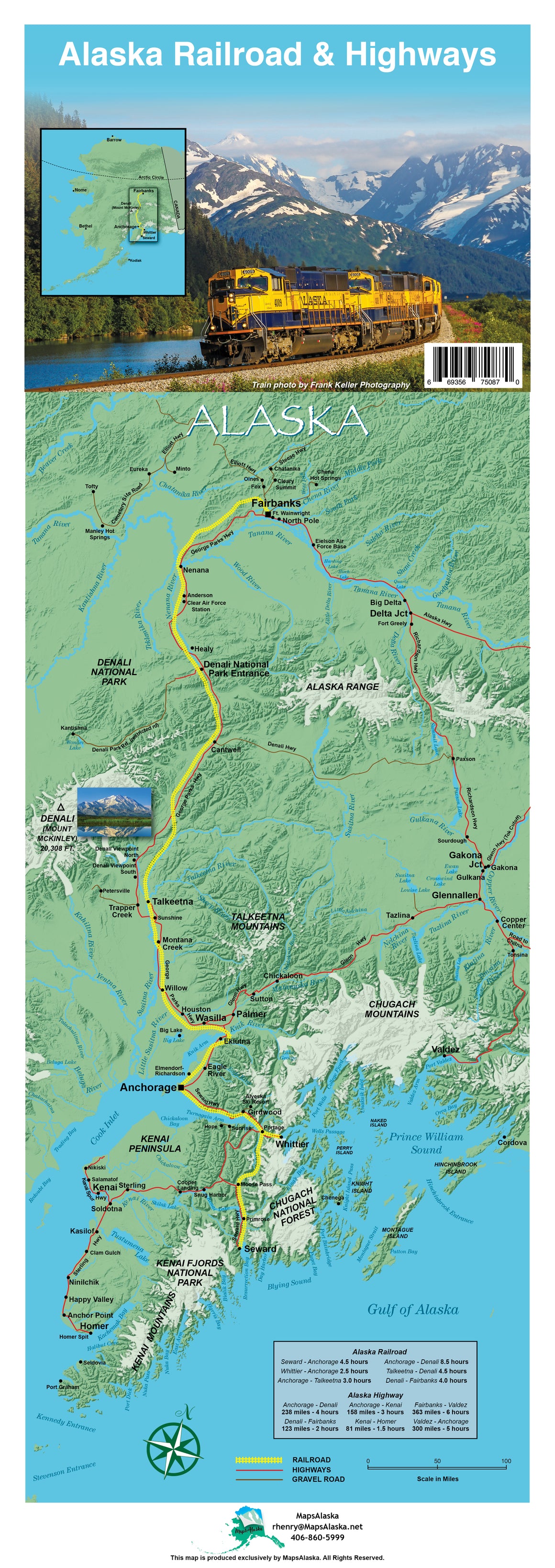
Alaska Railroad & Highway Map NEW EDITION OUT NOW Map measures 8 1/2" x 24" and features information and photos that allow you to track your Alaskan adventure through railroad and highways. This map acts not only as a guide but...


