WAGGONER TRIO- ON SALE NOW!!!
- Shop by Department
- Nautical Charts
- New Releases
- Marine Education Textbooks
- About Us
- +Shop by Department
- +Nautical Charts
- New Releases
- +Marine Education Textbooks
- +About Us
- Contact Us
- FAQ
- Repair Services
- Sign in


MAP-9780977648504
Sold Out
The Broughton Archipelago is British Columbia’s largest marine park. Consisting of dozens of undeveloped islands and islets, it is situated at the mouth of Knight Inlet, on the east side of Queen Charlotte Strait, across from the north end of Vancouver Island. It offers excellent boating, kayaking and wildlife viewing opportunities within a multitude of sheltered waters and anchorages with a backdrop of the magnificent coastal mountains to the east and the waters of Queen Charlotte Strait to the west.
Our Broughton Archipelago map includes a chart finder, a locator map, inset maps, and the unique Proven Cruising Routes© taken by Don and Réanne Douglass aboard their research vessel, Baidarka. Each map is GPS compatible. The back of the map has large-scale, detailed diagrams of local harbors and coves—all the places to tie up and anchor. Included are an alphabetical index of places, and a listing of route waypoints.

$21.95
Alaska & Canada's INSIDE PASSAGE Cruise Tour Guide This unique guide/map allows you to explore the magnificent Inside Passage before your trip begins. The giant six-foot by 11 3/4 inch fold-out map opens from the center of the guidebook to...
$21.95
Alaska & Canada's INSIDE PASSAGE Cruise Tour Guide This unique guide/map allows you to explore the magnificent Inside Passage before your trip begins. The giant six-foot by 11 3/4 inch fold-out map opens from the center of the guidebook to...
$6.95
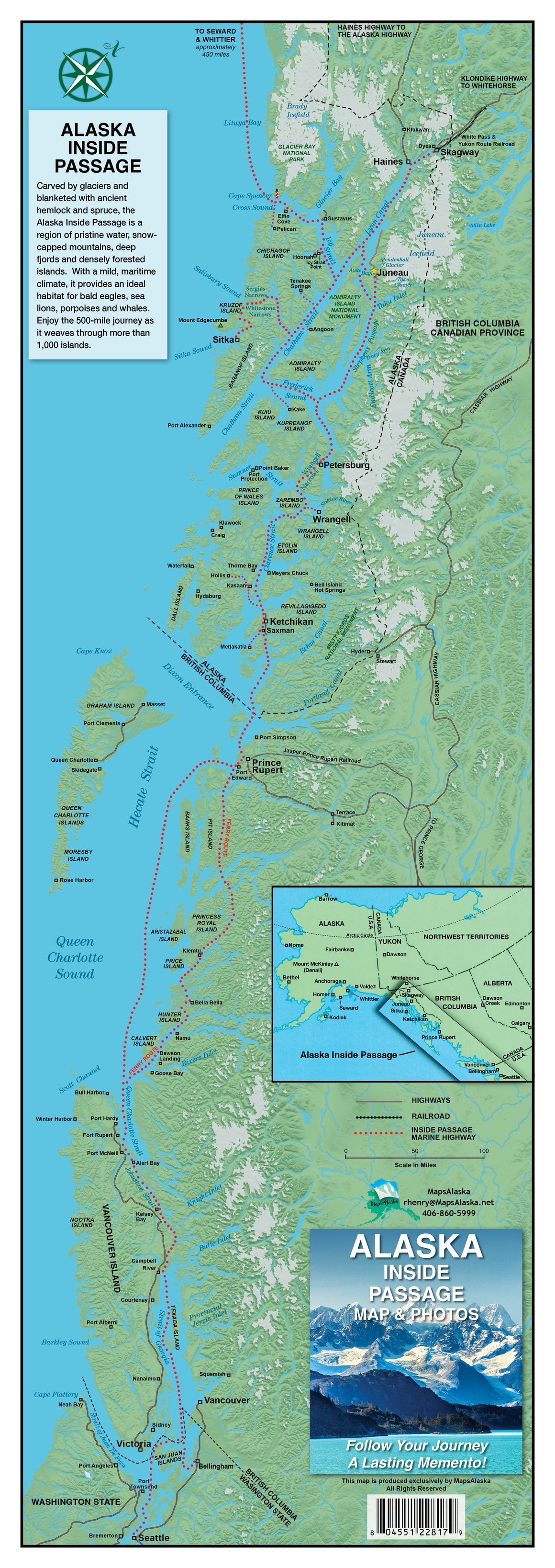
Ronald Henry's Alaska Inside Passage Map & Photos NEW EDITION OUT NOW Map measures 8 1/2" x 24" and features information and photos that allow you to track your Alaskan Inside Passage experience along the way from Seattle, WA, north all...
$6.95
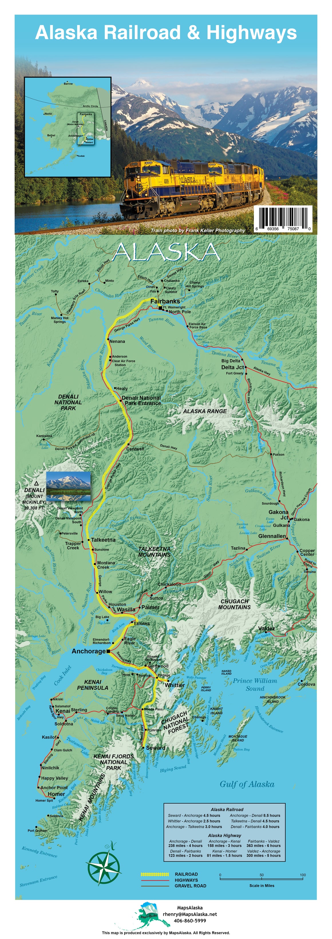
Alaska Railroad & Highway Map NEW EDITION OUT NOW Map measures 8 1/2" x 24" and features information and photos that allow you to track your Alaskan adventure through railroad and highways. This map acts not only as a guide but...


