Staten Island, New York 3-D Nautical Wood Chart (Large)
Size: 24.5" x 31"
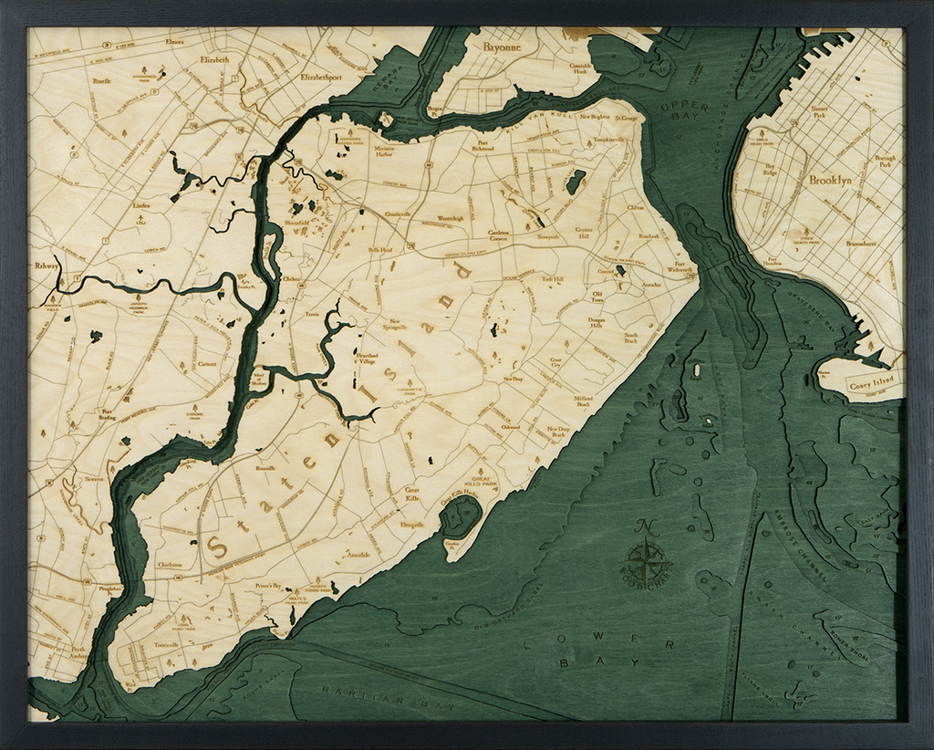
Laser-cut wooden relief map of Staten Island, featuring the New York City borough of Staten Island. Map is framed and ready to hang, a unique and beautiful gift of artwork for sailors and land-lovers alike.
Locale
Although Staten Island is the least populated of New York's boroughs, it is the third-largest in area. It is separated from Long Island by the Narrows, and from mainland New Jersey by Arthur Kill.
Points of Interest: Bayonne, Brooklyn, Fort Wadsworth, Hoffman Island, Island of Meadows, Kill Van Kull, Newark Bay, Port Richmond, St George, Swinburne Island, and Wolfe's Pond Park.
About
Wood Charts are based on soundings and measurements from bathymetric and nautical charts. Each depth layer is laser-cut from sheets of Baltic birch and glued together "bread and butter" style to create the contours and shorelines of striking waterways. Select layers are hand-stained a rich blue-green color to discern water from land, and major byways are etched into the land. The whole work is framed in a custom, solid wood frame and protected with a sheet of durable, ultra-transparent acrylic.
Special Order
This product is not stocked at Captain's store, but may be special-ordered from the manufacturer or distributor.
Please allow up to two weeks for your special-ordered item to arrive. Captain's will contact you if your item is expected to take longer, or if your item is out of stock at the supplier.
Returns of Special-Order Items:
Since this is a specialty item, there are no returns or exchanges for this product.