WAGGONER TRIO- ON SALE NOW!!!
- Shop by Department
- Nautical Charts
- New Releases
- Marine Education Textbooks
- About Us
- +Shop by Department
- +Nautical Charts
- New Releases
- +Marine Education Textbooks
- +About Us
- Contact Us
- FAQ
- Repair Services
- Sign in
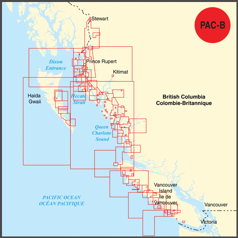
CHS-PAC-B
$599.95
BEFORE PURCHASING DIGITAL CHARTS, PLEASE READ THROUGH THE FAQ PAGE FOR ALL TECHNICAL QUESTIONS, THAT CAN BE FOUND THROUGH THIS LINK: https://www.charts.gc.ca/help-aide/faq-eng.html
Electronic Navigational Chart (ENC) collection in S-57 format for the west coast of Vancouver Island and north British Columbia from Barkley Sound to Prince Rupert, including Clayoquot Sound, Cape Scott, Queen Charlotte Sound, Haida Gwaii, Dixon Entrance, Hecate Strait, Kitimat, Bella Coola, and Bella Bella.
The PAC-B collection contains the approximate equal coverage as the following paper charts: 3000, 3002, 3598, 3602, 3603, 3604, 3605, 3646, 3647, 3651, 3668, 3670, 3671, 3673, 3674, 3675, 3677, 3679, 3680, 3681, 3683, 3685, 3686, 3733, 3736, 3744, 3794, 3800, 3807, 3808, 3809, 3890, 3894, 3909, 3910, 3911, 3912, 3920, 3921, 3927, 3931, 3933, 3934, 3935, 3936, 3937, 3938, 3939, 3940, 3941, 3942, 3943, 3944, 3945, 3946, 3947, 3948, 3955, 3956, 3957, 3958, 3959, 3960, 3964, 3974, 3984, 3985, 3986, 3987, and 3994.
Canadian Digital Chart Collections are fulfilled digitally. Once your purchase is complete, a unique transaction code will be provided within 24 hours, allowing you to register, download, and update your digital charts at the CHS Chart Registry Service.
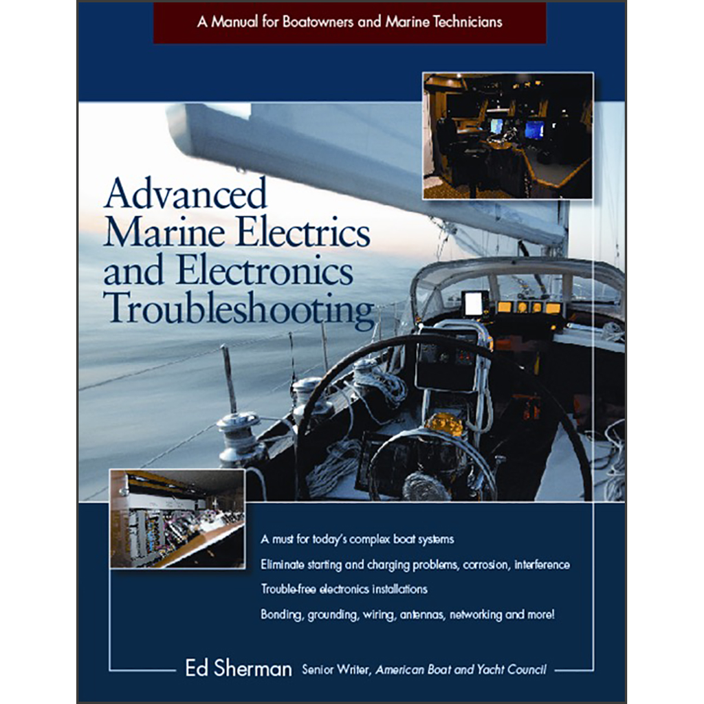
$34.00
By Edwin R. Sherman Save time and money with this state-of-the-art guide to the latest, most advanced diagnostic equipment and techniques Whether you are a marine electronics professional or a boatowner, Advanced Marine Electrics and Electronics Troubleshooting helps you understand the new,...
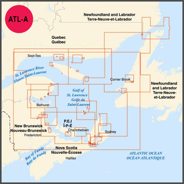
$599.95
BEFORE PURCHASING DIGITAL CHARTS, PLEASE READ THROUGH THE FAQ PAGE FOR ALL TECHNICAL QUESTIONS, THAT CAN BE FOUND THROUGH THIS LINK: https://www.charts.gc.ca/help-aide/faq-eng.html Electronic Navigational Chart (ENC) collection in S-57 format for the Gulf of St. Lawrence. The ALT-A collection contains...
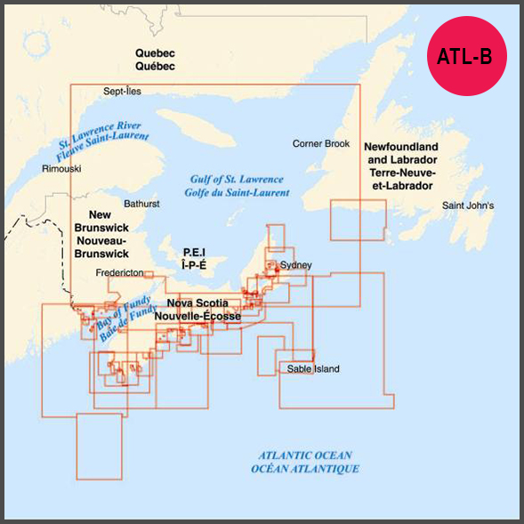
$599.95
BEFORE PURCHASING DIGITAL CHARTS, PLEASE READ THROUGH THE FAQ PAGE FOR ALL TECHNICAL QUESTIONS, THAT CAN BE FOUND THROUGH THIS LINK: https://www.charts.gc.ca/help-aide/faq-eng.html Electronic Navigational Chart (ENC) collection in S-57 format for Nova Scotia - Bay of Fundy. The ATL-B collection...

$599.95
BEFORE PURCHASING DIGITAL CHARTS, PLEASE READ THROUGH THE FAQ PAGE FOR ALL TECHNICAL QUESTIONS, THAT CAN BE FOUND THROUGH THIS LINK: https://www.charts.gc.ca/help-aide/faq-eng.html Electronic Navigational Chart (ENC) collection in S-57 format for Newfoundland East and South - Labrador. The ATL-C collection...


