WAGGONER TRIO- ON SALE NOW!!!
- Shop by Department
- Nautical Charts
- New Releases
- Marine Education Textbooks
- About Us
- +Shop by Department
- +Nautical Charts
- New Releases
- +Marine Education Textbooks
- +About Us
- Contact Us
- FAQ
- Repair Services
- Sign in
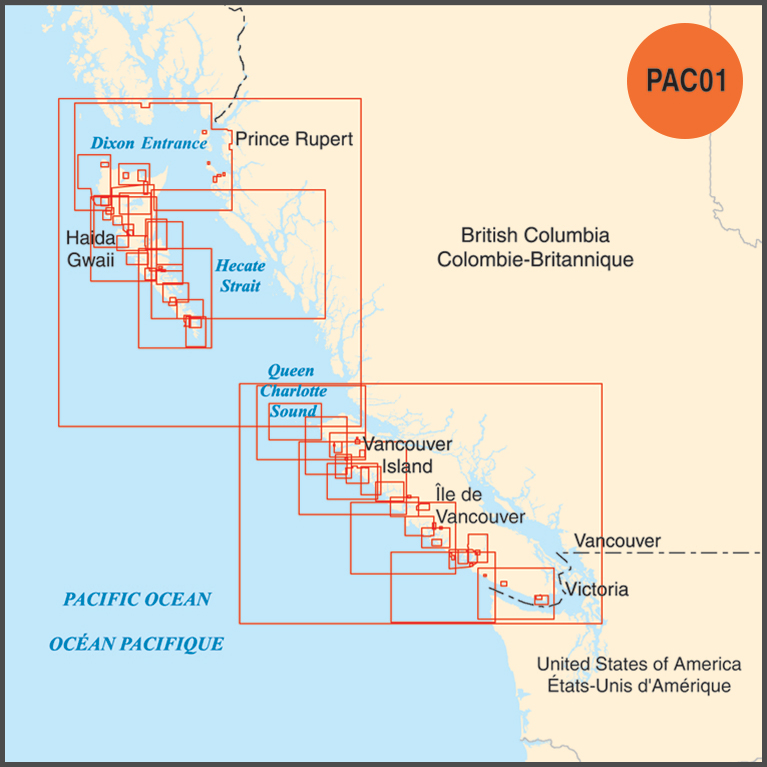
CHS-PAC01
Sold Out
Raster Collections, have been discontinued and are no longer available. Rasters are only available in individual format until they are converted to ENC and cancelled.
-----------------
BEFORE PURCHASING DIGITAL CHARTS, PLEASE READ THROUGH THE FAQ PAGE FOR ALL TECHNICAL QUESTIONS, THAT CAN BE FOUND THROUGH THIS LINK: https://www.charts.gc.ca/help-aide/faq-eng.html
Raster Navigational Chart (RNC) collection in BSB4 raster format for the West Coast of Vancouver and Haida Gwaii.
The PAC-01 collection contains the approximate equal coverage as the following paper charts:
3000, 3001, 3002, 3410, 3411, 3602, 3603, 3604, 3605, 3606, 3623, 3624, 3625, 3646, 3647, 3651, 3668, 3670, 3671, 3673, 3674, 3675, 3676, 3677, 3679, 3680, 3681, 3683, 3685, 3686, 3800, 3807, 3808, 3809, 3811, 3825, 3853, 3854, 3855, 3857, 3859, 3860, 3863, 3864, 3865, 3868, 3869, 3890, 3891, 3892, 3893, 3894, 3895, 3902, and 3909.
Canadian Digital Chart Collections are fulfilled digitally. Once your purchase is complete, a unique transaction code will be provided within 24 hours, allowing you to register, download, and update your digital charts at the CHS Chart Registry Service.
$599.95
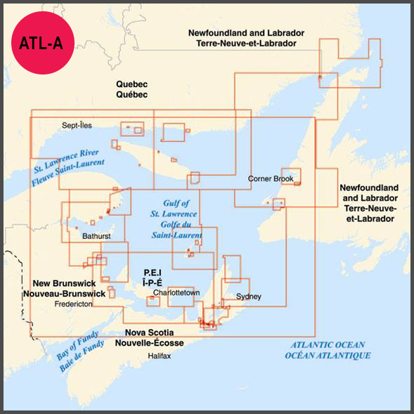
BEFORE PURCHASING DIGITAL CHARTS, PLEASE READ THROUGH THE FAQ PAGE FOR ALL TECHNICAL QUESTIONS, THAT CAN BE FOUND THROUGH THIS LINK: https://www.charts.gc.ca/help-aide/faq-eng.html Electronic Navigational Chart (ENC) collection in S-57 format for the Gulf of St. Lawrence. The ALT-A collection contains...
$599.95
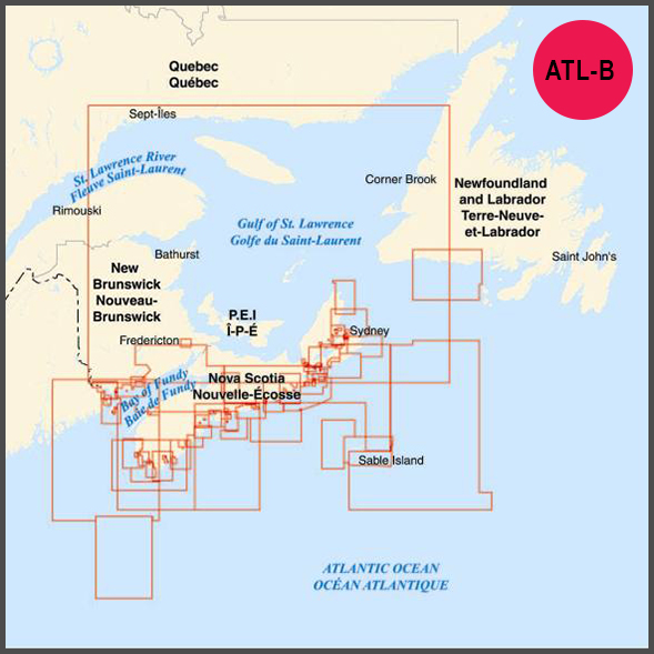
BEFORE PURCHASING DIGITAL CHARTS, PLEASE READ THROUGH THE FAQ PAGE FOR ALL TECHNICAL QUESTIONS, THAT CAN BE FOUND THROUGH THIS LINK: https://www.charts.gc.ca/help-aide/faq-eng.html Electronic Navigational Chart (ENC) collection in S-57 format for Nova Scotia - Bay of Fundy. The ATL-B collection...

$599.95
BEFORE PURCHASING DIGITAL CHARTS, PLEASE READ THROUGH THE FAQ PAGE FOR ALL TECHNICAL QUESTIONS, THAT CAN BE FOUND THROUGH THIS LINK: https://www.charts.gc.ca/help-aide/faq-eng.html Electronic Navigational Chart (ENC) collection in S-57 format for Newfoundland East and South - Labrador. The ATL-C collection...
$599.95
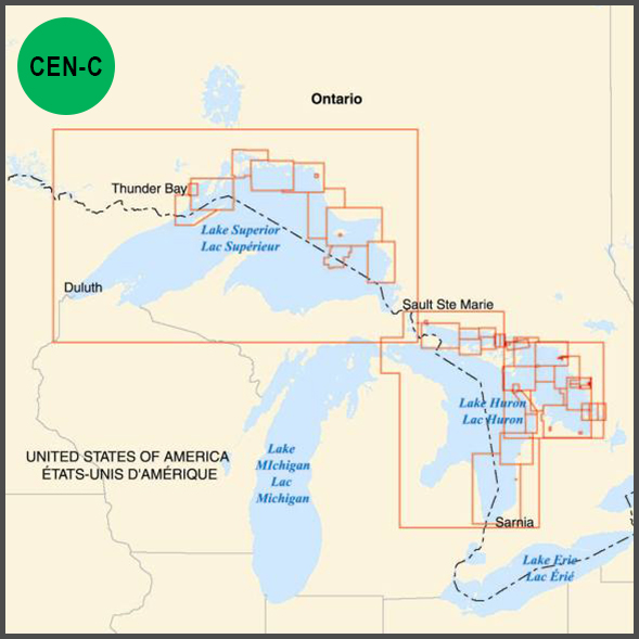
BEFORE PURCHASING DIGITAL CHARTS, PLEASE READ THROUGH THE FAQ PAGE FOR ALL TECHNICAL QUESTIONS, THAT CAN BE FOUND THROUGH THIS LINK: https://www.charts.gc.ca/help-aide/faq-eng.html Electronic Navigational Chart (ENC) collection in S-57 format for Great Lakes - Superior and Huron. The CEN-A...


