$59.99
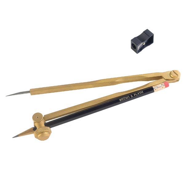
This large solid brass pencil compass is perfect for the professional navigator using large charts. Overview Draws up to 24in. circle. Solid brass with angles stainless steel point. Adjustable pivoting pencil mount. Includes pencil, sharpener and plastic pouch. Lifetime warranty....
$38.95
By Emily L. Moore Among Southeast Alaska's best-known tourist attractions are its totem parks, showcases for monumental wood sculptures by Tlingit and Haida artists. Although the art form is centuries old, the parks date back only to the waning years...
$50.00
PUB 111: List of Lights, Radio Aids and Fog Signals (2026) Navigate the waters of Western South America and the South Atlantic Ocean with confidence using PUB 111: List of Lights, Radio Aids and Fog Signals (2026). Published by the...
$60.00
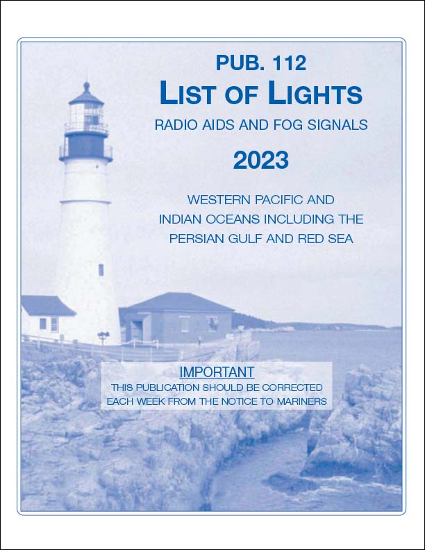
List of Lights 112: Radio Aids and Fog Signals covers the Western Pacific and Indian Oceans Including The Persian Gulf and Red Sea The List of Lights is published in seven volumes and contains lights and other aids to navigation used...
$55.00
PUB 113: List of Lights, Radio Aids and Fog Signals (2026) Navigate the waters of the West Coasts of Europe and Africa, the Mediterranean Sea, the Black Sea, and the Sea of Azov with confidence using PUB 113: List of...
$45.00
2024 Edition Out Now List of Lights 114: Radio Aids and Fog Signals covers the British Isles, the English Channel, and the North Sea. The List of Lights is published in seven volumes and contains lights and other aids to...
$45.00
PUB 114: List of Lights, Radio Aids and Fog Signals (2026) Navigate the busy waterways of the British Isles, the English Channel, and the North Sea with confidence using PUB 114: List of Lights, Radio Aids and Fog Signals (2026)....
$46.00
PUB 115: List of Lights, Radio Aids and Fog Signals (2026) Navigate the challenging waters of the North Atlantic and Arctic with confidence using PUB 115: List of Lights, Radio Aids and Fog Signals (2026). Published by the National Geospatial-Intelligence...
$45.00
PUB 116: List of Lights, Radio Aids and Fog Signals (2026) Navigate the waters of the Baltic Sea, Kattegat, the Belts and Sound, and the Gulf of Bothnia with confidence using PUB 116: List of Lights, Radio Aids and...
$45.00
Sailing Directions 127 (Enroute) covers the East Coast of Australia and New Zealand from the Torres Strait and Cape York between the southernmost tip of Australia and Papua New Guinea to Tasmania, including the Kermadac Islands and Macquarie Island. It...
$45.00
The Radar Navigation and Maneuvering Board Manual, compiled by the Maritime Safety Information Center, is an instruction handbook for navigation schools as well as naval and merchant marine personnel. [ISBN: 1-57785-248-6]
$50.00
Sailing Directions 142 (Enroute) covers Ireland and the West Coast of England from Mizen Head to Malin Head to the English Channel, including the Irish Sea. It is issued for use in conjunction with Sailing Directions 140 (Planning Guide) North...
$50.00
Sailing Directions 143 (Enroute) covers the West Coast of Europe and Northwest Africa from the Bay of Biscay in France to the Banana Islands and Cape Palmas off the west coast of Africa. It is issued for use in conjunction...
$50.00
PUB 146 – Sailing Directions (Enroute): Newfoundland, Labrador, and Hudson Bay (19th Edition) (2026) Navigate the challenging waters of Newfoundland, Labrador, and Hudson Bay with confidence using PUB 146 – Sailing Directions (Enroute). Published by the National Geospatial-Intelligence Agency (NGA),...
$45.00
Sailing Directions Caribbean Sea, Volume 1 (2025) 18th Edition
$45.00
Sailing Directions Caribbean Sea, Volume 2 (2025) 19th Edition
$50.00
2022 Sailing Directions 154 (Enroute) (16th Edition) covers British Columbia from the Strait of Juan de Fuca, through the Hecate Strait, to the southern border of Alaska. It is issued for use in conjunction with Sailing Directions 120 (Planning Guide)...
$50.00
(20th Edition). 2022 Sailing Directions 157 (Enroute) covers the Coasts of Korea and China from the northern coast of North Korea, around South Korea, through the Yellow Sea, to Guangzhou in Southeast China. It is issued for use in conjunction...
$50.00
(19th Edition). 2024 Sailing Directions 158 (Enroute) covers Japan from the coast of Hokkaido and Honshu to the Ryukyu Islands, Nanpo, and Shoto. It is issued for use in conjunction with Sailing Directions 120 (Planning Guide) Pacific Ocean and Southeast...
$40.00
(15th Edition), 2022 Sailing Directions 173 (Enroute) covers India and the Bay of Bengal from the Gulf of Kutch in Pakistan to Ko Phuket in Thailand, including the Maldive Islands, Sri Lanka, and the Nicobar Islands. It is issued for...
$50.00
(14th Edition.) 2022 Sailing Directions 175 (Enroute) covers the North, West, and South coasts of Australia from Cape York to Cape Northumberland, including the Great Australian Bight and Kangaroo Island. It is issued for use in conjunction with Sailing Directions...
$40.00
(20th Edition), 2022 Sailing Directions 191 (Enroute) covers the English Channel from Scilly Isles and Ile D
$45.00
North Sea (Enroute) 17th Edition- Sailing Directions are published to cover the harbors, coasts, and waters of the world. Each publication is divided into geographic areas called sectors and includes detailed coastal and port approach information which supplements the largest...
$47.00
Latitudes 0[ISBN: 1-57785-192-7]