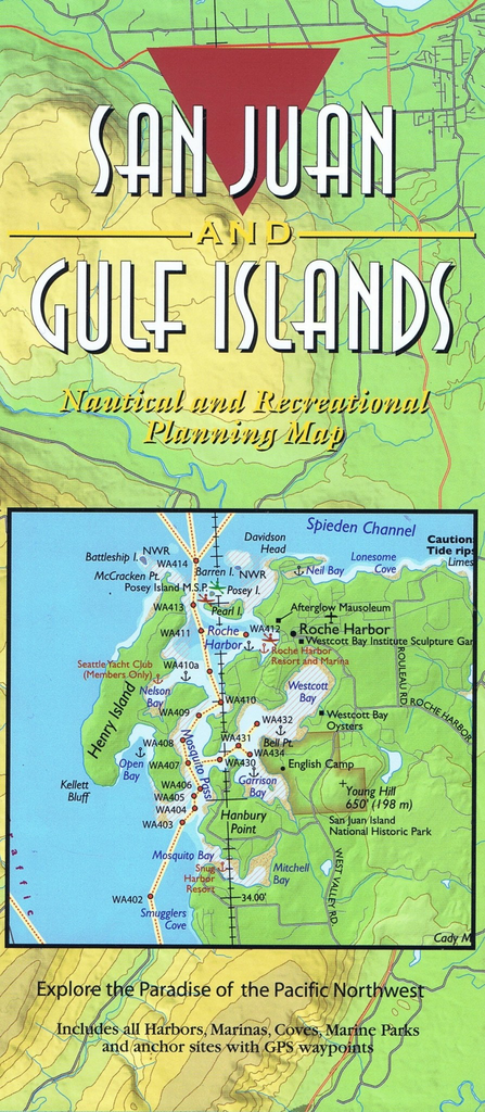
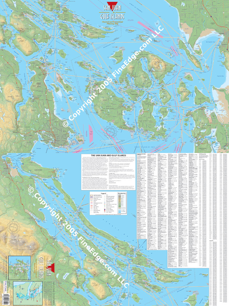
Boating and exploring one of the most popular cruising areas in the world is now easy with this colorful planning map of the San Juan and Gulf Islands. The map covers Deception Pass west to Victoria, and north from Bellingham to Nanaimo.
All harbors, coves, anchorages, and Cascade Marine Trail sites for kayaks or canoes are noted, as well as public and Provincial parks. Fine Edge’s Proven Cruising Routes © are shown with the Latitude/Longitude GPS Waypoints listed for all key locations and the turning points for the routes. The map, by Don Douglass & Réanne Hemingway-Douglass, is a perfect compliment to their best selling “Exploring the San Juan & Gulf Islands” cruising guide to plan your next trip to the islands.
This two-sided map is 36” wide by 24” high. The folded version folds down to 4” wide by 9” high and is printed on waterproof paper for convenient use on a boat or carrying in a backpack. The laminated version is shipped rolled into a tight tube. The back of the map includes the Canadian Gulf Islands and the GPS Waypoints for the routes shown and all major harbors and coves on the map.