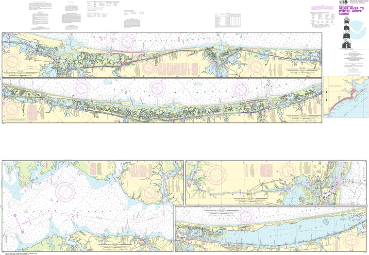
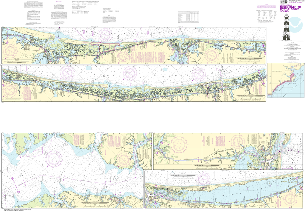
NOAA Chart 11541: Intracoastal Waterway - Neuse River to Myrtle Grove Sound
$23.75
The chart you are viewing is NOT updated weekly and does NOT include all of the latest Notice to Mariners corrections.
Region: Mid-Atlantic Paper Size: 62" x 42" Chart Image Size: 41" x 59" Scale: 1:40,000
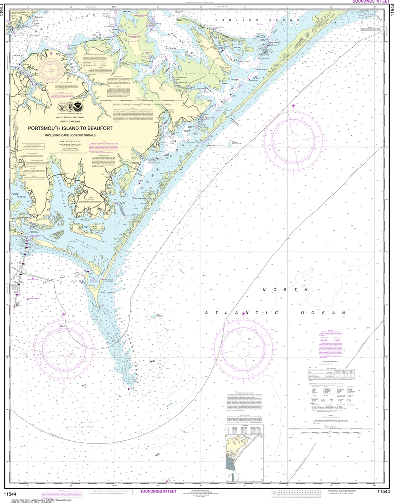
NOAA Chart 11544: Portsmouth Island to Beaufort, Including Cape Lookout Shoals
$23.75
The chart you are viewing is NOT updated weekly and does NOT include all of the latest Notice to Mariners corrections. Region: Mid-Atlantic Latest Edition: 41 Ed. (1-Dec-2013) Last Correction: 20-Nov-2019 Cleared Through: NTM 47/2019 (23-Nov-2019) ...
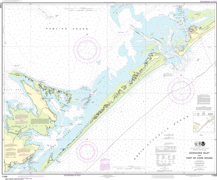
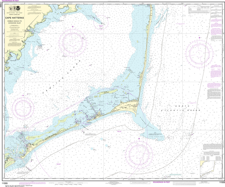
NOAA Chart 11550: Ocracoke lnlet and Part of Core Sound
$23.75
Region: Mid-Atlantic Paper Size: 46" x 36" Chart Image Size: 35" x 42" Scale: 1:40,000 Captain's Nautical Supplies is a Print-on-Demand nautical chart dealer for US Waters. All charts are printed up-to-date and corrected to the...
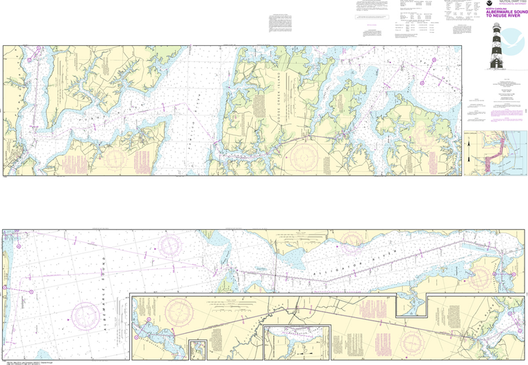
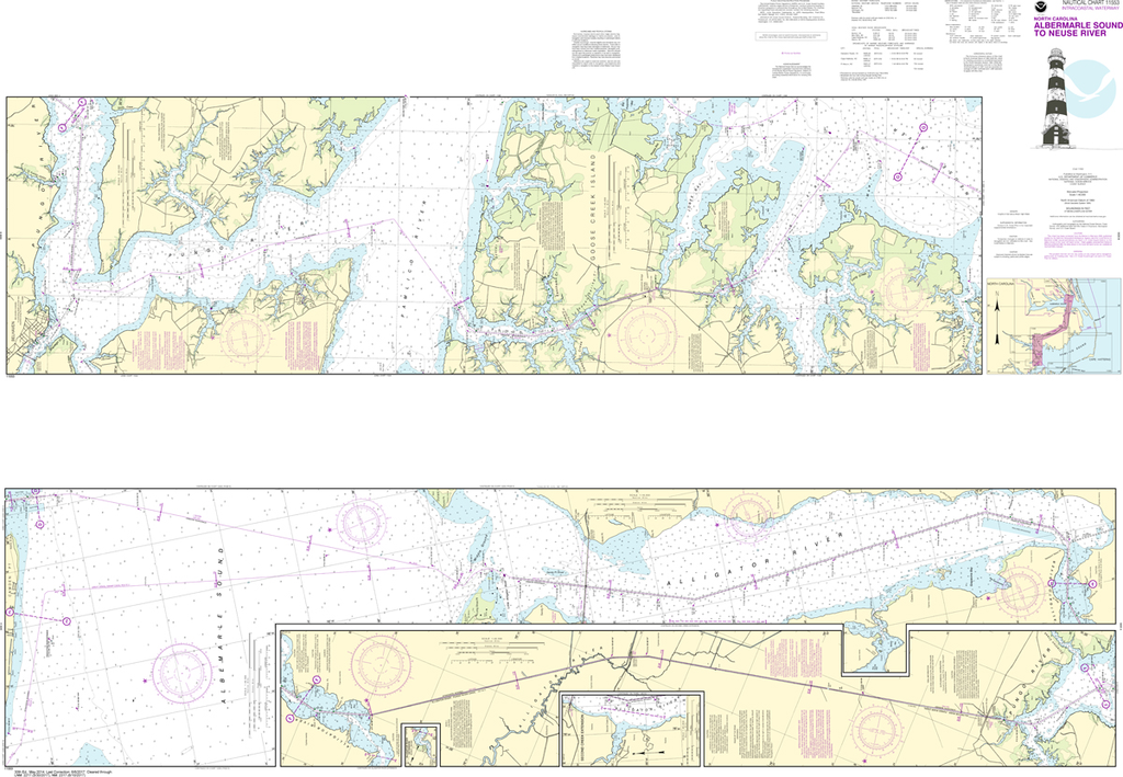
NOAA Chart 11553: Intracoastal Waterway - Albermarle Sound to Neuse River, Alligator River, Second Creek
$23.75
The chart you are viewing is NOT updated weekly and does NOT include all of the latest Notice to Mariners corrections. Region: Mid-Atlantic Paper Size: 62" x 42" Chart Image Size: 41" x 59" Scale: 1:40,000 Captain's...
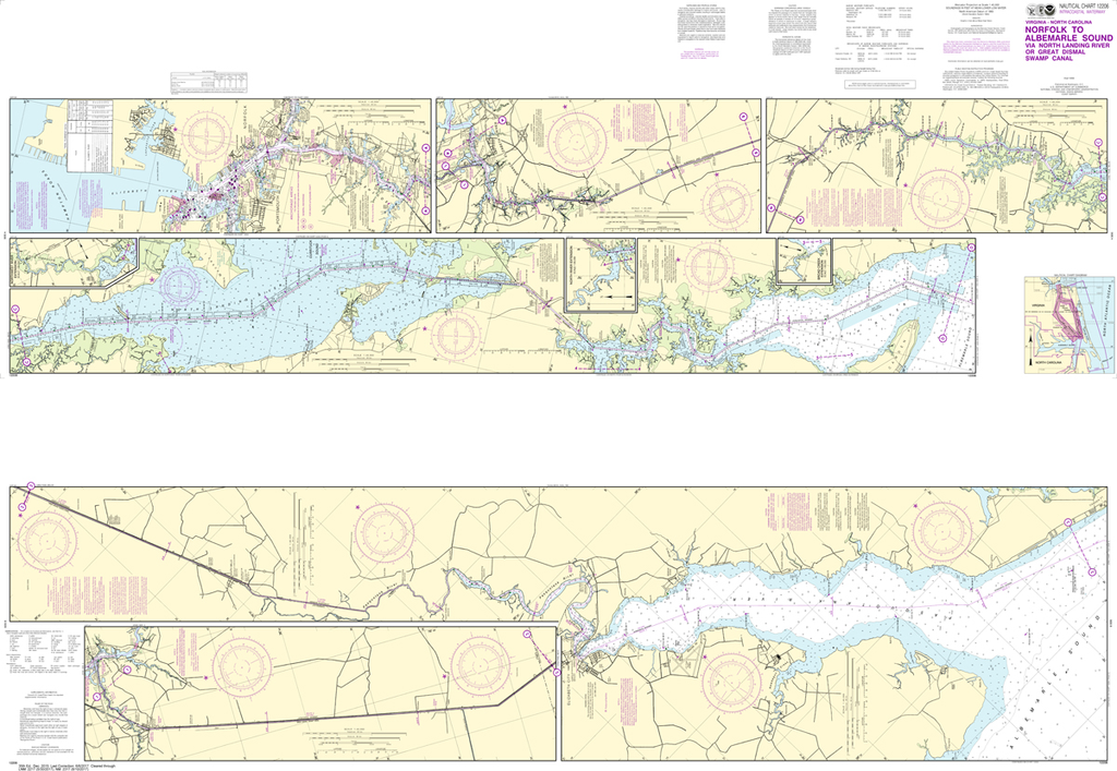
NOAA Chart 12206: Intracoastal Waterway - Norfolk to Albemarle Sound via North Landing River or Great Dismal Swamp Canal
$23.75
The chart you are viewing is NOT updated weekly and does NOT include all of the latest Notice to Mariners corrections. Region: Mid-Atlantic Paper Size: 62" x 42" Chart Image Size: 41" x 59" Scale: 1:40,000 Captain's Nautical...
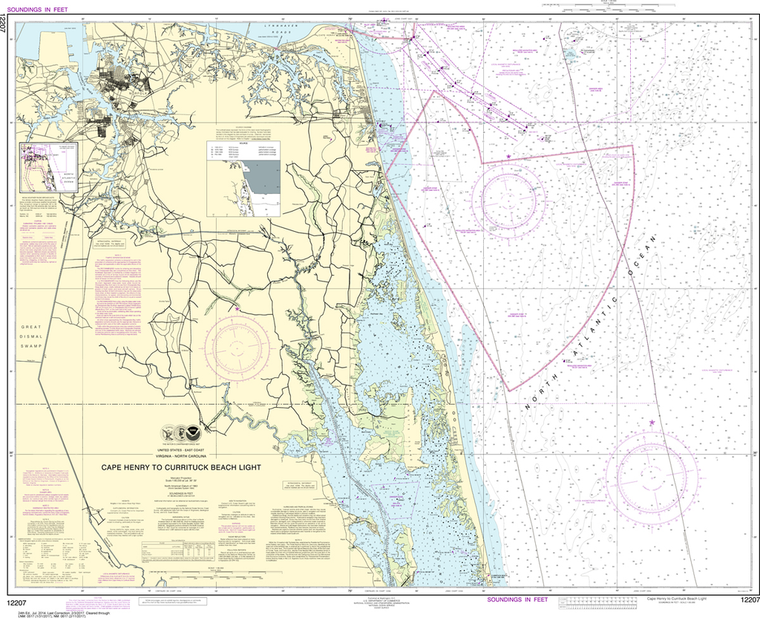
NOAA Chart 12207: Cape Henry to Currituck Beach Light
$23.75
The chart you are viewing is NOT updated weekly and does NOT include all the of the latest Notice to Mariners corrections.
Region: Mid-Atlantic Paper Size: 45" x 36" Chart Image Size: 34" x 42" Scale: 1:80,000
The chart you are viewing is NOT updated weekly and does NOT include all the of the latest Notice to Mariners corrections.
Region: Mid-Atlantic Paper Size: 45" x 36" Chart Image Size: 42" x 31" Scale: 1:50,000
NOAA Chart 12210: Chincoteague Inlet to Great Machipongo Inlet, Chincoteague Inlet
$23.75
The chart you are viewing is NOT updated weekly and does NOT include all of the latest Notice to Mariners corrections. Region: Mid-Atlantic Latest Edition: 45 Ed. (1-Nov-2019) Last Correction: 26-Nov-2019 Cleared Through: NTM 47/2019 (23-Nov-2019) ...
The chart you are viewing is NOT updated weekly and does NOT include all the of the latest Notice to Mariners corrections. Region: Mid-Atlantic Paper Size: 47" x 36" Chart Image Size: 35" x 44" Scale: 1:80,000 ...
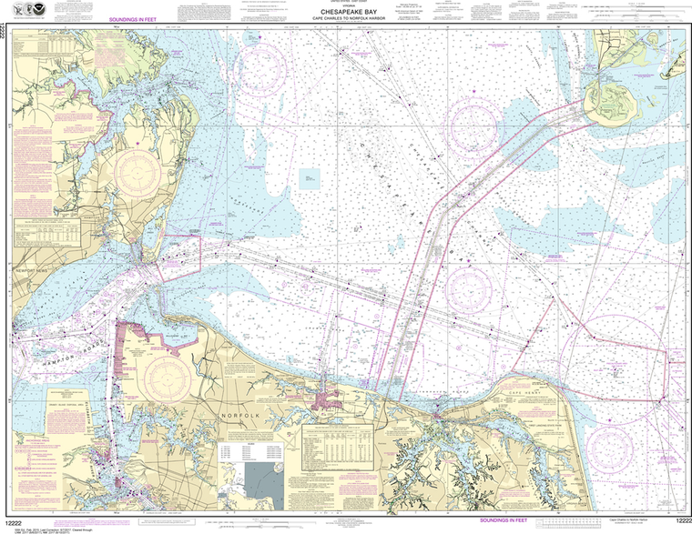
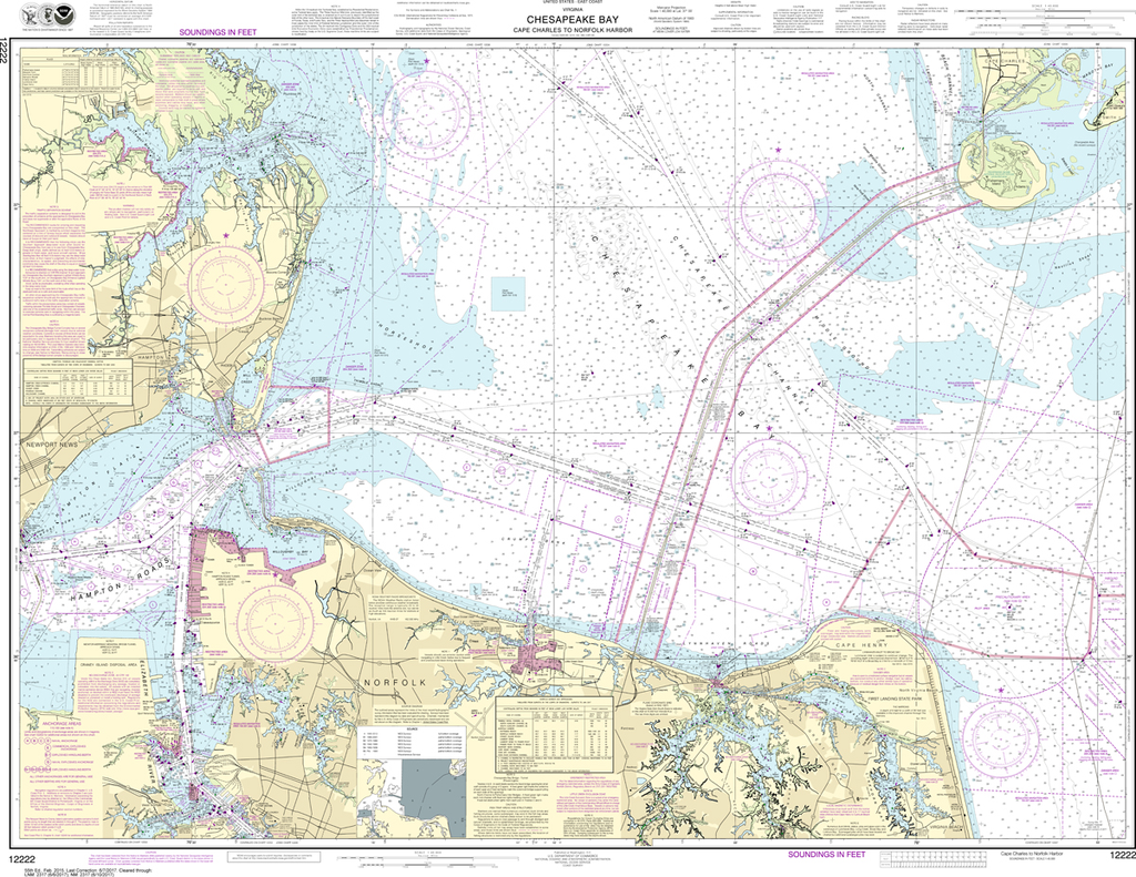
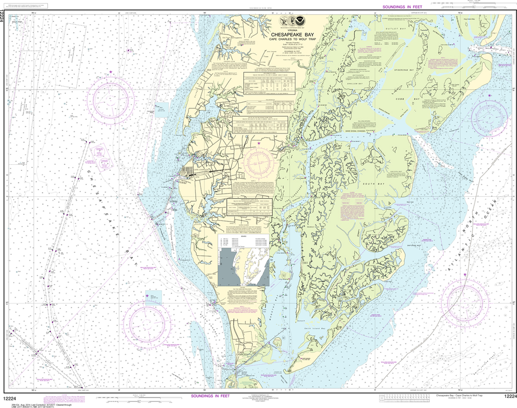
NOAA Chart 12222: Chesapeake Bay - Cape Charles to Norfolk Harbor
$23.75
The chart you are viewing is NOT updated weekly and does NOT include all the of the latest Notice to Mariners corrections.
Region: Mid-Atlantic Paper Size: 49" x 36" Chart Image Size: 35" x 46" Scale: 1:40,000
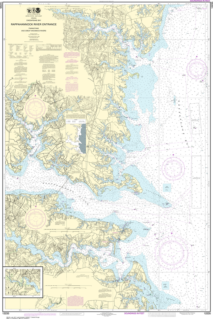
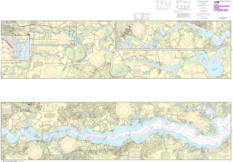
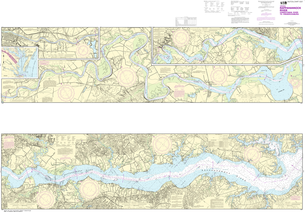
NOAA Chart 12237: Rappahannock River - Corrotoman River to Fredericksburg
$23.75
THIS CHART IS CURRENTLY CANCELED BY NOAA. We know there are many questions about NOAA charts, newest editions and charts being cancelled. The U.S. Office of Coast Survey provides an updated list of all chart updates and the ones being...
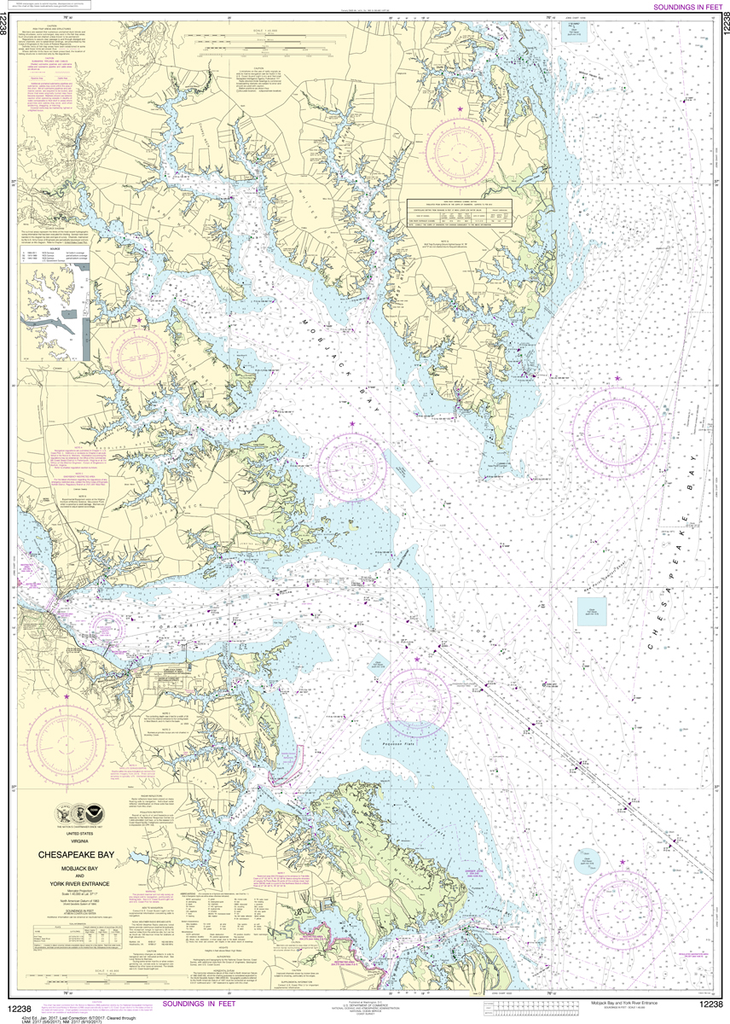
NOAA Chart 12238: Chesapeake Bay - Mobjack Bay and York River Entrance
$23.75
The chart you are viewing is NOT updated weekly and does NOT include all of the latest Notice to Mariners corrections. Region: Mid-Atlantic Paper Size: 50" x 36" Chart Image Size: 46" x 33" Scale: 1:40,000 Captain's Nautical...
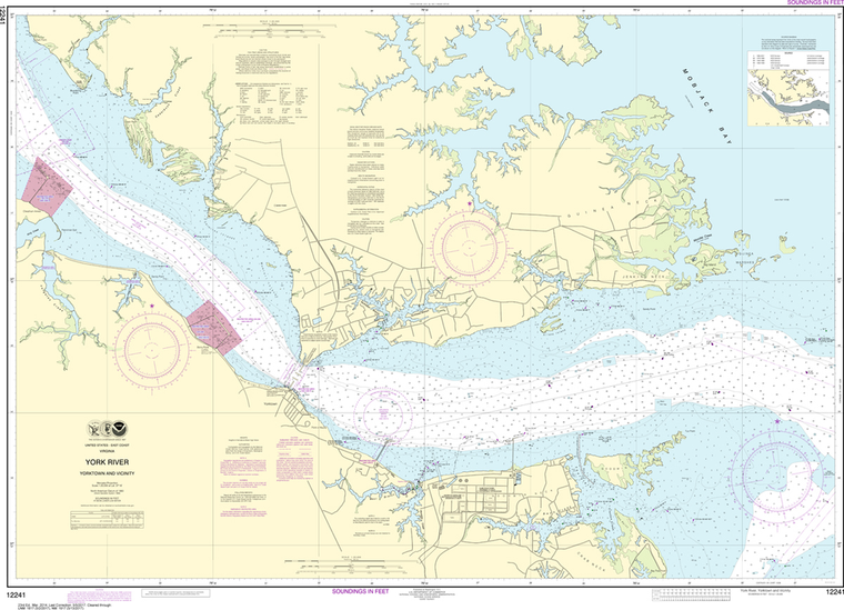
NOAA Chart 12241: York River - Yorktown and Vicinity
$23.75
The chart you are viewing is NOT updated weekly and does NOT include all of the latest Notice to Mariners corrections. Region: Mid-Atlantic Paper Size: 50" x 36" Chart Image Size: 34" x 46" Scale: 1:20,000 Captain's Nautical...
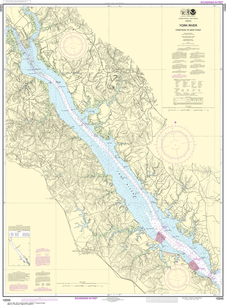
NOAA Chart 12243: York River - Yorktown to West Point
$23.75
The chart you are viewing is NOT updated weekly and does NOT include all of the latest Notice to Mariners corrections. Region: Mid-Atlantic Paper Size: 45" x 36" Chart Image Size: 42" x 31" Scale: 1:40,000 Captain's Nautical...
THIS CHART IS CURRENTLY CANCELED BY NOAA. We know there are many questions about NOAA charts, newest editions and charts being cancelled. The U.S. Office of Coast Survey provides an updated list of all chart updates and the ones being...