2025 Tidal Current Tables: Atlantic Coast of North America
$19.95
2025 Atlantic Coast Tidal Current Tables informs the reader on the expected behaviors of the oceans along the eastern coasts of North and South America, as well as the western coasts of Europe and Africa, and its waves through charts,...
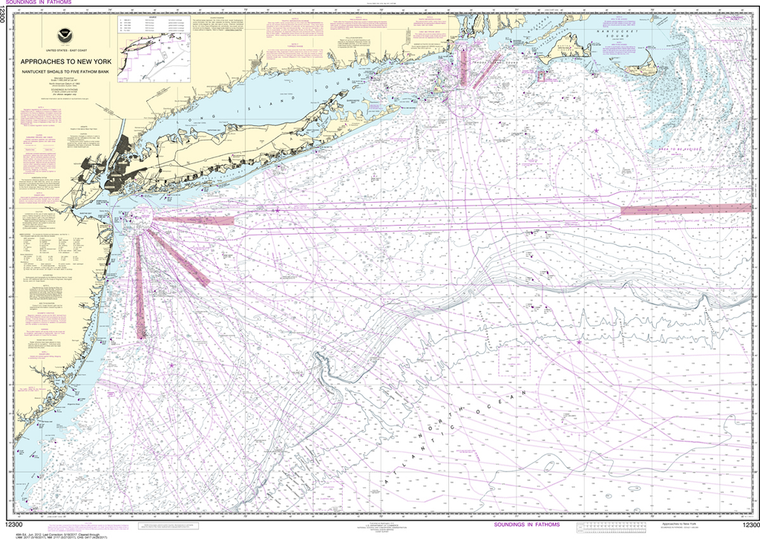
The chart you are viewing is NOT updated weekly and does NOT include all of the latest Notice to Mariners corrections. Region: Northeast Atlantic Latest Edition: 6 Ed. (1-Mar-2017) Last Correction: 30-Nov-2018 Cleared Through: NTM...
The chart you are viewing is NOT updated weekly and does NOT include all of the latest Notice to Mariners corrections. Region: Northeast Atlantic Latest Edition: 108 Ed. (1-Nov-2018) Last Correction: 20-Dec-2019 Cleared Through: NTM 47/2019 (23-Nov-2019)...
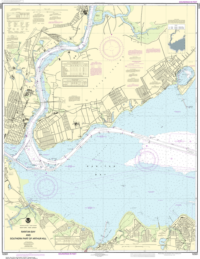
NOAA Chart 12331: Raritan Bay and Southern Part of Arthur Kill
$23.75
The chart you are viewing is NOT updated weekly and does NOT include all of the latest Notice to Mariners corrections. Region: Northeast Atlantic Latest Edition: 33 Ed. (1-Dec-2014) Last Correction: 15-Nov-2019 Cleared Through: NTM 47/2019...
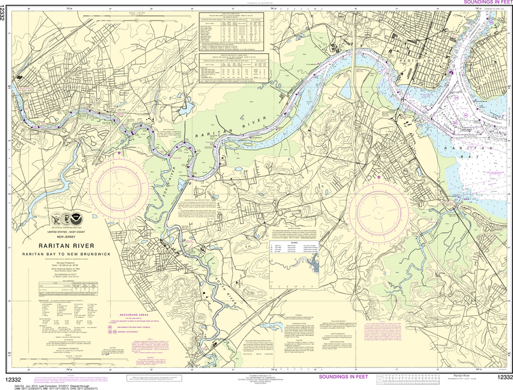
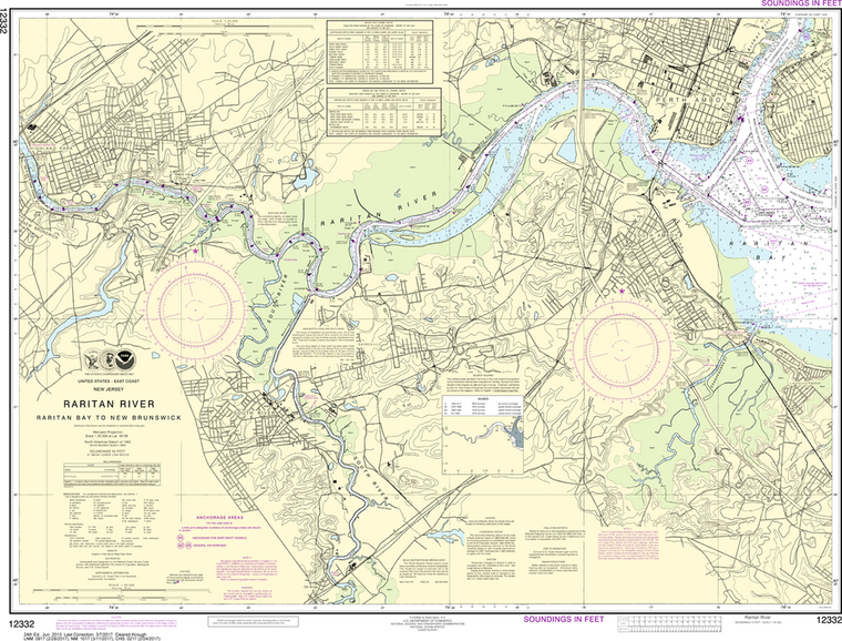
NOAA Chart 12332: Raritan River - Raritan Bay to New Brunswick
$23.75
The chart you are viewing is NOT updated weekly and does NOT include all of the latest Notice to Mariners corrections. Region: Northeast Atlantic Paper Size: 30" x 36" Chart Image Size: 27" x 35" Scale:...
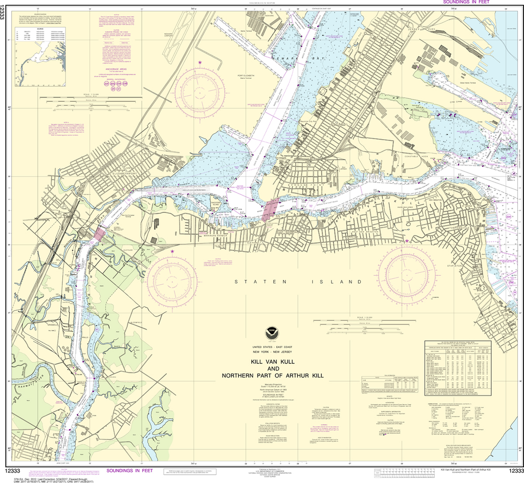
NOAA Chart 12333: Kill Van Kull and - Northern Part of Arthur Kill
$23.75
The chart you are viewing is NOT updated weekly and does NOT include all of the latest Notice to Mariners corrections. Region: Northeast Atlantic Latest Edition: 37 Ed. (1-Dec-2012) Last Correction: 31-Jul-2019 Cleared Through: NTM 47/2019...
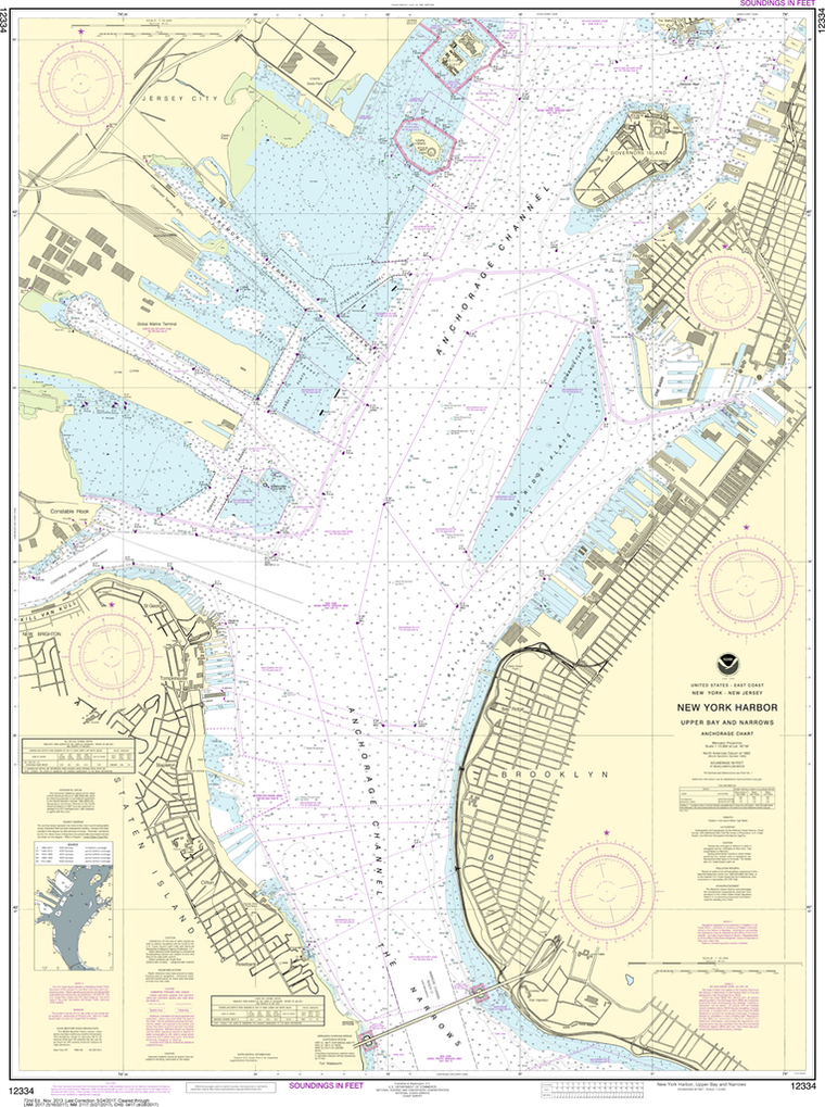
NOAA Chart 12334: New York Harbor - Upper Bay and Narrows, Anchorage Chart
$23.75
The chart you are viewing is NOT updated weekly and does NOT include all of the latest Notice to Mariners corrections. Region: Northeast Atlantic Latest Edition: 73 Ed. (1-Dec-2018) Last Correction: 1-Oct-2019 Cleared Through: NTM 47/2019...
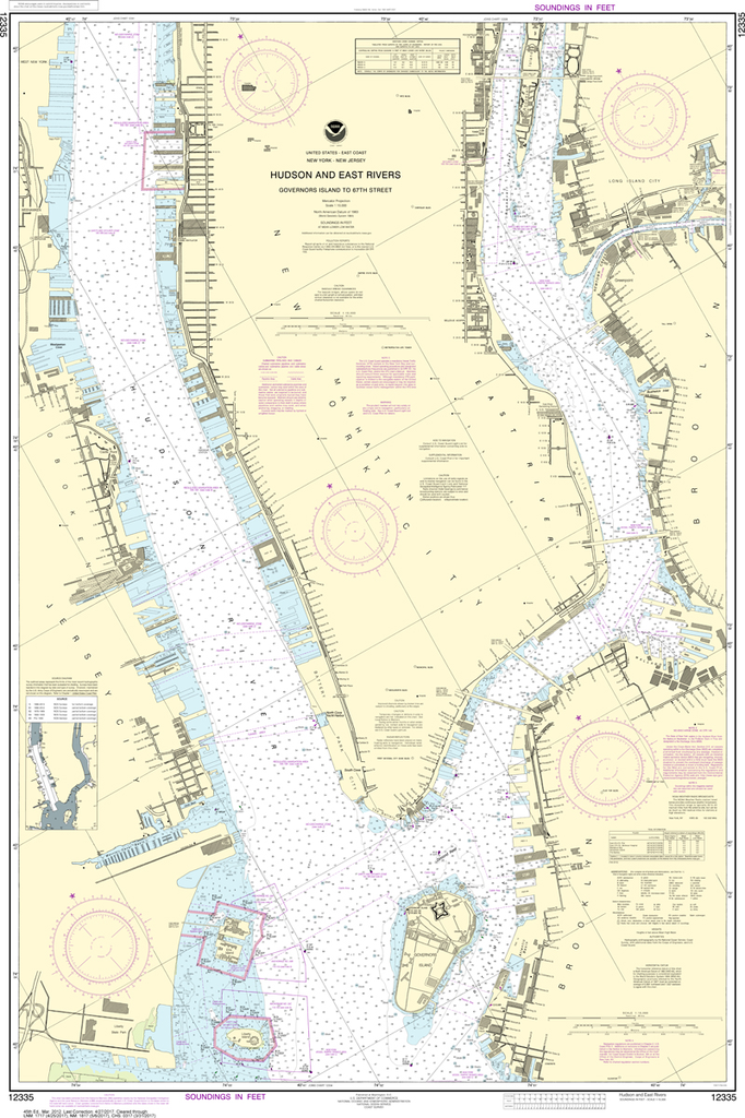
NOAA Chart 12335: Hudson and East Rivers - Governors Island to 67th Straiteet
$23.75
The chart you are viewing is NOT updated weekly and does NOT include all of the latest Notice to Mariners corrections. Region: Northeast Atlantic Latest Edition: 46 Ed. (1-Feb-2019) Last Correction: 1-Oct-2019 Cleared Through: NTM 47/2019...
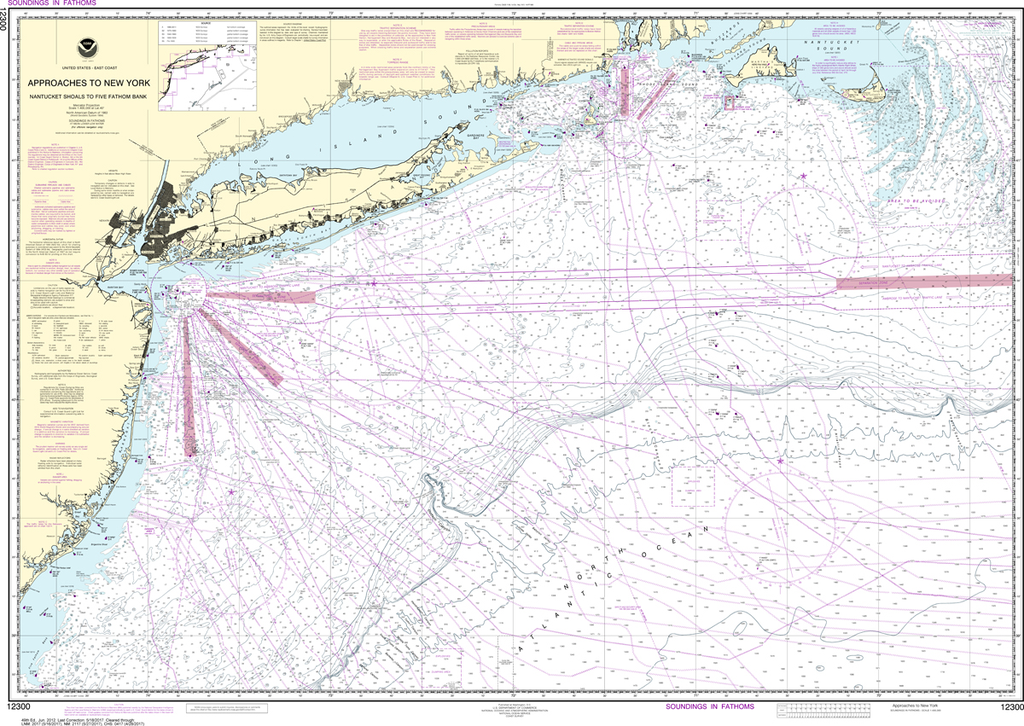
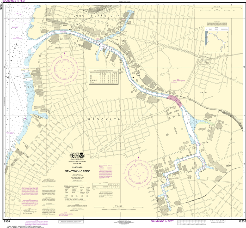
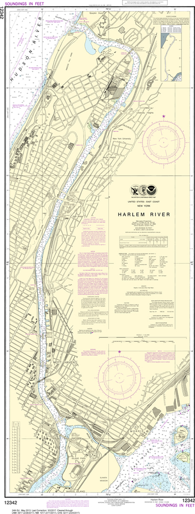
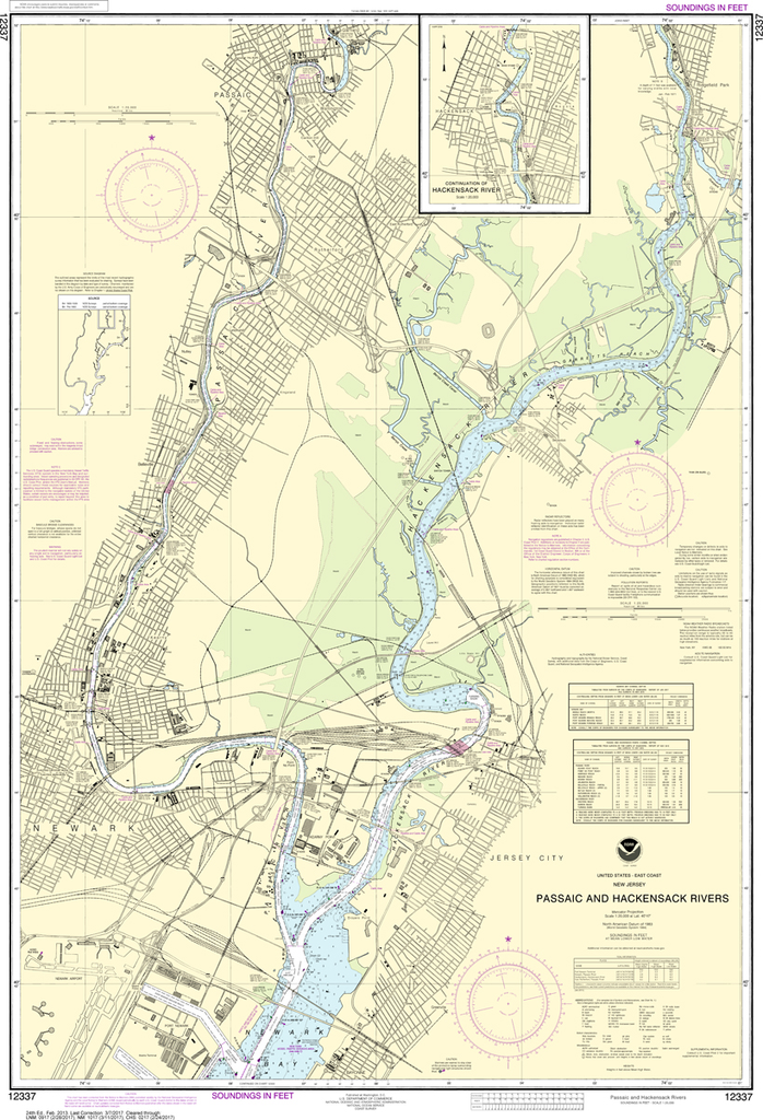
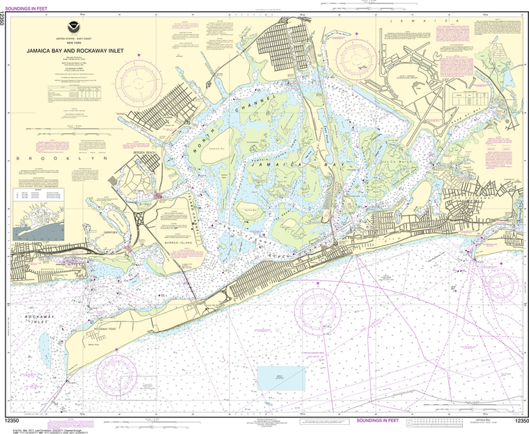
The chart you are viewing is NOT updated weekly and does NOT include all of the latest Notice to Mariners corrections. Region: Northeast Atlantic Latest Edition: 24 Ed. (1-Feb-2013) Last Correction: 20-Dec-2019 Cleared Through: NTM 47/2019...
The chart you are viewing is NOT updated weekly and does NOT include all of the latest Notice to Mariners corrections. Region: Northeast Atlantic Latest Edition: 11 Ed. (1-May-2013) Last Correction: 13-Feb-2019 Cleared Through: NTM 47/2019...
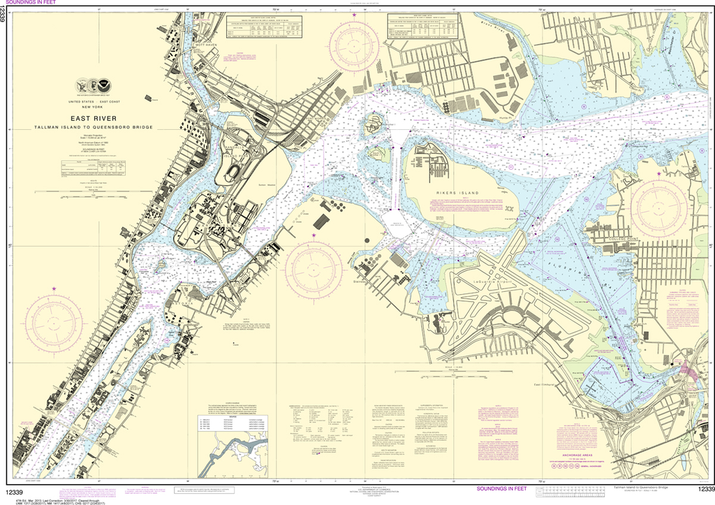
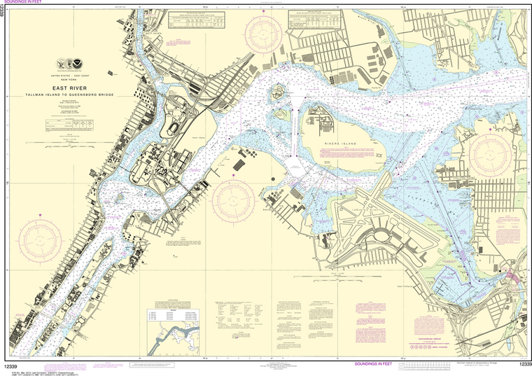
NOAA Chart 12339: East River - Tallman Island to Queensboro Bridge
$23.75
The chart you are viewing is NOT updated weekly and does NOT include all of the latest Notice to Mariners corrections. Region: Northeast Atlantic Latest Edition: 47 Ed. (1-Mar-2013) Last Correction: 15-Oct-2019 Cleared Through: NTM 47/2019...
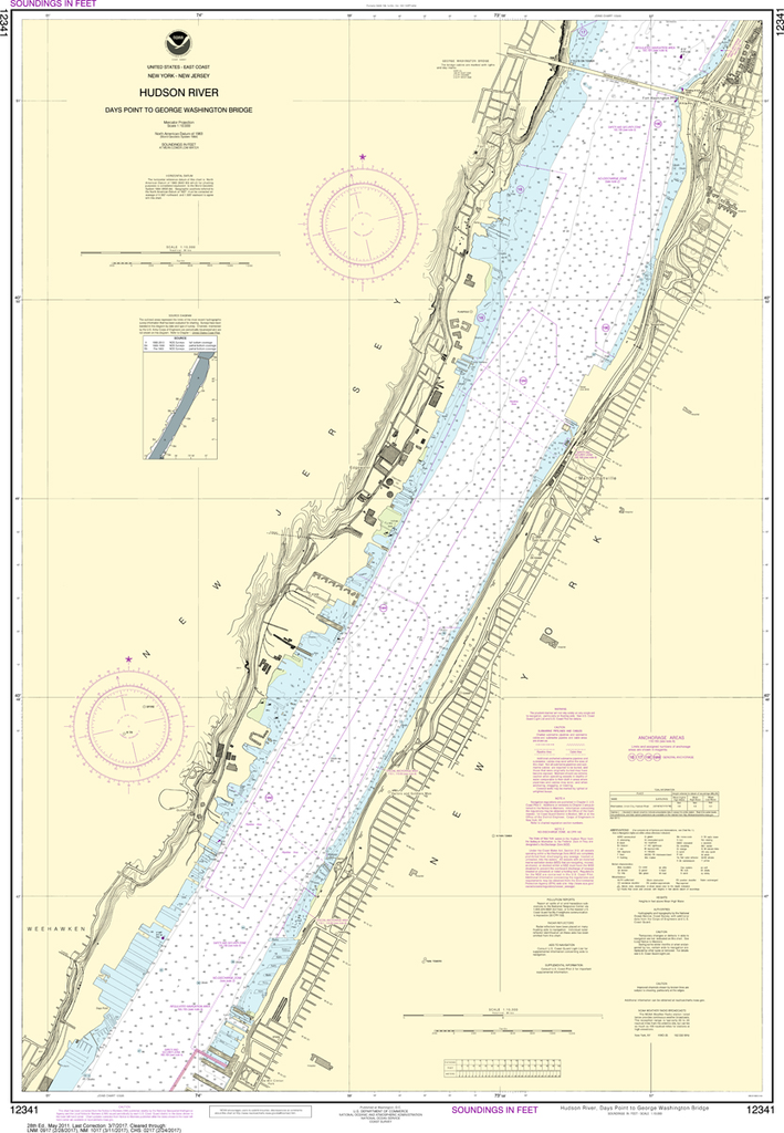
NOAA Chart 12341: Hudson River - Days Point to George Washington Bridge
$23.75
The chart you are viewing is NOT updated weekly and does NOT include all of the latest Notice to Mariners corrections. Region: Northeast Atlantic Latest Edition: 28 Ed. (1-May-2011) Last Correction: 12-Aug-2019 Cleared Through: NTM 47/2019...
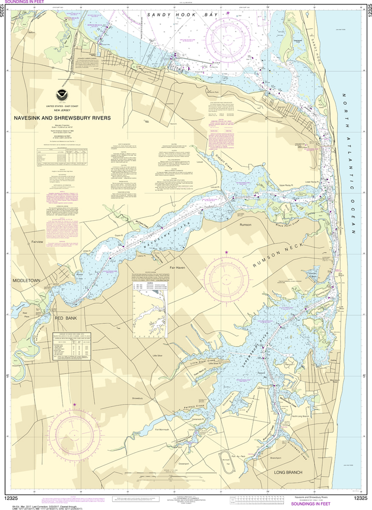
The chart you are viewing is NOT updated weekly and does NOT include all of the latest Notice to Mariners corrections. Region: Northeast Atlantic Latest Edition: 24 Ed. (1-May-2013) Last Correction: 2-Mar-2017 Cleared Through: NTM 47/2019...
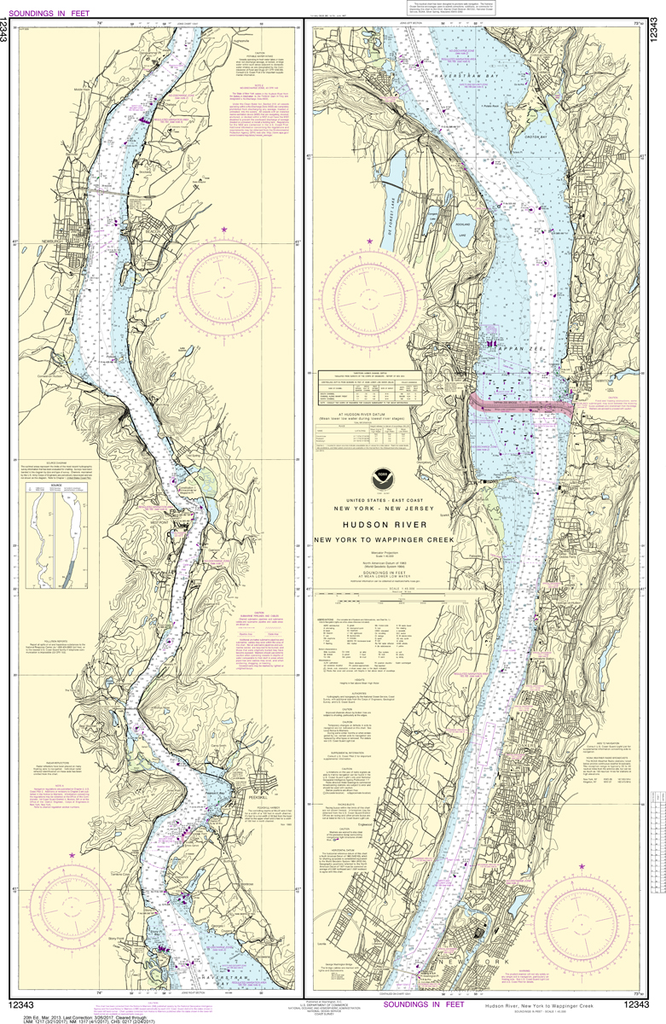
NOAA Chart 12343: Hudson River - New York to Wappinger Creek
$23.75
The chart you are viewing is NOT updated weekly and does NOT include all of the latest Notice to Mariners corrections. Region: Northeast Atlantic Latest Edition: 20 Ed. (1-Mar-2013) Last Correction: 26-Aug-2019 Cleared Through: NTM 47/2019...
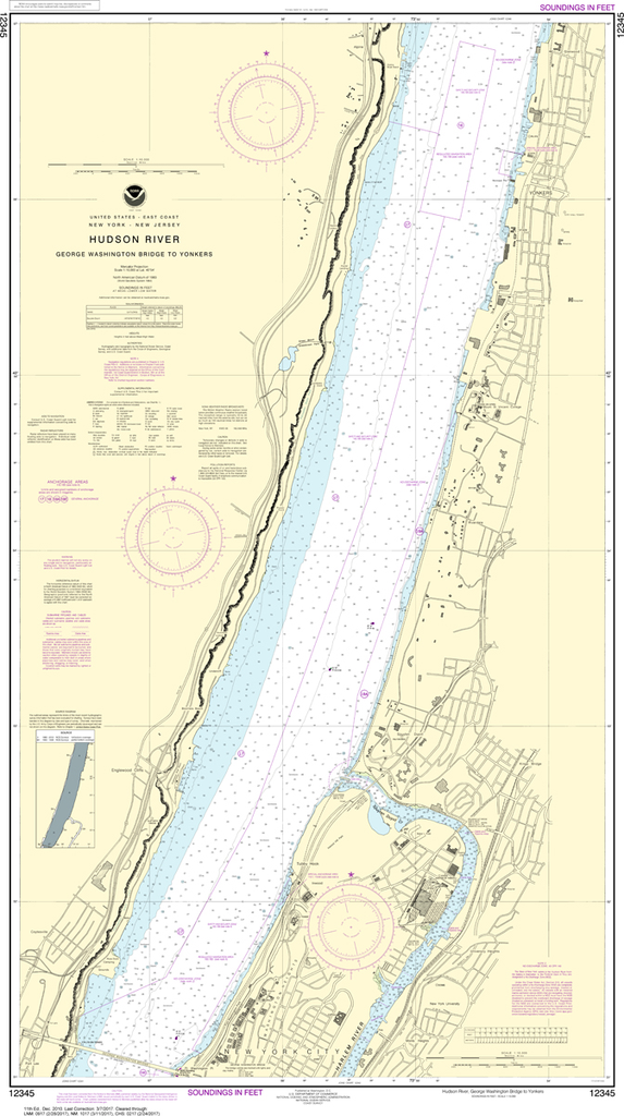
NOAA Chart 12345: Hudson River - George Washington Bridge to Yonkers
$23.75
The chart you are viewing is NOT updated weekly and does NOT include all of the latest Notice to Mariners corrections. Region: Northeast Atlantic Latest Edition: 11 Ed. (1-Dec-2010) Last Correction: 12-Aug-2019 Cleared Through: NTM 47/2019...
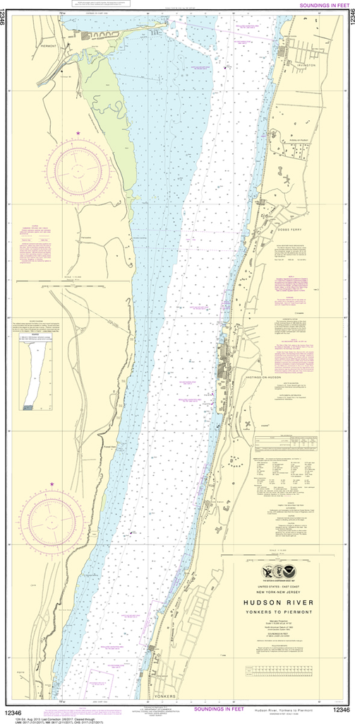
NOAA Chart 12346: Hudson River - Yonkers to Piermont
$23.75
The chart you are viewing is NOT updated weekly and does NOT include all of the latest Notice to Mariners corrections. Region: Northeast Atlantic Latest Edition: 12 Ed. (1-Aug-2013) Last Correction: 22-Oct-2018 Cleared Through: NTM 47/2019...
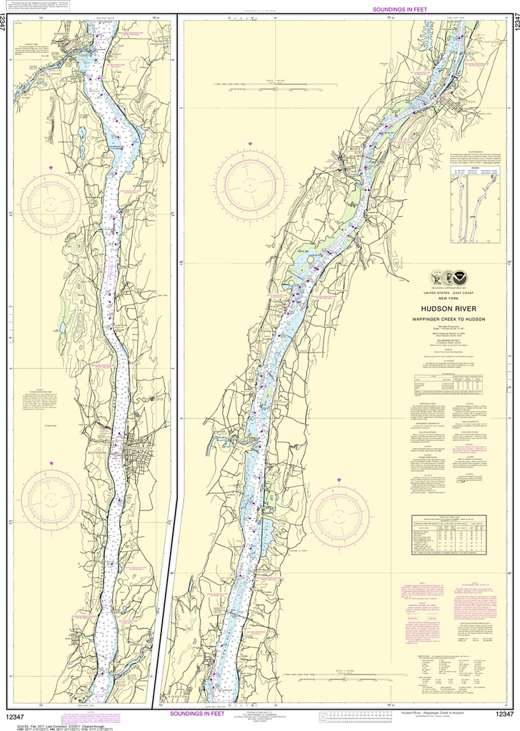
NOAA Chart 12347: Hudson River - Wappinger Creek to Hudson
$23.75
The chart you are viewing is NOT updated weekly and does NOT include all of the latest Notice to Mariners corrections. Region: Northeast Atlantic Latest Edition: 32 Ed. (1-Feb-2017) Last Correction: 20-Dec-2019 Cleared Through: NTM 47/2019...
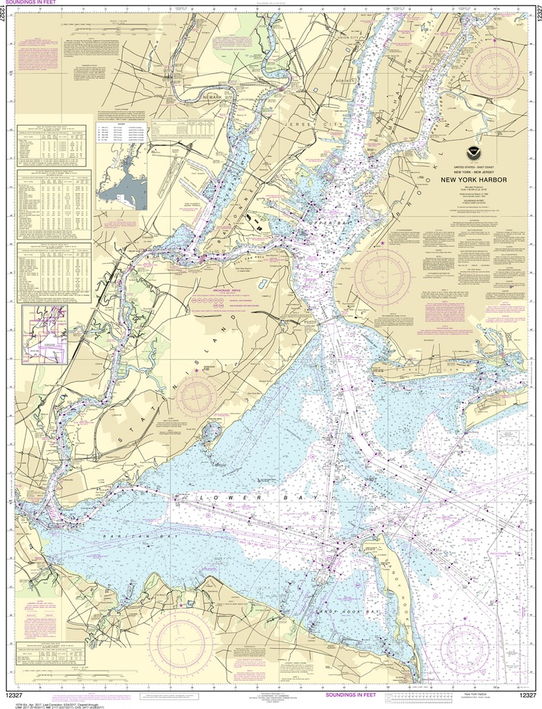
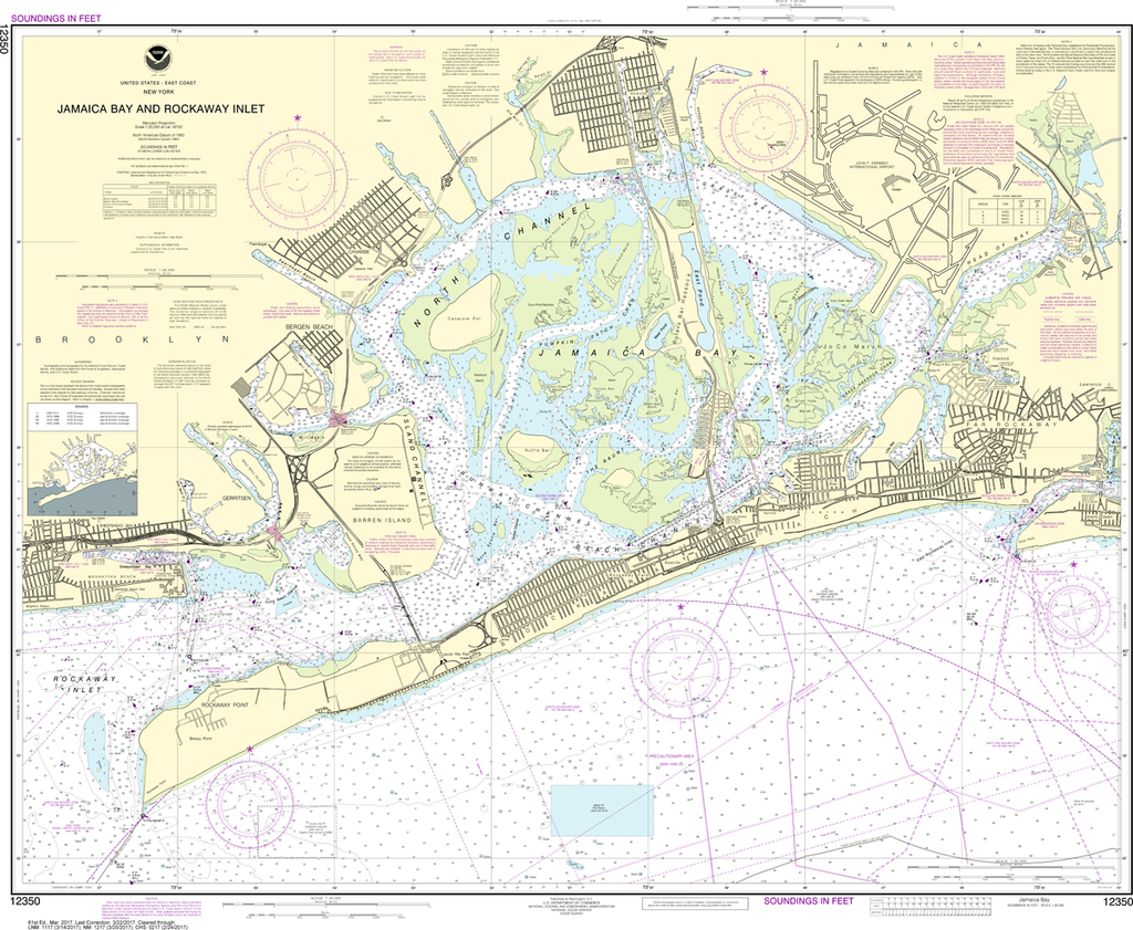
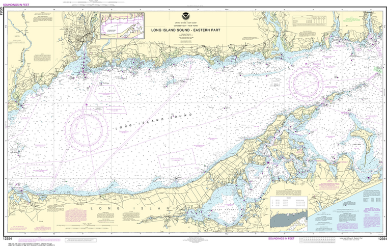
The chart you are viewing is NOT updated weekly and does NOT include all of the latest Notice to Mariners corrections. Region: Northeast Atlantic Latest Edition: 62 Ed. (1-Feb-2019) Last Correction: 25-Nov-2019 Cleared Through: NTM 47/2019...
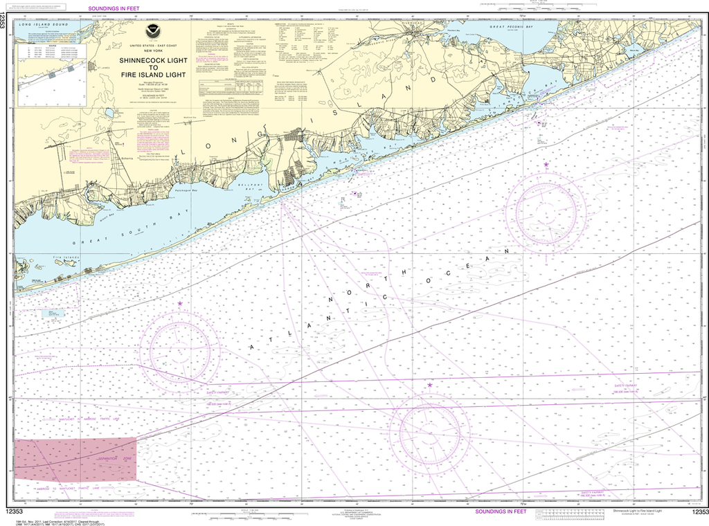
NOAA Chart 12353: Shinnecock Light to Fire Island Light
$23.75
The chart you are viewing is NOT updated weekly and does NOT include all of the latest Notice to Mariners corrections. Region: Northeast Atlantic Latest Edition: 19 Ed. (1-Nov-2011) Last Correction: 6-Jan-2020 Cleared Through: NTM 47/2019 (23-Nov-2019)...
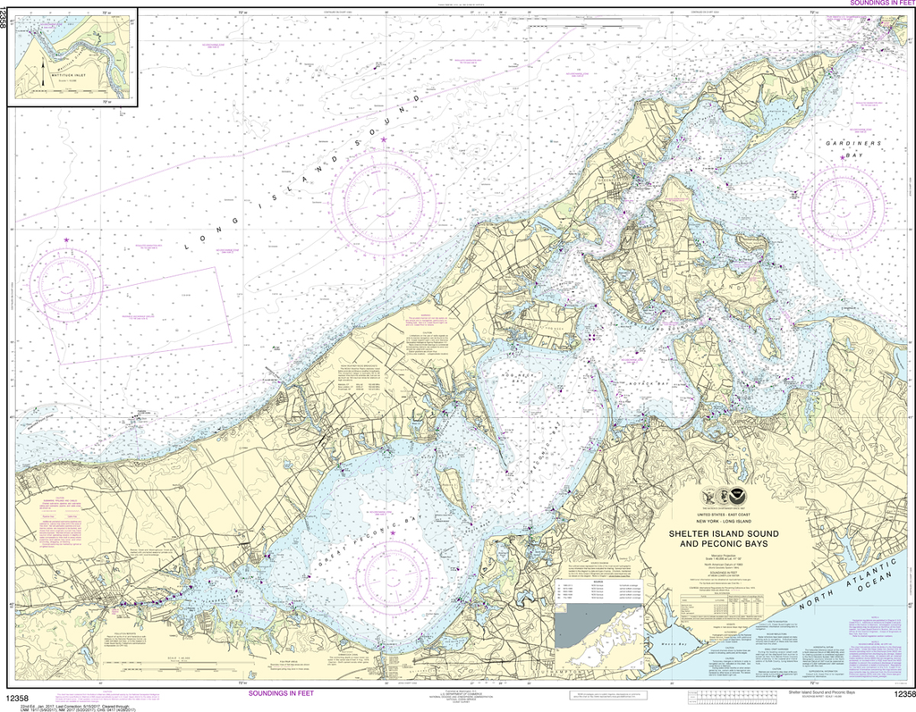
NOAA Chart 12358: New York - Long Island to Shelter Island Sound and Peconic Bays, Mattituck Inlet
$23.75
The chart you are viewing is NOT updated weekly and does NOT include all of the latest Notice to Mariners corrections. Region: Northeast Atlantic Latest Edition: 23 Ed. (1-Apr-2019) Last Correction: 25-Nov-2019 Cleared Through: NTM 47/2019...
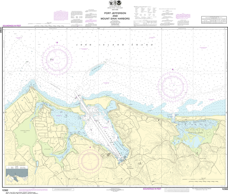
NOAA Chart 12362: Port Jefferson and Mount Sinai Harbors
$23.75
The chart you are viewing is NOT updated weekly and does NOT include all of the latest Notice to Mariners corrections. Region: Northeast Atlantic Paper Size: 43" x 36" Chart Image Size: 34" x 40" Scale:...