The chart you are viewing is NOT updated weekly and does NOT include all of the latest Notice to Mariners corrections. Region: Gulf Coast & Caribbean Islands Paper Size: 56" x 36" Chart Image Size: 35" x 53" Scale:...
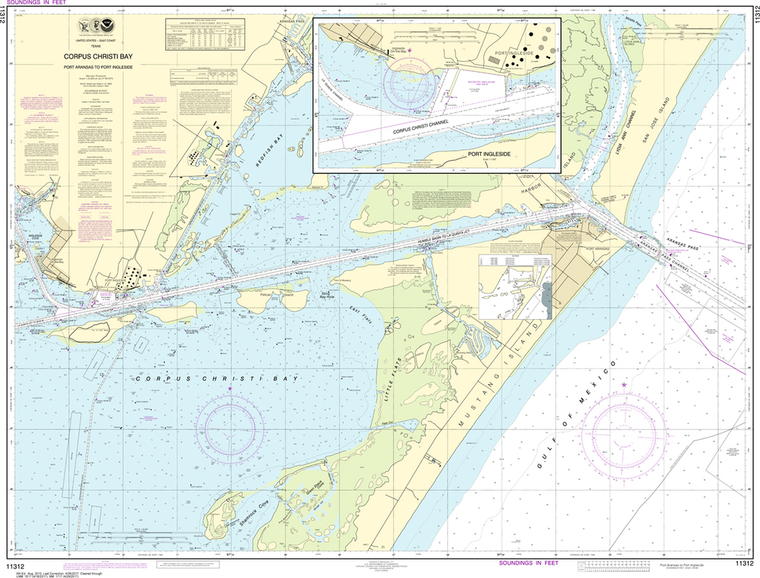
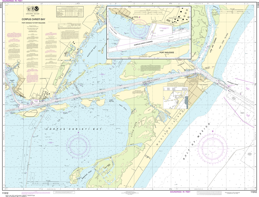
NOAA Chart 11312: Corpus Christi Bay, Port Aransas to Port Ingleside
$23.75
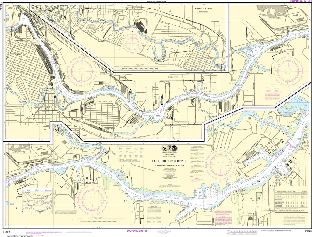
The chart you are viewing is NOT updated weekly and does NOT include all the of the latest Notice to Mariners corrections. Region: Gulf Coast & Caribbean Islands Paper Size: 49" x 36" Chart Image Size: 35" x 45"...
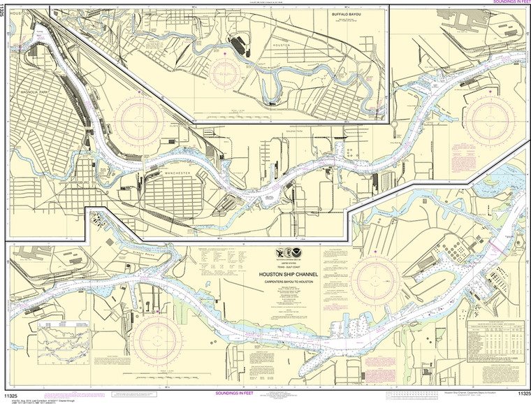
NOAA Chart 11325: Houston Ship Channel Carpenters Bayou to Houston
$23.75
The chart you are viewing is NOT updated weekly and does NOT include all of the latest Notice to Mariners corrections. Region: Gulf Coast & Caribbean Islands Paper Size: 48" x 36" Chart Image Size: 34" x 44" Scale:...
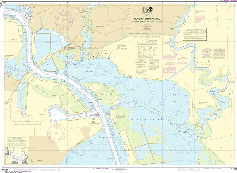
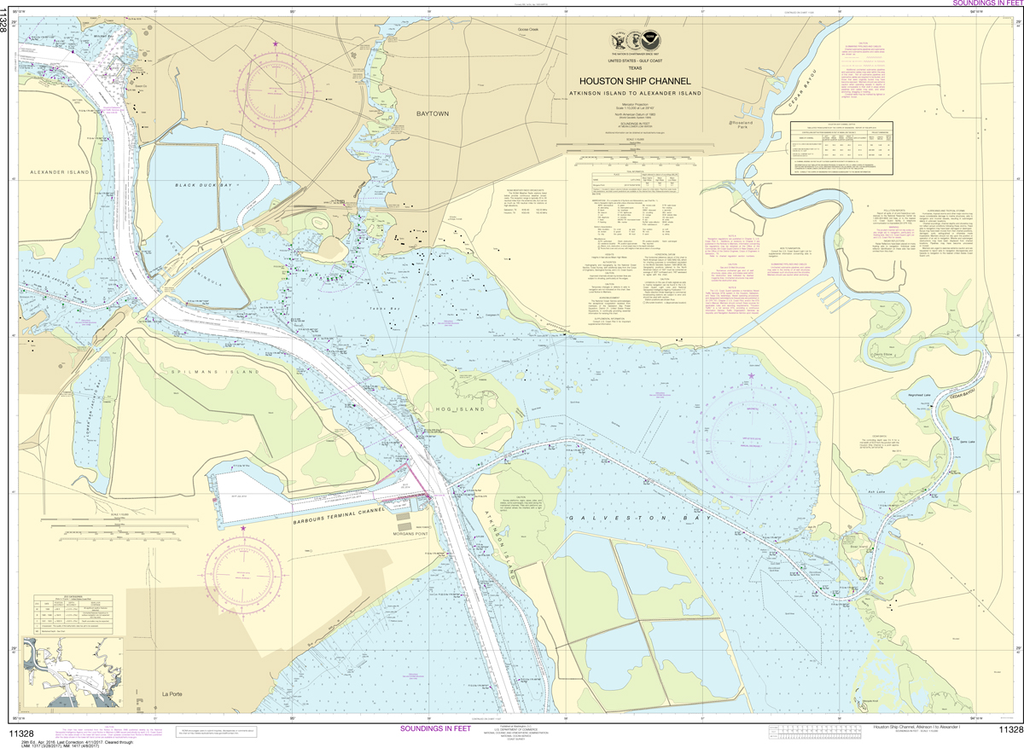
The chart you are viewing is NOT updated weekly and does NOT include all of the latest Notice to Mariners corrections. Region: Gulf Coast & Caribbean Islands Paper Size: 62" x 36" Chart Image Size: 58" x 32" Scale:...
NOAA Chart 11328: Houston Ship Channel Atkinson Island to Alexander Island
$23.75
The chart you are viewing is NOT updated weekly and does NOT include all of the latest Notice to Mariners corrections. Region: Gulf Coast & Caribbean Islands Paper Size: 51" x 36" Chart Image Size: 35" x 48" Scale: 1:10,000...
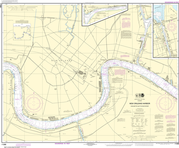
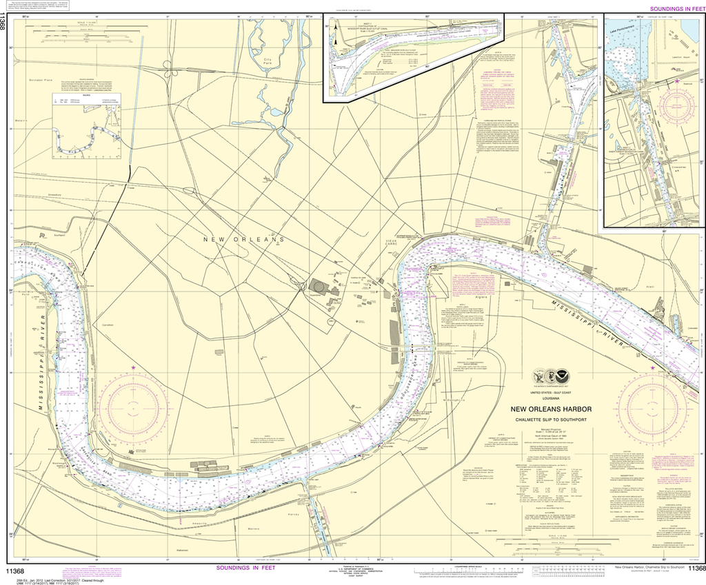
Region: Gulf Coast & Caribbean Islands Paper Size: 54" x 36" Chart Image Size: 51" x 31" Scale: 1:20,000 Captain's Nautical Supplies is a Print-on-Demand nautical chart dealer for US Waters. All charts are printed up-to-date and...
NOAA Chart 11368: New Orleans Harbor - Chalmette Slip to Southport
$23.75
The chart you are viewing is NOT updated weekly and does NOT include all of the latest Notice to Mariners corrections. Region: Gulf Coast & Caribbean Islands Paper Size: 46" x 36" Chart Image Size: 35" x 42" Scale:...
The chart you are viewing is NOT updated weekly and does NOT include all of the latest Notice to Mariners corrections. Region: Gulf Coast & Caribbean Islands Paper Size: 51" x 36" Chart Image Size: 47" x 34" Scale:...
NOAA Chart 11380: Mobile Bay East - Fowl River to Deer River Point, Mobile Middle Bay Terminal
$23.75
The chart you are viewing is NOT updated weekly and does NOT include all the of the latest Notice to Mariners corrections. Region: Gulf Coast & Caribbean Islands Paper Size: 42" x 36" Chart Image Size: 38" x 29"...
THIS CHART IS CURRENTLY CANCELED BY NOAA. We know there are many questions about NOAA charts, newest editions and charts being cancelled. The U.S. Office of Coast Survey provides an updated list of all chart updates and the ones...
NOAA Chart 11392: St. Andrew Bay, Bear Point to Sulpher Point
$23.75
The chart you are viewing is NOT updated weekly and does NOT include all of the latest Notice to Mariners corrections. Region: Gulf Coast & Caribbean Islands Paper Size: 33" x 36" Chart Image Size: 30" x 34" Scale: 1:5,000...
Region: Gulf Coast & Caribbean Islands Paper Size: 33" x 36" Chart Image Size: 30" x 24" Scale: 1:15,000 Captain's Nautical Supplies is a Print-on-Demand nautical chart dealer for US Waters. All charts are printed up-to-date and corrected to...
The chart you are viewing is NOT updated weekly and does NOT include all of the latest Notice to Mariners corrections. Region: Gulf Coast & Caribbean Islands Paper Size: 46" x 36" Chart Image Size: 42" x 35" Scale:...
Region: Mid-Atlantic Paper Size: 48" x 36" Chart Image Size: 35" x 45" Scale: 1:12,000 Captain's Nautical Supplies is a Print-on-Demand nautical chart dealer for US Waters. All charts are printed up-to-date and corrected to the latest...
Region: Gulf Coast & Caribbean Islands Paper Size: 46" x 36" Chart Image Size: 42" x 33" Scale: 1:10,000 Captain's Nautical Supplies is a Print-on-Demand nautical chart dealer for US Waters. All charts are printed up-to-date and corrected...
Region: Mid-Atlantic Paper Size: 39" x 36" Chart Image Size: 21" x 36" Scale: 1:10,000 Captain's Nautical Supplies is a Print-on-Demand nautical chart dealer for US Waters. All charts are printed up-to-date and corrected to the latest Notice to...
NOAA Chart 11478: Port Canaveral, Canaveral Barge Canal Extension
$23.75
The chart you are viewing is NOT updated weekly and does NOT include all of the latest Notice to Mariners corrections.
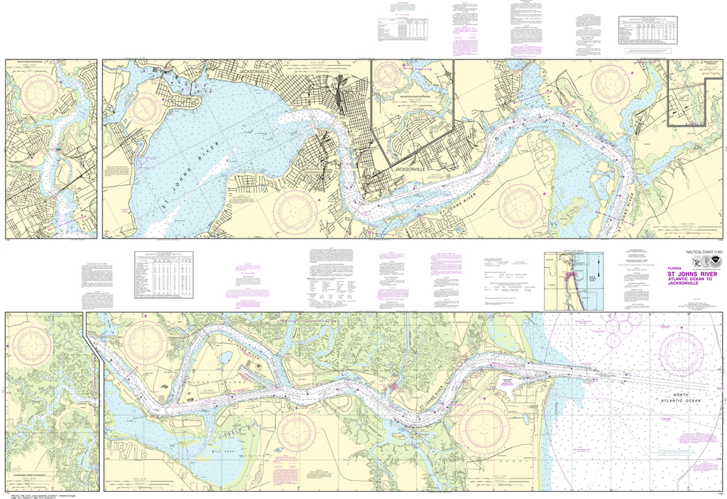
Region: Mid-Atlantic Paper Size: 45" x 36" Chart Image Size: 27" x 42" Scale: 1:10,000
NOAA Chart 11491: St. Johns River - Atlantic Ocean to Jacksonville
$23.75
The chart you are viewing is NOT updated weekly and does NOT include all of the latest Notice to Mariners corrections.
Region: Mid-Atlantic Paper Size: 62" x 42" Chart Image Size: 40" x 59" Scale: 1:20,000
NOAA Chart 11515: Savannah River - Brier Creek to Augusta
$23.75
THIS CHART IS CURRENTLY CANCELED BY NOAA. We know there are many questions about NOAA charts, newest editions and charts being cancelled. The U.S. Office of Coast Survey provides an updated list of all chart updates and the ones being...
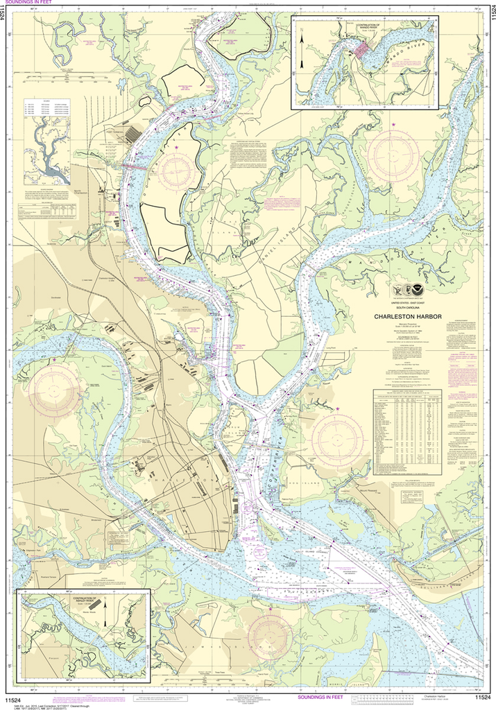
The chart you are viewing is NOT updated weekly and does NOT include all of the latest Notice to Mariners corrections. Region: Mid-Atlantic Latest Edition: 54 Ed. (1-Jun-2015) Last Correction: 13-Aug-2019 Cleared Through: NTM 47/2019 (23-Nov-2019) ...
Region: Mid-Atlantic Paper Size: 49" x 36" Chart Image Size: 46" x 30" Scale: 1:20,000 Captain's Nautical Supplies is a Print-on-Demand nautical chart dealer for US Waters. All charts are printed up-to-date and corrected to the...
The chart you are viewing is NOT updated weekly and does NOT include all of the latest Notice to Mariners corrections.
Region: Mid-Atlantic Paper Size: 53" x 36" Chart Image Size: 50" x 33" Scale: 1:15,000