- Shop by Department
- Nautical Charts
- New Releases
- Marine Education Textbooks
- About Us
- +Shop by Department
- +Nautical Charts
- New Releases
- +Marine Education Textbooks
- +About Us
- Contact Us
- FAQ
- Repair Services
- Sign in

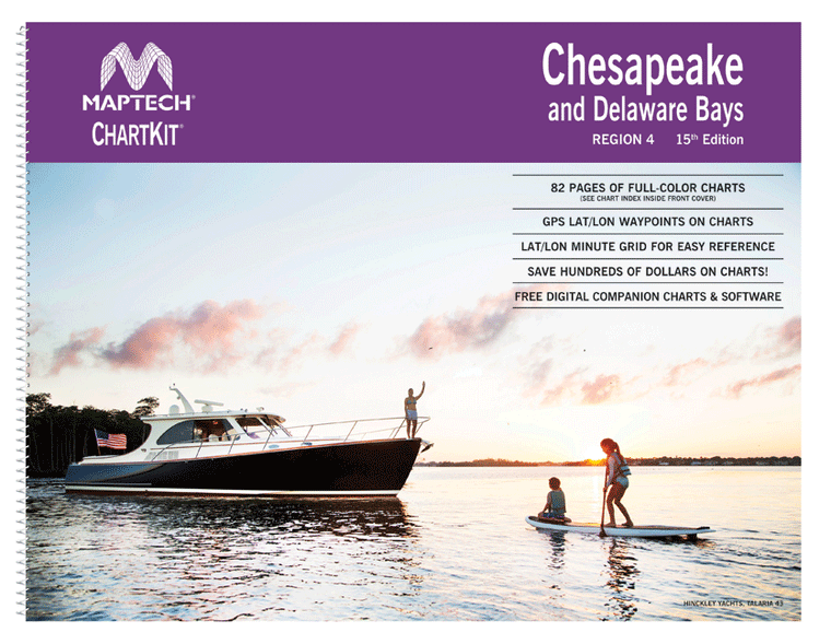
$149.95
ChartKit® Region 4, 15th EditionChesapeake and Delaware Bays Completely updated. Coastal and offshore coverage. Full-color charts, GPS waypoints, courses and distances, Yeoman points, and color aerial photos. Save hundreds of dollars on charts. Chartbook Companion Software included free with continental...

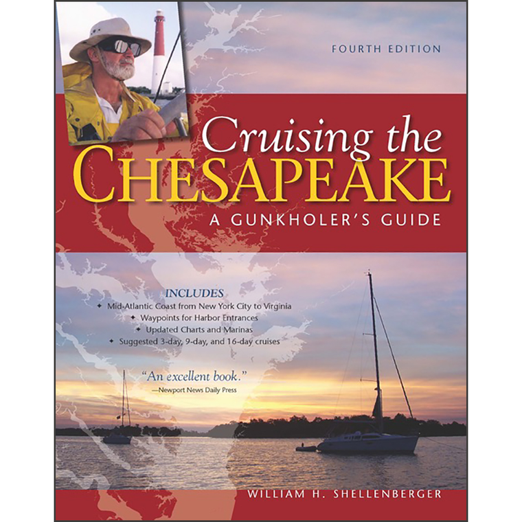
$48.00
By William H. ShellenbergerDotting its more than 3,000-mile shoreline are creeks, coves, and inlets – or gunkholes in Chesapeake Bay parlance. They are as challenging as they are charming for cruisers to fi nd and enter, sometimes discouraging the less...
$49.95
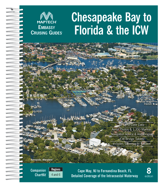
Cape May and Delaware Bay through the Chesapeake and Intracoastal Waterway and offshore to Fernandina Beach in northern Florida. Packed with detailed listings for marinas, local navigation advice, aerial photos, and an Intracoastal Waterway Bridge Table. 572 pages. Description Maptech's...

$8.95
Nautical placemat, 18" x 12" printed on Waterproof paper, almost indestructible, food and wine will wipe right off. Each placemat is a reproduction of a NOAA Nautical Chart for this particular area and completely reusable!When we were first looking to...
$8.95
Printed on waterproof paper (almost indestructible), high resolution four color printing, 18" x 12", all the details of a nautical chart. Easy to clean up and look great in your dining room, kitchen table and even the boat. Completely reusable!

$23.75
The chart you are viewing is NOT updated weekly and does NOT include all of the latest Notice to Mariners corrections. Region: Mid-Atlantic Latest Edition: 45 Ed. (1-Nov-2019) Last Correction: 26-Nov-2019 Cleared Through: NTM 47/2019 (23-Nov-2019) ...

$23.75
The chart you are viewing is NOT updated weekly and does NOT include all of the latest Notice to Mariners corrections. Region: Mid-Atlantic Latest Edition: 48 Ed. (1-Dec-2018) Last Correction: 10-Dec-2019 Cleared Through: NTM 47/2019 (23-Nov-2019) ...

$23.75
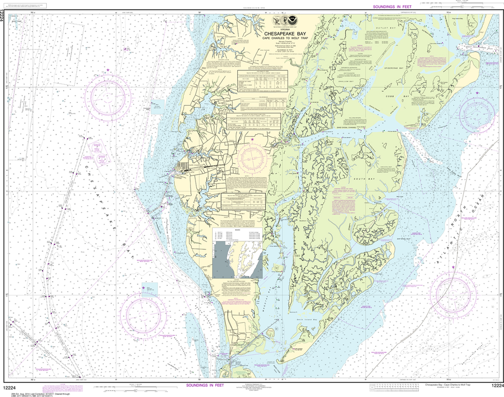
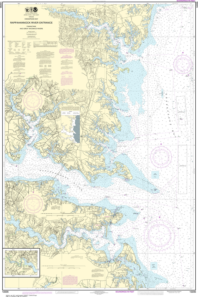
Region: Mid-Atlantic Latest Edition: 31 Ed. (1-Nov-2018) Last Correction: 28-Jun-2019 Cleared Through: NTM 47/2019 (23-Nov-2019) Paper Size: 41" x 36" Chart Image Size: 37" x 30" Scale: 1:40,000 Captain's Nautical Supplies is a...

$23.75
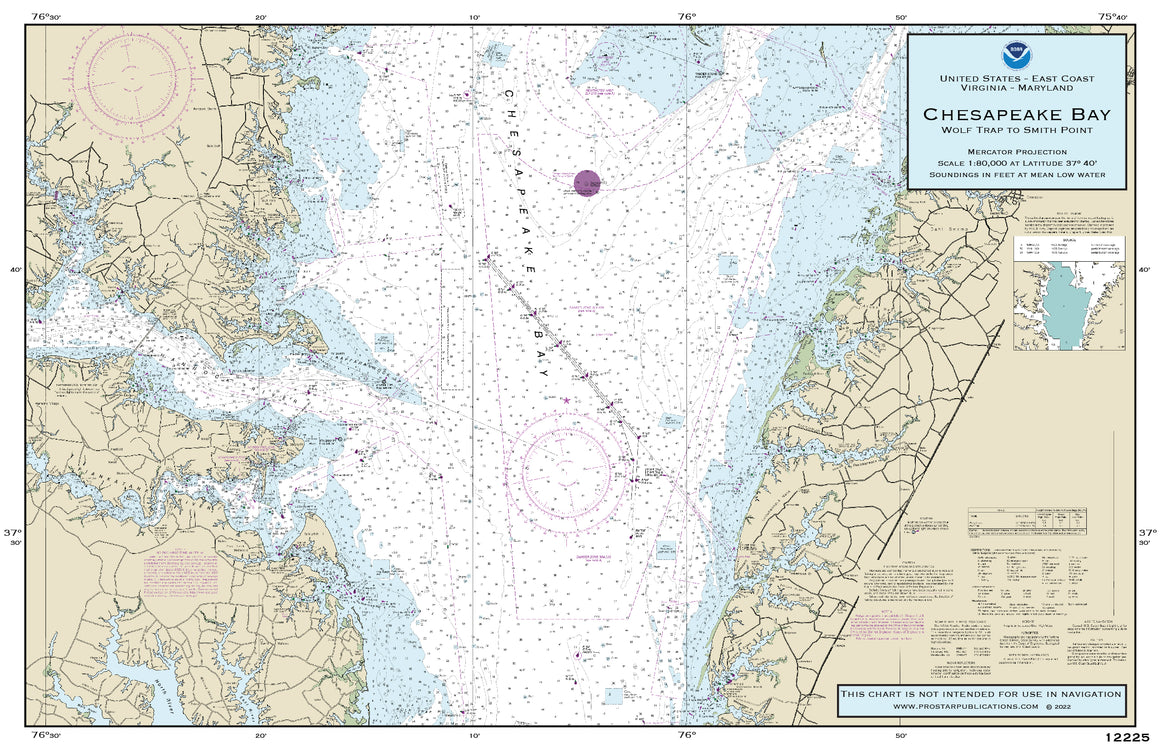
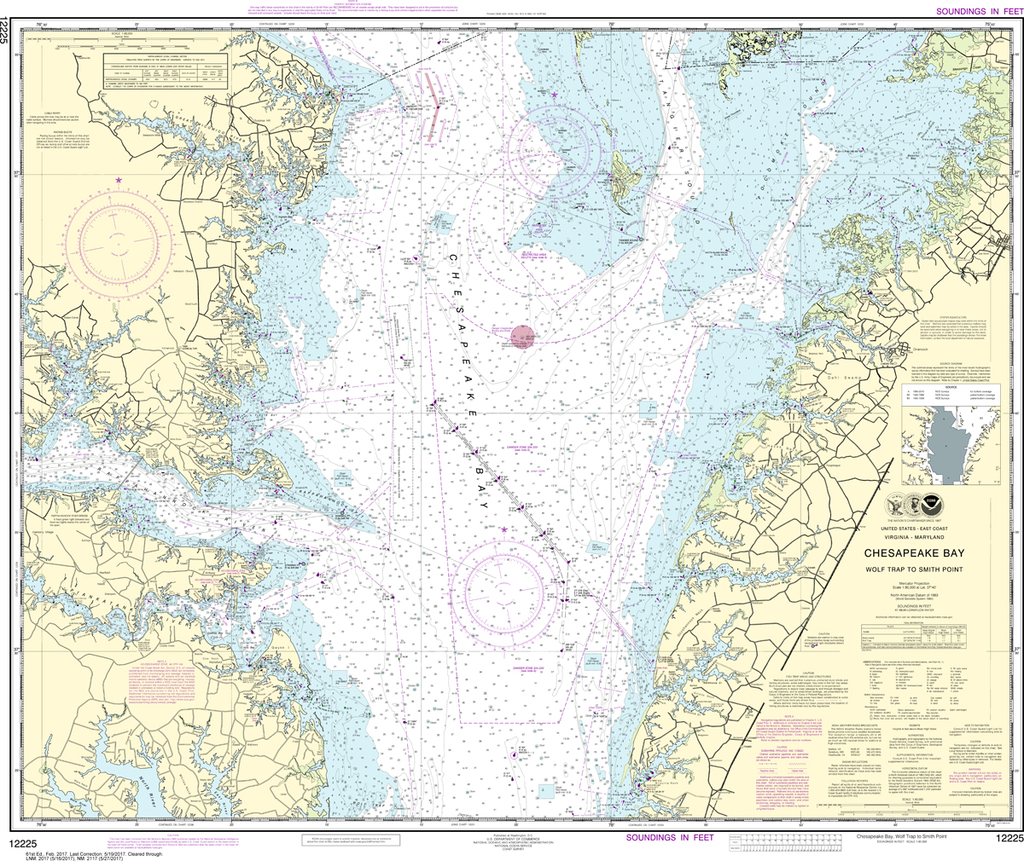
The chart you are viewing is NOT updated weekly and does NOT include all the of the latest Notice to Mariners corrections. Region: Mid-Atlantic Paper Size: 47" x 36" Chart Image Size: 35" x 44" Scale: 1:80,000 ...
$23.75
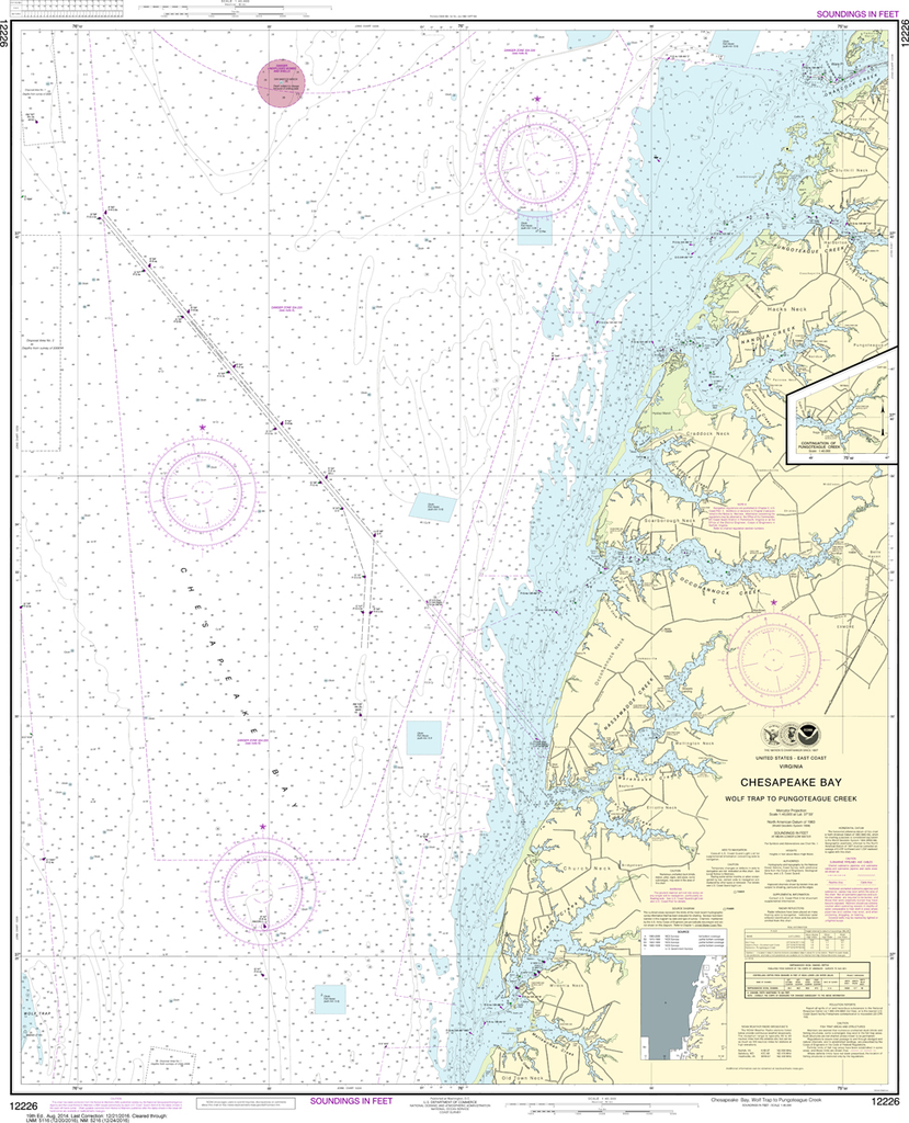
Region: Mid-Atlantic Latest Edition: 28 Ed. (1-Dec-2018) Last Correction: 3-Jan-2020 Cleared Through: NTM 47/2019 (23-Nov-2019) Paper Size: 48" x 36" Chart Image Size: 35" x 44" Scale: 1:40,000 Captain's Nautical Supplies is a...
$23.75
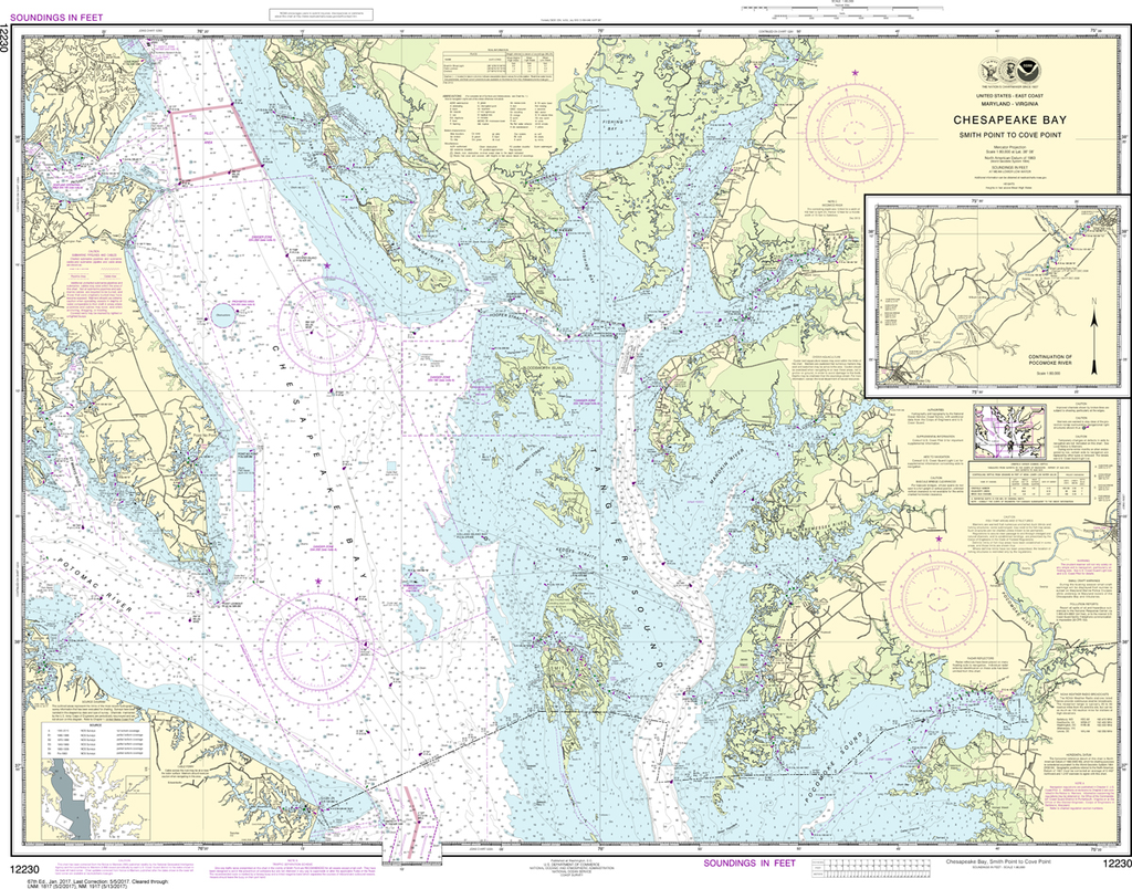
Region: Mid-Atlantic Latest Edition: 62 Ed. (1-Aug-2019) Last Correction: 8-Nov-2019 Cleared Through: NTM 47/2019 (23-Nov-2019) Paper Size: 43" x 36" Chart Image Size: 33" x 39" Scale: 1:80,000 Captain's Nautical Supplies is a...
$23.75
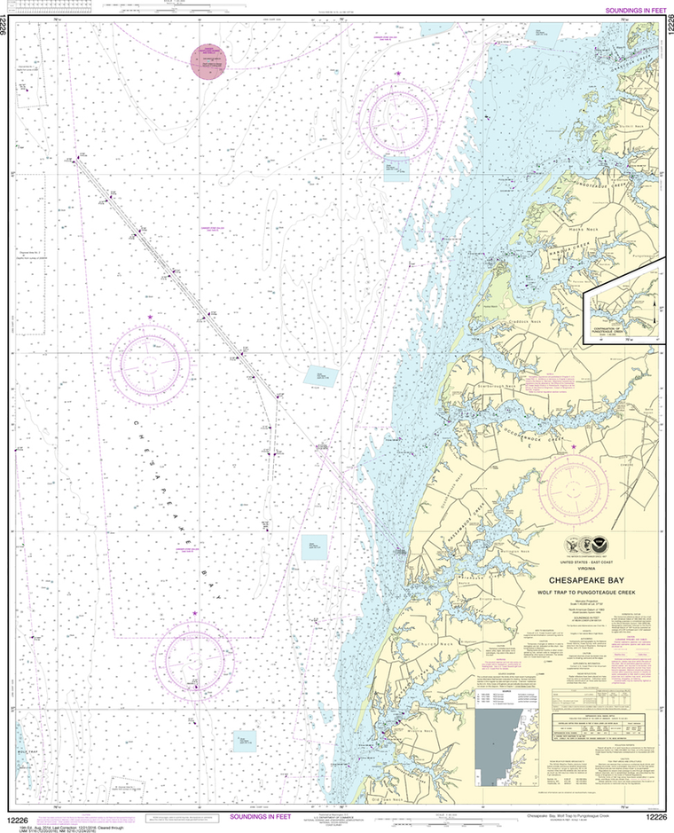
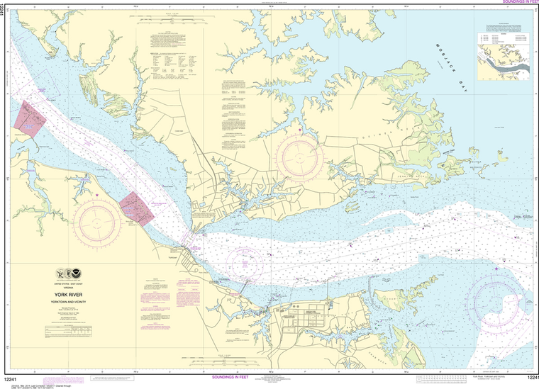
Region: Mid-Atlantic Latest Edition: 19 Ed. (1-Aug-2014) Last Correction: 8-Nov-2019 Cleared Through: NTM 47/2019 (23-Nov-2019) Paper Size: 46" x 36" Chart Image Size: 43" x 34" Scale: 1:40,000 Captain's Nautical Supplies is a...

$23.75
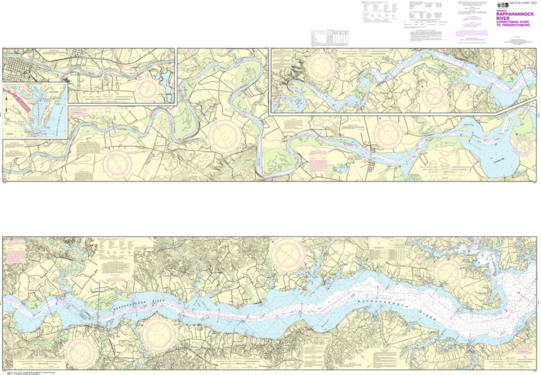
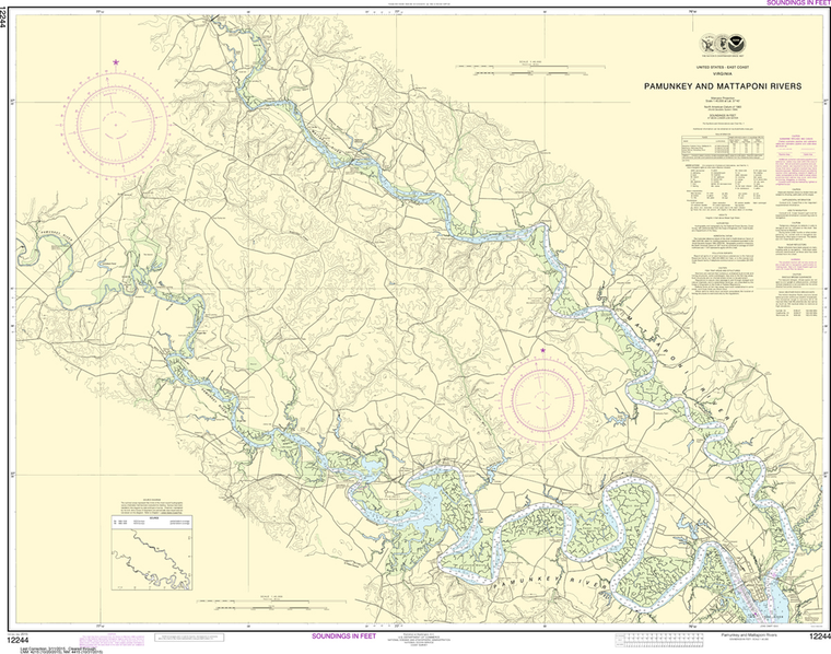
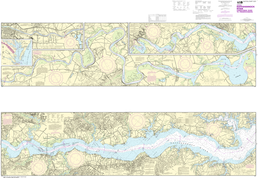
Region: Mid-Atlantic Latest Edition: 35 Ed. (1-Sep-2017) Last Correction: 19-Jul-2019 Cleared Through: NTM 47/2019 (23-Nov-2019) Paper Size: 54" x 36" Chart Image Size: 35" x 50" Scale: 1:40,000 Captain's Nautical Supplies is a...
$23.75
Region: Mid-Atlantic Latest Edition: 67 Ed. (1-Jan-2017) Last Correction: 5-Nov-2019 Cleared Through: NTM 47/2019 (23-Nov-2019) Paper Size: 45" x 36" Chart Image Size: 32" x 41" Scale: 1:80,000 Captain's Nautical Supplies is a...

$23.75
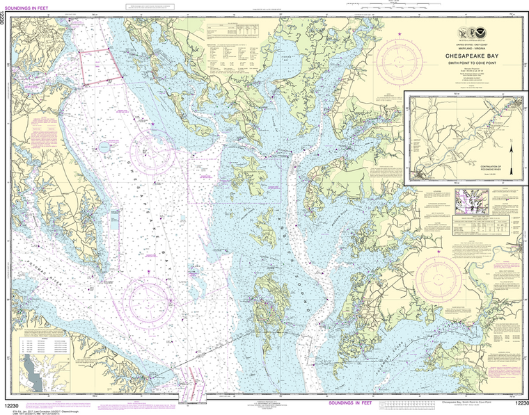
Region: Mid-Atlantic Latest Edition: 32 Ed. (1-Jun-2019) Last Correction: 15-Oct-2019 Cleared Through: NTM 47/2019 (23-Nov-2019) Paper Size: 46" x 36" Chart Image Size: 34" x 43" Scale: 1:40,000 Captain's Nautical Supplies is a...

$23.75
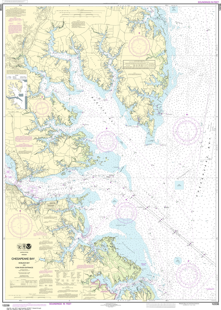
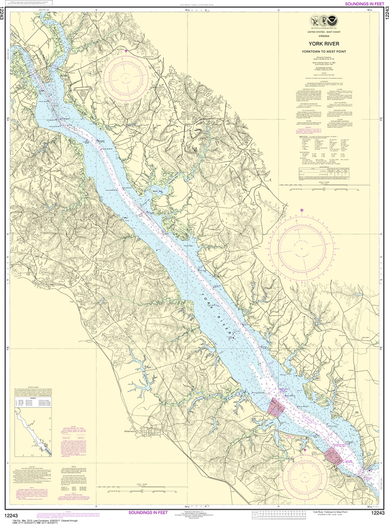
Region: Mid-Atlantic Latest Edition: 39 Ed. (1-Sep-2017) Last Correction: 9-Aug-2019 Cleared Through: NTM 47/2019 (23-Nov-2019) Paper Size: 49" x 36" Chart Image Size: 46" x 35" Scale: 1:40,000 Captain's Nautical Supplies is a...
$23.75
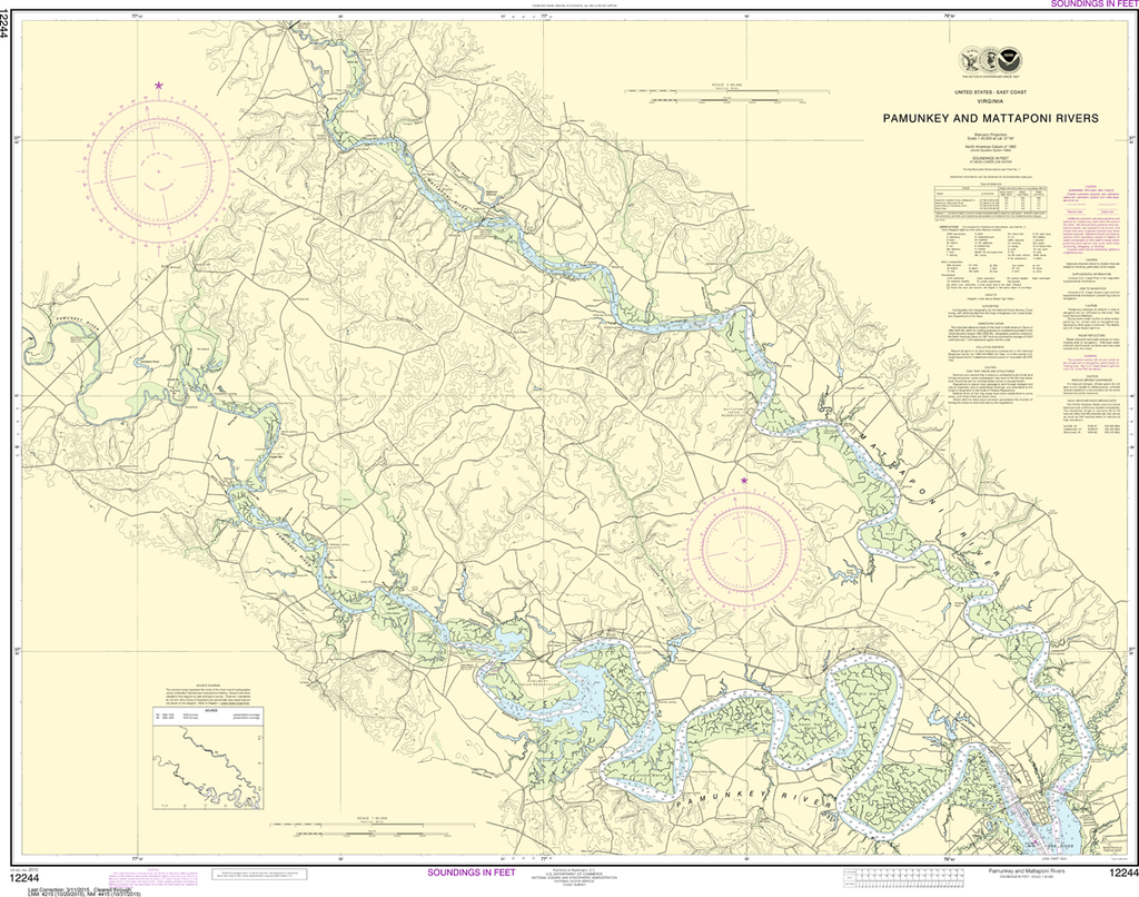
Region: Mid-Atlantic Latest Edition: 36 Ed. (1-Dec-2017) Last Correction: 9-Aug-2019 Cleared Through: NTM 47/2019 (23-Nov-2019) Paper Size: 53" x 36" Chart Image Size: 50" x 33" Scale: 1:40,000 Captain's Nautical Supplies is a...
$23.75
THIS CHART IS CURRENTLY CANCELED BY NOAA. We know there are many questions about NOAA charts, newest editions and charts being cancelled. The U.S. Office of Coast Survey provides an updated list of all chart updates and the ones being...

$23.75
The chart you are viewing is NOT updated weekly and does NOT include all of the latest Notice to Mariners corrections. Region: Mid-Atlantic Paper Size: 50" x 36" Chart Image Size: 46" x 33" Scale: 1:40,000 Captain's Nautical...

$23.75
The chart you are viewing is NOT updated weekly and does NOT include all of the latest Notice to Mariners corrections. Region: Mid-Atlantic Paper Size: 50" x 36" Chart Image Size: 34" x 46" Scale: 1:20,000 Captain's Nautical...
$23.75
The chart you are viewing is NOT updated weekly and does NOT include all of the latest Notice to Mariners corrections. Region: Mid-Atlantic Paper Size: 45" x 36" Chart Image Size: 42" x 31" Scale: 1:40,000 Captain's Nautical...
$23.75
THIS CHART IS CURRENTLY CANCELED BY NOAA. We know there are many questions about NOAA charts, newest editions and charts being cancelled. The U.S. Office of Coast Survey provides an updated list of all chart updates and the ones being...

$23.75
Region: Mid-Atlantic Latest Edition: 24 Ed. (1-Aug-2013) Last Correction: 11-Jun-2019 Cleared Through: NTM 47/2019 (23-Nov-2019) Paper Size: 45" x 36" Chart Image Size: 33" x 42" Scale: 1:40,000 Captain's Nautical Supplies is a...

$23.75
Region: Mid-Atlantic Latest Edition: 25 Ed. (1-Jan-2013) Last Correction: 28-Jun-2019 Cleared Through: NTM 47/2019 (23-Nov-2019) Paper Size: 46" x 36" Chart Image Size: 33" x 43" Scale: 1:20,000 Captain's Nautical Supplies is a...