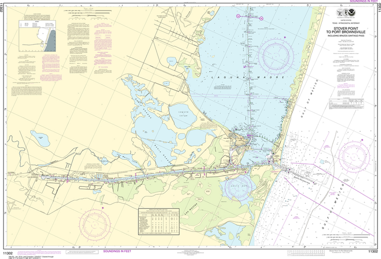
NOAA Chart 11302: Intracoastal Waterway - Stover Point to Port Brownsville-including Brazos Santiago Pass
$23.75
The chart you are viewing is NOT updated weekly and does NOT include all of the latest Notice to Mariners corrections. Region: Gulf Coast & Caribbean Islands Paper Size: 47" x 36" Chart Image Size: 30" x 44" Scale:...
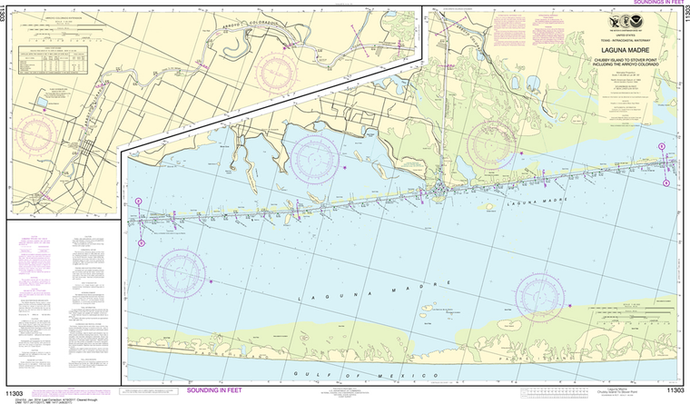
NOAA Chart 11303: Intracoastal Waterway - Laguna Madre, Chubby Island to Stover Point, including The Arroyo Colorado
$23.75
The chart you are viewing is NOT updated weekly and does NOT include all of the latest Notice to Mariners corrections. Region: Gulf Coast & Caribbean Islands Paper Size: 48" x 36" Chart Image Size: 26" x 44" Scale:...
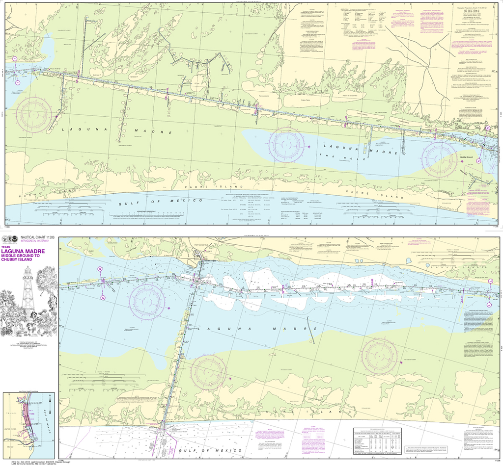
NOAA Chart 11306: Intracoastal Waterway - Laguna Madre Middle Ground to Chubby Island
$23.75
Region: Gulf Coast & Caribbean Islands Paper Size: 47" x 42" Chart Image Size: 41" x 44" Scale: 1:40,000 Captain's Nautical Supplies is a Print-on-Demand nautical chart dealer for US Waters. All charts are printed up-to-date...
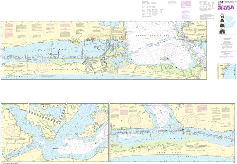
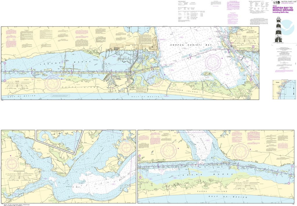
NOAA Chart 11308: Intracoastal Waterway - Redfish Bay to Middle Ground
$23.75
The chart you are viewing is NOT updated weekly and does NOT include all of the latest Notice to Mariners corrections. Region: Gulf Coast & Caribbean Islands Paper Size: 62" x 42" Chart Image Size: 41" x 59"...
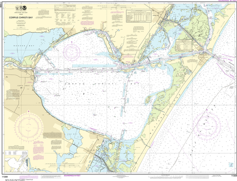
The chart you are viewing is NOT updated weekly and does NOT include all of the latest Notice to Mariners corrections. Region: Gulf Coast & Caribbean Islands Paper Size: 48" x 36" Chart Image Size: 34" x 45" Scale:...
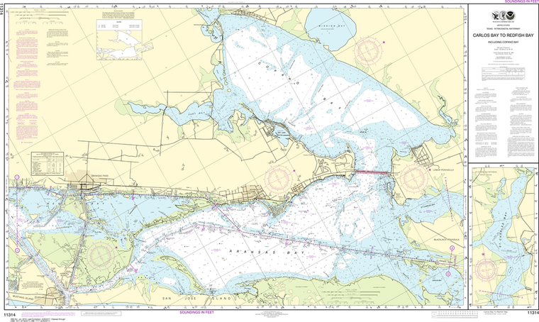
NOAA Chart 11314: Intracoastal Waterway - Carlos Bay to Redfish Bay-including Copano Bay
$23.75
Region: Gulf Coast & Caribbean Islands Paper Size: 54" x 36" Chart Image Size: 30" x 51" Scale: 1:40,000 Captain's Nautical Supplies is a Print-on-Demand nautical chart dealer for US Waters. All charts are printed up-to-date...
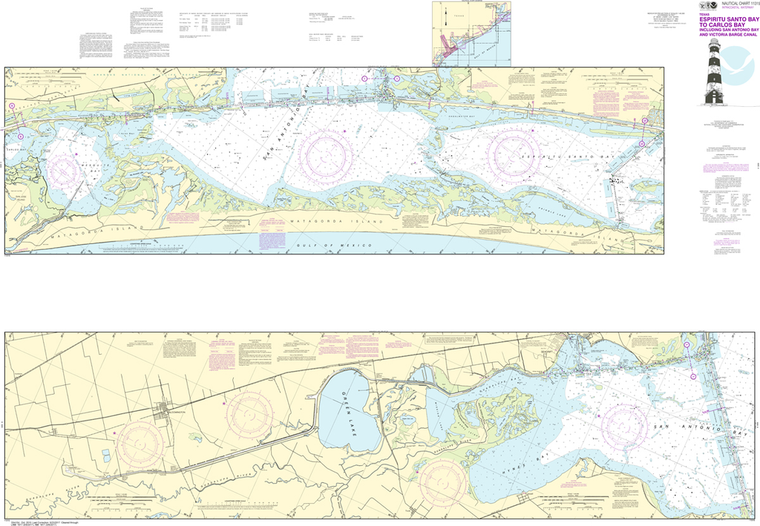
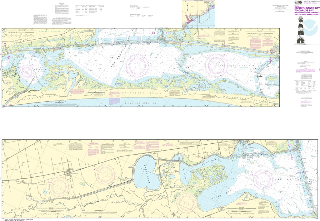
NOAA Chart 11315: Intracoastal Waterway - Espiritu Santo Bay to Carlos Bay including San Antonio Bay and Victoria Barge Canal
$23.75
Region: Gulf Coast & Caribbean Islands Paper Size: 62" x 42" Chart Image Size: 41" x 59" Scale: 1:40,000 Captain's Nautical Supplies is a Print-on-Demand nautical chart dealer for US Waters. All charts are printed up-to-date and corrected...
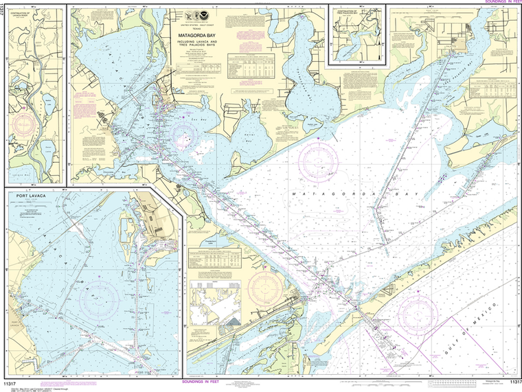
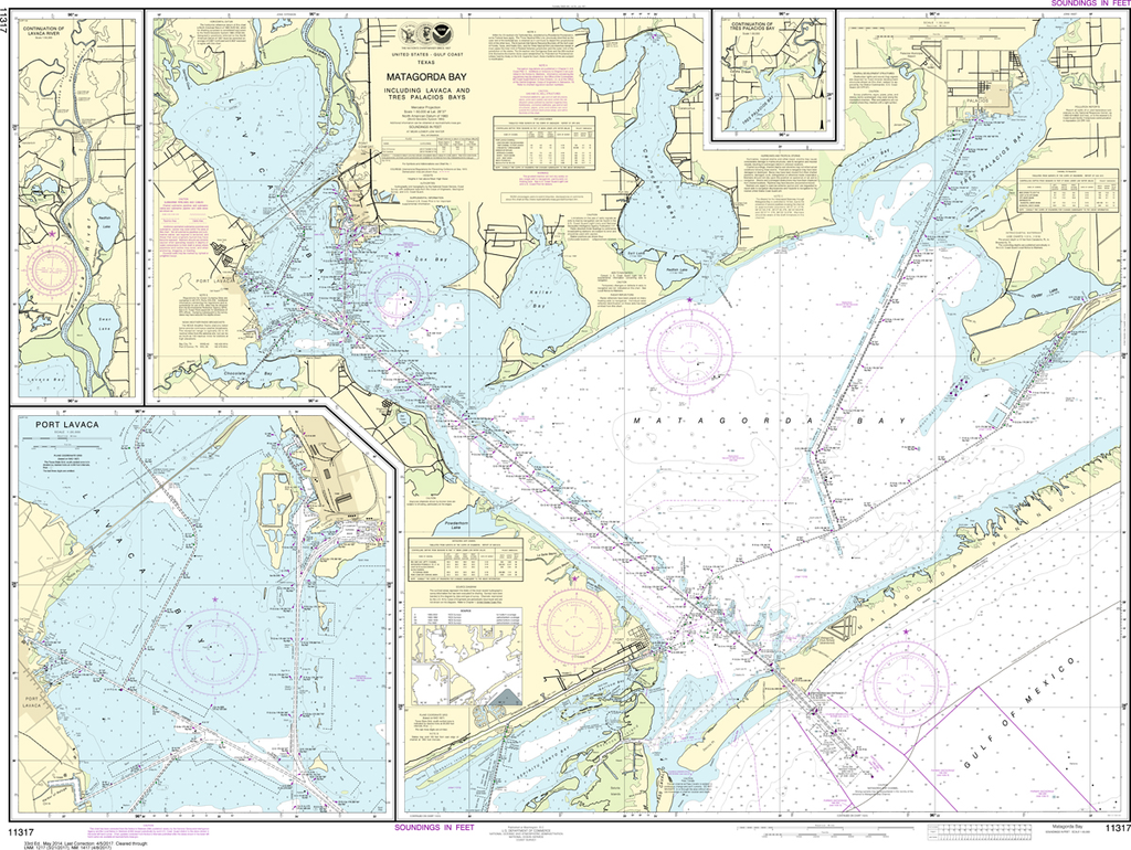
NOAA Chart 11317: Matagorda Bay including Lavaca and Tres Palacios Bays, Port Lavaca, Continuation of Lavaca River, Continuation of Tres Palacios Bay
$23.75
The chart you are viewing is NOT updated weekly and does NOT include all the of the latest Notice to Mariners corrections. Region: Gulf Coast & Caribbean Islands Paper Size: 50" x 36" Chart Image Size: 35" x 47"...
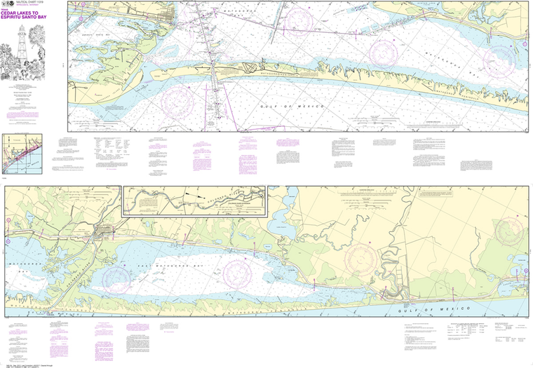
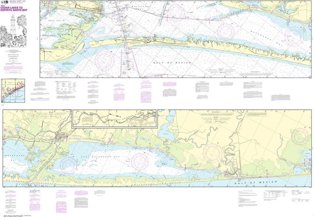
NOAA Chart 11319: Intracoastal Waterway - Cedar Lakes to Espiritu Santo Bay
$23.75
Region: Gulf Coast & Caribbean Islands Paper Size: 62" x 42" Chart Image Size: 41" x 59" Scale: 1:40,000 Captain's Nautical Supplies is a Print-on-Demand nautical chart dealer for US Waters. All charts are printed up-to-date and corrected to...
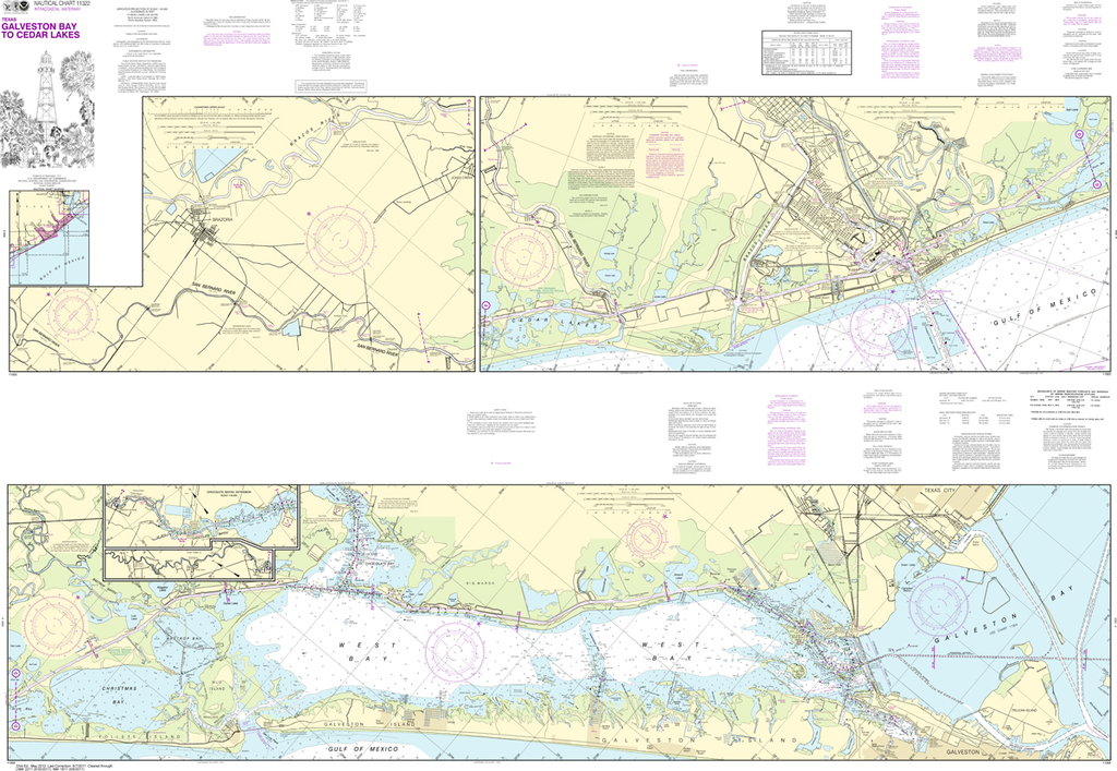
NOAA Chart 11322: Intracoastal Waterway - Galveston Bay to Cedar Lakes
$23.75
The chart you are viewing is NOT updated weekly and does NOT include all of the latest Notice to Mariners corrections. Region: Gulf Coast & Caribbean Islands Paper Size: 62" x 42" Chart Image Size: 41" x 59" Scale:...
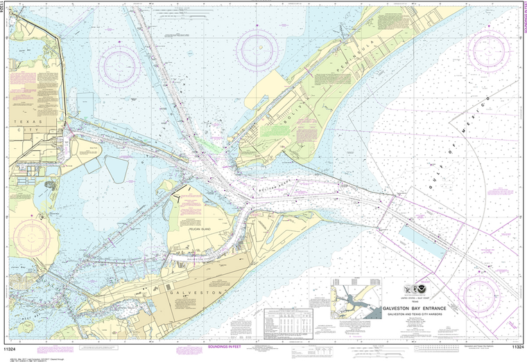
NOAA Chart 11324: Galveston Bay Entrance Galveston and Texas City Harbors
$23.75
The chart you are viewing is NOT updated weekly and does NOT include all of the latest Notice to Mariners corrections. Region: Gulf Coast & Caribbean Islands Paper Size: 55" x 36" Chart Image Size: 35" x 51" Scale:...
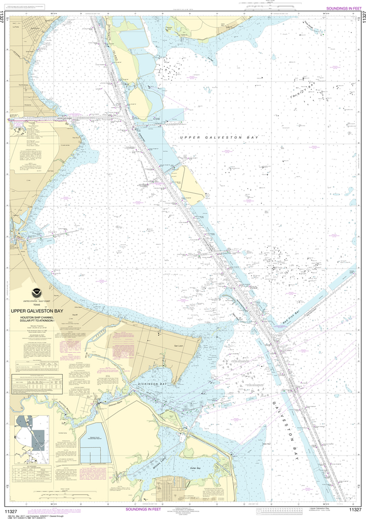
NOAA Chart 11327: Upper Galveston Bay, Houston Ship Channel, Dollar Point to Atkinson
$23.75
The chart you are viewing is NOT updated weekly and does NOT include all the of the latest Notice to Mariners corrections. Region: Gulf Coast & Caribbean Islands Paper Size: 52" x 36" Chart Image Size: 48" x...
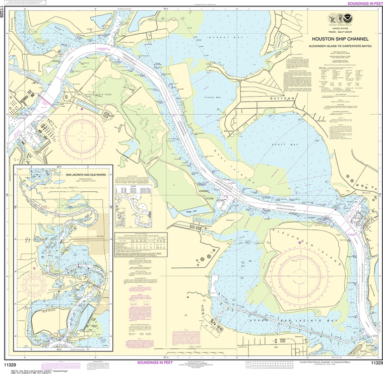
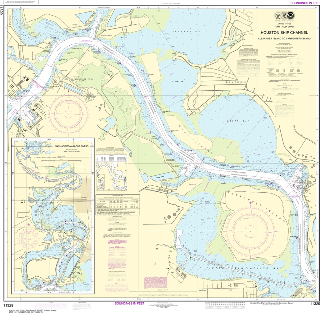
NOAA Chart 11329: Houston Ship Channel Alexander Island to Carpenters Bayou, San Jacinto and Old Rivers
$23.75
Region: Gulf Coast & Caribbean Islands Paper Size: 37" x 36" Chart Image Size: 34" x 34" Scale: 1:25,000 Captain's Nautical Supplies is a Print-on-Demand nautical chart dealer for US Waters. All charts are printed up-to-date and corrected...
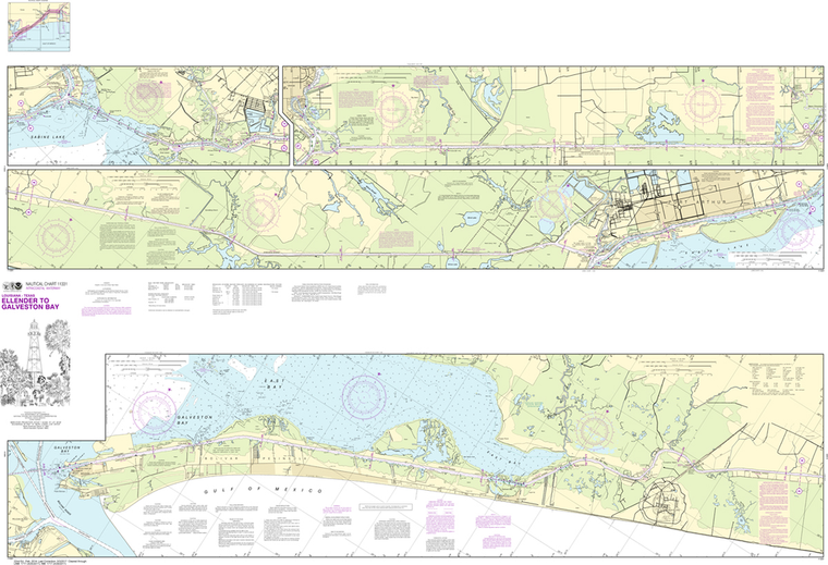
NOAA Chart 11331: Intracoastal Waterway - Ellender to Galveston Bay
$23.75
The chart you are viewing is NOT updated weekly and does NOT include all of the latest Notice to Mariners corrections. Region: Gulf Coast & Caribbean Islands Paper Size: 62" x 42" Chart Image Size: 40" x 59" Scale:...
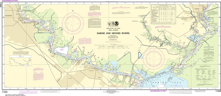
Region: Gulf Coast & Caribbean Islands Paper Size: 61" x 36" Chart Image Size: 57" x 34" Scale: 1:50,000 Captain's Nautical Supplies is a Print-on-Demand nautical chart dealer for US Waters. All charts are printed up-to-date and...
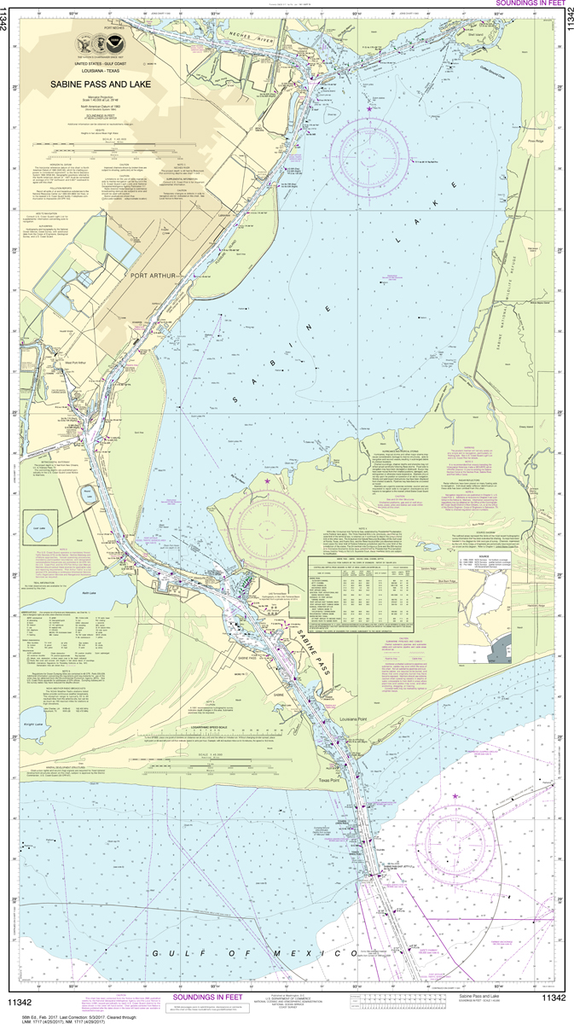
The chart you are viewing is NOT updated weekly and does NOT include all the of the latest Notice to Mariners corrections. Region: Gulf Coast & Caribbean Islands Paper Size: 49" x 36" Chart Image Size: 46" x 26"...
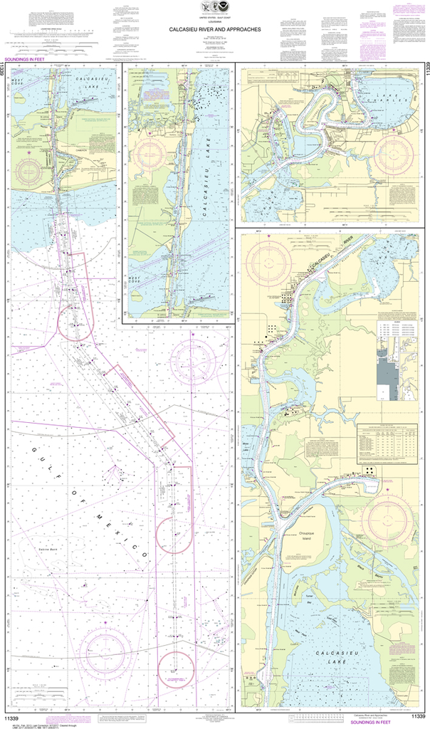
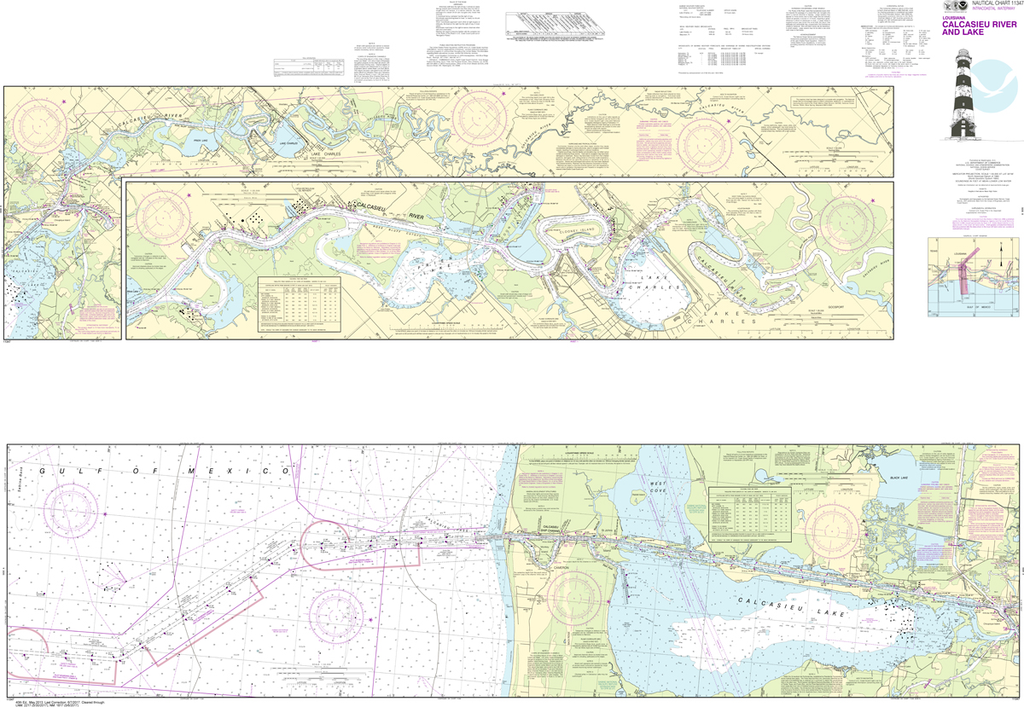
The chart you are viewing is NOT updated weekly and does NOT include all of the latest Notice to Mariners corrections. Region: Gulf Coast & Caribbean Islands Paper Size: 46" x 36" Chart Image Size: 19" x 42" Scale:...
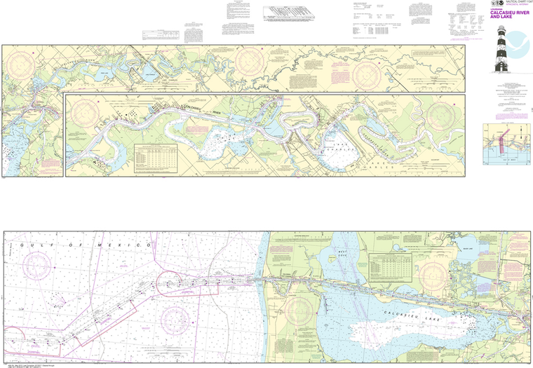
Region: Gulf Coast & Caribbean Islands Paper Size: 62" x 42" Chart Image Size: 41" x 59" Scale: 1:50,000 Captain's Nautical Supplies is a Print-on-Demand nautical chart dealer for US Waters. All charts are printed up-to-date and...
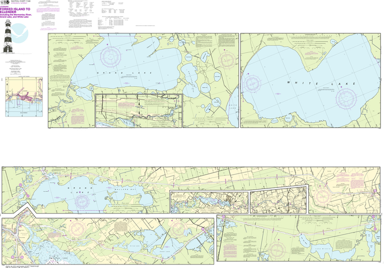
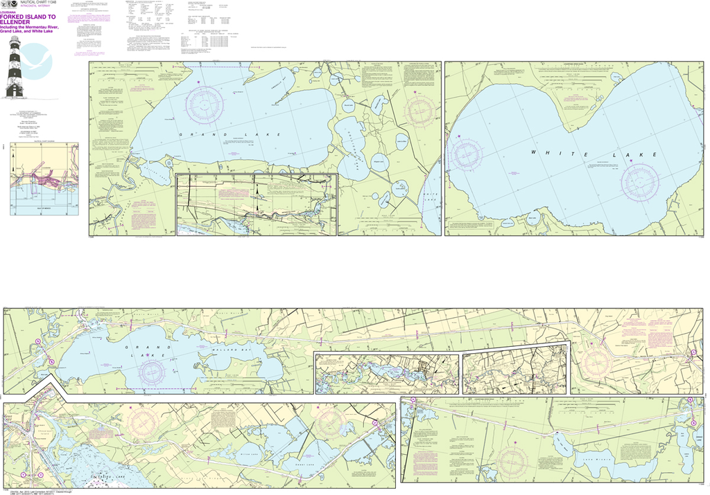
NOAA Chart 11348: Intracoastal Waterway - Forked Island to Ellender, including the Mermantau River, Grand Lake and White Lake
$23.75
Region: Gulf Coast & Caribbean Islands Paper Size: 62" x 42" Chart Image Size: 41" x 59" Scale: 1:40,000 Captain's Nautical Supplies is a Print-on-Demand nautical chart dealer for US Waters. All charts are printed up-to-date and...
NOAA Chart 11350: Intracoastal Waterway - Wax Lake Outlet to Forked Island including Bayou Teche, Vermilion River, and Freshwater Bayou
$23.75
The chart you are viewing is NOT updated weekly and does NOT include all of the latest Notice to Mariners corrections. Region: Gulf Coast & Caribbean Islands Paper Size: 62" x 42" Chart Image Size: 41" x 59" Scale:...
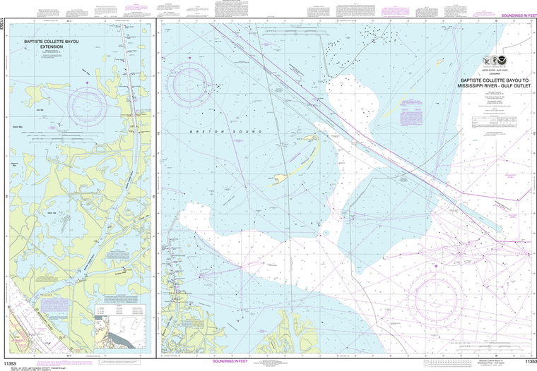
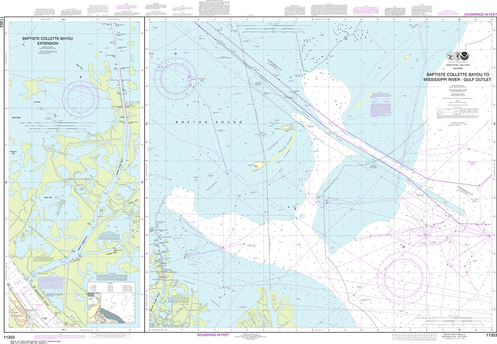
NOAA Chart 11353: Baptiste Collette Bayou to Mississippi River Gulf Outlet, Baptiste Collette Bayou Extension
$23.75
The chart you are viewing is NOT updated weekly and does NOT include all the of the latest Notice to Mariners corrections. Region: Gulf Coast & Caribbean Islands Paper Size: 52" x 36" Chart Image Size: 34" x 48" Scale:...
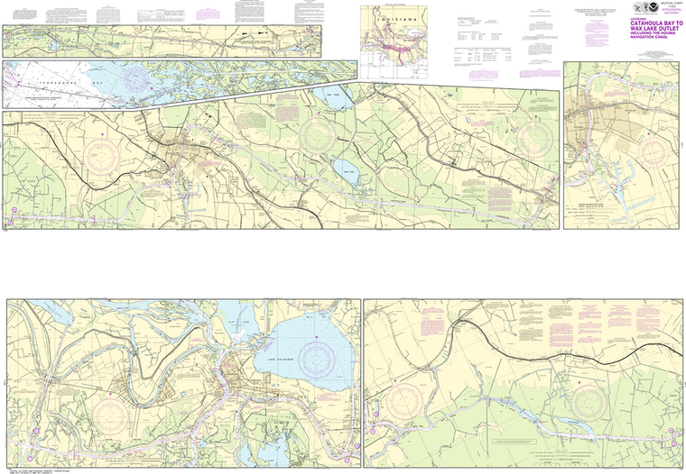
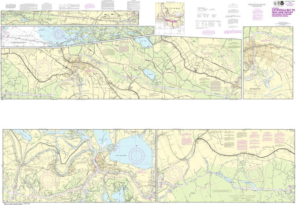
NOAA Chart 11355: Intracoastal Waterway - Catahoula Bay to Wax Lake Outlet including the Houma Navigation canal
$23.75
The chart you are viewing is NOT updated weekly and does NOT include all of the latest Notice to Mariners corrections. Region: Gulf Coast & Caribbean Islands Paper Size: 62" x 42" Chart Image Size: 41" x 59" Scale:...
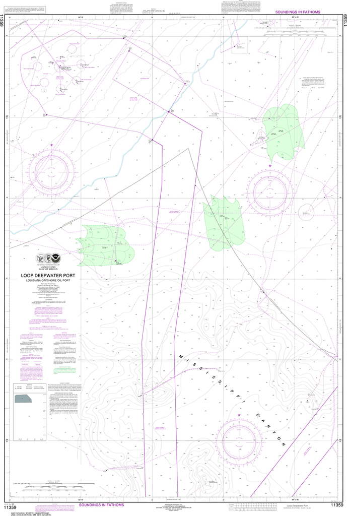
NOAA Chart 11359: Loop Deepwater Port, Louisiana Offshore Oil Port
$23.75
The chart you are viewing is NOT updated weekly and does NOT include all the of the latest Notice to Mariners corrections. Region: Gulf Coast & Caribbean Islands Paper Size: 50" x 36" Chart Image Size: 46" x...
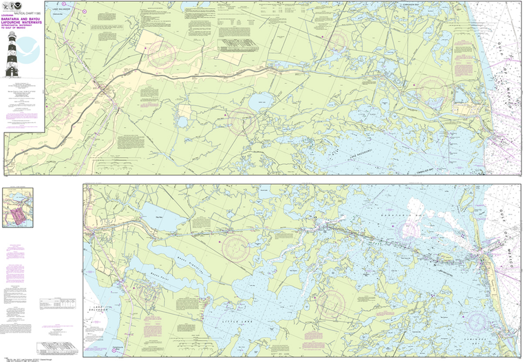
NOAA Chart 11365: Barataria and Bayou Lafourche Waterways, Intracoastal Waterway to Gulf of Mexico
$23.75
Region: Gulf Coast & Caribbean Islands Paper Size: 62" x 42" Chart Image Size: 41" x 59" Scale: 1:50,000 Captain's Nautical Supplies is a Print-on-Demand nautical chart dealer for US Waters. All charts are printed up-to-date and...