"Sunsetting" Traditional Paper Charts: What It Really Means
November 20, 2019
5 Comments

Many of Captain's customers and clients have contacted us about NOAA's recent announcement that they plan to "Sunset" or discontinue traditional paper charts.
Read the full announcement and "sunsetting" plan on NOAA's website
Here's the short version: don't worry. NOAA is discontinuing one of two digital formats they provide chart data in. Print-On-Demand charts will still be available, using the other digital format, from Captain's and from other providers of NOAA charts.
Here's the long version:
We first learned of the Sunsetting plan two years ago, when NOAA released its National Charting Plan. The announcement made last week laid out the detailed process and schedule for that plan. While the title is worrying, this is part of a well-thought-out decision to provide the best paper and electronic charts to both commercial and recreational boaters.
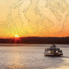
NOAA itself has not provided paper charts since 2014, when it discontinued printing traditional lithographs. Since then, NOAA has provided the data to Certified Chart Agents to print charts on-demand from digital files. These digital files are known as "raster" files, or RNCs and they are a graphic image file, usually formatted as a PDF. They can be downloaded from NOAA's website free of charge (though they don't meet commercial carriage requirements unless printed by a Certified Chart Agent).
NOAA also provides the same data - soundings, locations of aids to navigation, shipping lanes, and all other information that goes onto a chart – in a digital "vector" file, also known as an ENC, or Electronic Navigation Chart. Currently, these files are used primarily by chart plotters and navigation programs, and they typically contain more detail than is possible to put into an image-based RNC file.
Providing navigation data in these two formats means that NOAA has two chart databases to keep up-to-date and correct, and they have decided to stop duplicating their efforts. As such, the image-based raster chart database is being discontinued, but the vector chart database is not. Captain's and other providers of nautical charts will still be able to print on-demand NOAA charts using the ENC vector data rather than the RNC raster data.
Here's the official statement from OceanGrafix, the Certified Chart Agent who Captain's works with to provide print-on-demand NOAA, Canadian, and other charts:
As you may know, NOAA put an announcement in the Federal Register stating that there is a five-year plan to end all raster and paper chart production. Last week, OceanGrafix spent time at NOAA's facility discussing this topic. NOAA is currently having issues supporting both the ENC and RNC corrections, so has decided to have the ENCs serve as the master database. There will still be paper charts, but the data will now come from the ENC database, and the look and feel could be slightly different than what we print today.
Over the next year, OceanGrafix will work with NOAA to determine what information should be on the charts. Once again, the suite of paper charts is not going away; it's merely a change in format, and OceanGrafix is working alongside NOAA for this conversion. We feel this is a positive change and could open the door for other custom chart programs.
Regardless of the digital format NOAA provides data in, Captain's will always have the best and most up-to-date printed charts available. We'll also continue to provide you with information and developments as the sunsetting plan progresses. In the meantime, please continue to reach out to us with your questions and concerns about this process. NOAA itself also encourages you, the end user of its charts, to give feedback through their online customer support portal.
5 Responses
Leave a comment


XmQqFdkOJWncRvTL
August 15, 2020
iXCjkDrPst